logo
ResearchBunny Logo
The uneven impact of climate change on drought with elevation in the Canary Islands

Earth Sciences

The uneven impact of climate change on drought with elevation in the Canary Islands

J. Carrillo, S. Hernández-barrera, et al.

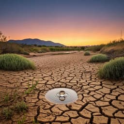
In light of rising greenhouse gas concentrations, a team of researchers including Judit Carrillo and Sara Hernández-Barrera has projected alarming increases in drought duration and severity for the Canary Islands by the late 21st century. Their study reveals a critical impact at higher altitudes, presenting a dire forecast for the region's future.

00:00
00:00
~3 min • Beginner • English
Introduction
The study investigates how climate change will alter drought characteristics across elevation gradients in the Canary Islands, a mountainous subtropical archipelago with complex topography. Droughts, which arise primarily from precipitation deficits and are modulated by evapotranspiration and land–atmosphere processes, are critical hazards for society and ecosystems. Conventional indices like SPI capture precipitation deficits, but indices incorporating evapotranspiration (SPEI) are needed to assess climate-change-driven increases in atmospheric water demand. Prior research suggests elevation-dependent warming and decreasing precipitation in the Canary Islands, with stronger trends at higher elevations. This work aims to quantify how drought frequency, duration, severity, spatial extent, and aridity will change by late century (2070–2099) relative to 1980–2009, and how these changes vary with elevation bands (0–400, 400–1100, 1100–2100, >2100 m) under RCP4.5 and RCP8.5.
Literature Review
Global and regional studies based on SPI and SPEI show robust increases in drought frequency and severity since the late 20th century in regions including Patagonia, the Sahel, the Congo basin, the Mediterranean, and NE China. CORDEX-driven projections under RCP4.5 and RCP8.5 indicate increased drought frequency and severity by century’s end in the Amazon, southern South America, the Mediterranean, southern Africa, and southern Australia, with stronger signals in SPEI than SPI due to warming-enhanced evapotranspiration. Aridity projections from GCMs show major dryland expansions under RCP8.5 in North America, North Africa’s fringe, the Mediterranean, Southern Africa, parts of Australia, the Middle East, Central Asia, and South America. Small islands are highly vulnerable to climate change; many are projected to warm and, in several basins (e.g., Caribbean, some Atlantic and Indian Ocean regions), to become drier. Prior island-focused aridity analyses under RCP8.5 identified increasing aridity for most islands by mid- and late-century, with particularly strong increases for Madeira and the Canary Islands. Observations and downscaled projections in the Canary Islands indicate elevation-dependent warming and decreasing precipitation, especially at higher elevations, motivating an elevation-resolved assessment.
Methodology
Study area and elevation bands: Four elevation intervals were analyzed to capture altitude dependence: 0–400 m, 400–1100 m, 1100–2100 m, and >2100 m, guided by previously defined thermotypes on Tenerife. Regional climate simulations: The non-hydrostatic WRF/ARW v3.4.1 model with one-way triple nesting was used, achieving 3×3 km resolution over the archipelago. Physics schemes included: WRF double-moment 6-class microphysics, Yonsei University PBL, Noah land surface model, CAM3 longwave/shortwave radiation, and Kain–Fritsch cumulus parameterization (deactivated in the innermost domain). Vertical grid: 32 levels concentrated near the surface. Forcing and periods: Three CMIP5 GCMs (r1i1p1) provided lateral boundary conditions: GFDL-ESM2M (2.5×2°), IPSL-CM5A-MR (2.5×1.25°), and MIROC-ESM (2.8×2.8°). Simulated periods: recent past (1980–2009) and future (2070–2099) under RCP4.5 and RCP8.5; simulations included a 1-year spin-up discarded from analysis. Bias adjustment: A trend-preserving Scaled Distribution Mapping (SDM) method was applied using the pyCAT implementation, referencing a WRF simulation driven by ERA-Interim from prior work. Bias correction was applied per land gridpoint using a sliding 3-month window centered on each calendar month to minimize discontinuities. Drought indices: SPI and SPEI were computed at 3- and 12-month time scales to represent meteorological and hydrological droughts, respectively. For each index, rolling monthly series were built using the preceding n months (n=3 or 12). Probability density functions were fitted using a log-logistic distribution with L-moments (Probability Weighted Moments), and transformed to standard normal space. A relative approach was used: distribution parameters were estimated from the recent past period and applied to both past and future to facilitate change interpretation. PET estimation: Potential evapotranspiration was calculated using the FAO/WMO-recommended Penman–Monteith method; alternative PET methods were tested but diverged from PM and prior studies, so PM was adopted. Drought event definition and metrics: At each land gridpoint, a drought event begins when SPI/SPEI falls below −1 (15.9th percentile of the reference period) and ends upon return to ≥0 (50th percentile), with a minimum event length of 2 months. Index values were constrained to [−3, 3] (0.1th to 99.9th percentiles). Metrics include frequency (number of events per 30-year period), duration (consecutive months), severity (minimum index within an event), and spatial extent (percent of land gridpoints with index < −1 each month). Aridity: The Aridity Change Index (ACI) quantified long-term aridity change as (PET_F/PET_RP)/(P_F/P_RP), where F and RP denote future and recent past, respectively. ACI<1 indicates wetter, ACI>1 drier conditions. Validation and observational data: Modeled precipitation and PET seasonal cycles were evaluated against ECA&D station data (1980–2009) at three Tenerife WMO stations spanning elevations: Santa Cruz de Tenerife (SCT, 46 m), Tenerife Norte (TFN, 632 m), and Izaña (IZA, 2371 m). Robustness and significance: Changes at a gridpoint were deemed robust if all three GCM-driven simulations agreed in sign. Statistical significance of mean changes was assessed using a non-parametric bootstrap (1000 resamples) on monthly series; one-tailed tests with p<0.05 denoted significance.
Key Findings
- Model skill: WRF simulations reproduced the seasonal cycle of precipitation and PET at coastal, mid-, and high-elevation stations, with noted coastal biases due to mixed land–ocean grid representation and localized extreme events in observations. - Precipitation CDFs: At higher elevations, recent-past 12-month precipitation totals are larger, but projections show drastic decreases by 2070–2099. Thresholds corresponding to extreme dryness in the recent past become commonplace by the end of the century under RCP8.5 and are indicative of moderate drought in RCP4.5. - Seasonal indices: SPEI and SPI reveal distinct seasonal behavior. Despite slight summer precipitation increases (especially at low elevations), SPI3 can turn slightly positive in late summer–early autumn, whereas SPEI3 remains strongly negative (near −3 at >2100 m) due to peak PET, highlighting the crucial role of evapotranspiration. SPEI12 also approaches −3 at high elevations. - Elevation dependence: Precipitation decreases and PET increases with elevation, the latter driven by stronger warming and reduced humidity aloft; coastal PET is smaller due to higher humidity and frequent stratocumulus. - Spatial extent under drought (SPEI < −1): Relative to the recent past baseline extent of 15.9%, projected increases in area affected (percentage points, pp) are larger for hydrological (12-month) than meteorological (3-month) drought by ~12–17 pp across elevations, and increase with elevation and emissions: • 0–400 m: +37 (3mo RCP4.5), +60 (3mo RCP8.5), +54 (12mo RCP4.5), +74 (12mo RCP8.5). • 400–1100 m: +42, +64, +57, +77. • 1100–2100 m: +43, +64, +56, +76. • >2100 m: +51, +68, +65, +80. All changes significant at p<0.05. Under RCP8.5, hydrological drought would affect nearly the entire high-elevation area (~96%). - Event characteristics: On 3-month scales, some regions show fewer events but dramatically longer durations (up to ~250 months under RCP8.5), with severity saturating at −3 in many areas. On 12-month scales, events are less frequent but much longer (durations up to ~300 months over 360 simulated months) and more severe, even in RCP4.5. - SPEI vs SPI: SPEI projects more frequent, longer, and more severe droughts across most areas due to rising PET. SPI-only analyses can misleadingly suggest reduced drought in parts of Lanzarote and Fuerteventura, underscoring SPEI’s necessity in semi-arid regions. - Aridity (ACI): ACI increases uniformly (all gridpoints positive). Mean ACI ranges: RCP4.5 from ~1.6 (<400 m) to ~2.6 (>2100 m); RCP8.5 from ~2.6 (<400 m) up to ~4.9 (>2100 m), with local maxima up to ~6 at highest elevations. Largest ACI increases appear on the southeastern slopes of Tenerife and Gran Canaria; changes are smaller on the already arid eastern islands (Lanzarote, Fuerteventura).
Discussion
The projections indicate a strong elevation dependence in drought intensification driven by greater warming and reduced humidity at higher elevations, compounded by precipitation declines. Incorporating evapotranspiration is essential: SPEI reveals severe drying where SPI alone might suggest slight improvements due to minor precipitation increases. Seasonally, autumn emerges as the most drought-impacted period, with additional increases in spring droughts, threatening crop planting, growth periods, and reforestation efforts. Socioeconomic sectors (tourism, agriculture) and ecosystems will face heightened risks, including increased wildfire danger. Desalination may buffer water supply for tourism and agriculture but cannot mitigate ecological impacts. Fog interception and stratocumulus clouds are crucial to forest water balances and evapotranspiration reduction; their potential changes under climate warming were not analyzed but could modulate impacts. The pronounced elevation gradient of projected change demonstrates the need for high-resolution regional modeling to capture orographic precipitation, land–sea contrasts, and windward/leeward effects that coarser GCMs miss. Overall, the findings directly address the research question: drought frequency, duration, severity, spatial extent, and aridity will all increase, with the strongest impacts at higher elevations and under higher emissions, emphasizing urgent adaptation planning.
Conclusion
This work delivers the first high-resolution, convection-permitting drought and aridity projections for the Canary Islands that explicitly resolve elevation effects up to >2100 m. Using WRF downscaling of three CMIP5 GCMs and SPEI/SPI/ACI diagnostics, the study finds marked increases in drought duration, severity, and spatial extent by 2070–2099 relative to 1980–2009, with amplification at higher elevations. Under RCP8.5, hydrological drought is projected to affect nearly all high-elevation areas, and ACI may reach values up to ~6, indicating profound aridification. The results demonstrate that evapotranspiration must be included (via SPEI) to avoid underestimating drought in semi-arid, topographically complex islands. Future research should: assess climate change impacts on stratocumulus clouds and fog/horizontal precipitation; incorporate water demand and management scenarios to quantify risk; refine orographic precipitation and land–sea interaction processes with enhanced resolution and physics; expand GCM/RCM ensembles and scenarios; and evaluate compound hazards (e.g., fire weather) and ecosystem responses along elevation gradients.
Limitations
- Cloud processes and horizontal precipitation (fog interception, stratocumulus frequency/height/strength) were not explicitly analyzed, though they strongly affect water balance and PET. - Even at 3 km resolution, the discretized topography under-represents maximum elevations (~3000 m vs. actual ~3700 m on Tenerife), potentially biasing orographic precipitation and temperature gradients. - Only three CMIP5 GCMs and two RCPs were used; broader ensembles could better sample model uncertainty. - Bias correction relies on SDM with a WRF–ERA-Interim reference; method and reference uncertainties may influence adjusted fields. - Coastal gridpoints may mix land–ocean signals at 3 km, affecting coastal PET and precipitation representation. - Validation focused on a small set of stations on Tenerife; observational sparsity may limit comprehensive evaluation across all islands and elevations.
Listen, Learn & Level Up
Over 10,000 hours of research content in 25+ fields, available in 12+ languages.
No more digging through PDFs, just hit play and absorb the world's latest research in your language, on your time.
listen to research audio papers with researchbunny