logo
ResearchBunny Logo
The role of mountains in shaping the global meridional overturning circulation

Earth Sciences

The role of mountains in shaping the global meridional overturning circulation

H. Yang, R. Jiang, et al.

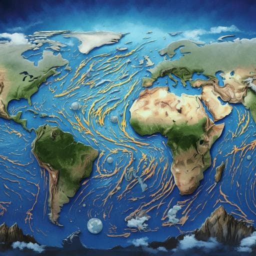
This study explores the pivotal influence of mountain ranges on global thermohaline circulation, revealing the Tibetan Plateau's vital role in Atlantic MOC formation and its impact on the Pacific MOC. Researchers from various esteemed institutions have uncovered significant findings about the global hydrological cycle's role in these processes.

00:00
00:00
~3 min • Beginner • English
Introduction
The study addresses how major continental mountain ranges, particularly the Tibetan Plateau (TP), influence the global meridional overturning circulation (GMOC) and its basin-specific manifestations in the Atlantic (AMOC) and Pacific (PMOC). Observationally, a robust AMOC (~18 Sv) exists today with deep-water formation in the subpolar North Atlantic, whereas no analogous PMOC forms in the North Pacific. Geological and modeling evidence suggests shifts in Northern Hemisphere deep-water formation between ocean basins through the Cenozoic, though the precise timing remains debated. Proposed controls include basin-scale freshwater flux asymmetry, basin geometry, and changes in ocean gateways. Continental orography is also thought to modulate atmospheric moisture transport and winds, potentially reorganizing the GMOC. This study isolates the topographic effect by conducting controlled orography perturbation experiments to test the roles of the Rocky Mountains, Antarctic orography, Andes, Greenland, and the TP in initiating or suppressing AMOC/PMOC under otherwise modern boundary conditions.
Literature Review
Prior work attributes Atlantic–Pacific asymmetry in overturning to net surface freshwater flux patterns that make the North Atlantic saltier than the North Pacific, and to basin geometry favoring deep overturning in narrower basins. Gateway changes such as the opening of Drake Passage/Tasman Seaway have been implicated in promoting NADW formation. Geological reconstructions indicate complex uplift histories: the Rockies rose ~80–45 Ma; Antarctic mountain systems predate the Cenozoic with major glaciation at ~34–33.5 Ma; Andes uplift initiated ~70 Ma and matured by ~15–10 Ma; Greenland uplift began ~11–10 Ma. The Tibetan Plateau’s uplift timing is debated, with suggestions ranging from parts in place by 38–33 Ma to rapid main uplift 10–8 Ma or near-modern elevation by ~15 Ma, broadly coincident with hypothesized onset of significant NADW. Modeling studies have shown mountains and ice sheets can strengthen AMOC and that removing the TP can collapse the AMOC, indicating strong orographic controls on GMOC. Nonetheless, the chronology and relative roles of individual ranges remain debated, motivating systematic sensitivity tests.
Methodology
Model: NCAR CESM 1.0 (low-resolution configuration T31_gx3v7). Atmosphere: CAM4, 26 levels, T31 (~3.75°). Ocean: POP2, 60 vertical levels, gx3v7 (~3° near poles to 0.6° at equator). Land: CLM4; Sea ice: CICE with corresponding grids. Experimental design: Single-variable (orography) sensitivity experiments under preindustrial forcing (CO2=285 ppm), modern insolation and orbital parameters, modern bathymetry and continental configuration, and modern land–sea mask. River routing, vegetation, and dynamic ice sheets are not altered; continental ice sheets treated as bright rocks with albedo adjusting thermally. The reference experiment “Flat” imposes globally flat topography at 50 m above sea level and is integrated 1600 years (initialized from a completed control with realistic topography, “Real”). Experiment sets: 1) Individual topography added to Flat at year 801 and integrated ≥800 years: RM (Rocky Mountains), AT (Antarctic orography), AM (Andes Mountains), GL (Greenland), TP (Tibetan Plateau). 2) Sequential uplift experiment “Flat2Real”: add RM at year 801 (integrate 1200y); add AT at year 2001 (integrate 400y); add AM at year 2401 (integrate 1000y); add GL at year 3401 (integrate 600y); add TP at year 4001 (integrate 2000y). 3) Combination experiments starting from Flat year 801 and integrated ≥800 years: TP+RM, TP+GL, TP+AM, TP+AT; plus Real (all five topographies). Diagnostics: AMOC and PMOC indices defined as the maximum overturning streamfunction (Sv) between 20°–70°N and below 500 m in the North Atlantic and North Pacific, respectively; time series smoothed with a 51-year running mean. Ekman pumping computed from surface wind stress curl. Changes due to topography computed as experiment minus Flat. Statistical significance assessed via Student’s t-test (most changes significant at 95%), though not plotted for clarity.
Key Findings
- In the Flat configuration, the ocean exhibits a strong PMOC and negligible AMOC. After adding the Tibetan Plateau (TP) in the sequential Flat2Real experiment, the AMOC rapidly recovers, overshoots within ~800 years, and reaches quasi-equilibrium within ~1000 years near the Real magnitude (~18 Sv). Concurrently, the PMOC collapses within ~200 years toward an “off” state comparable to Real (~4 Sv). - No single mountain range can initiate the AMOC from a flat-Earth baseline. However, the TP alone is sufficient to collapse the PMOC, while AT (Antarctic), AM (Andes), RM (Rockies), or GL (Greenland) alone cannot establish an AMOC. - Only the TP+AT combination establishes a modern-like AMOC from Flat. Other TP+X combinations (TP+RM, TP+GL, TP+AM) fail to build a strong AMOC even after ~2200 years, though the presence of TP in any combination suppresses PMOC. - Mechanism for AMOC initiation with TP+AT: TP reorganizes atmospheric moisture transport leading to more net precipitation over the North Pacific (freshening and reduced density) and less over the North Atlantic (salinification), shutting down PMOC and preconditioning NADW formation. AT restores strong Southern Ocean Ekman pumping, enhancing Southern Ocean upwelling and supporting a vigorous AMOC. - Density and salinity changes: In Real, subpolar Atlantic sea-surface density (SSD) exceeds 27.5 σ0, enabling NADW formation despite Ekman upwelling. In Flat, North Atlantic SSD is reduced to ~25.5 σ0 (Δσ ≈ −2.0 kg/m3), halting NADW formation. In the North Pacific, SSD increases by ~0.5 kg/m3 in the NE Pacific in Flat, sufficient for shallow subduction but not deep-water formation without enhanced Ekman downwelling. - Southern Ocean wind/Ekman changes without Antarctic orography: Flat induces a high-pressure anomaly over Antarctica, anomalous easterlies, and an ~80% reduction in wind stress and Ekman pumping along Antarctica; the Deacon cell weakens by ~50%; southward intermediate-to-deep water transport across 30°S is ~30% weaker than in Real. - Andes effect: AM strengthens PMOC by weakening equatorial trades but amplifying off-equatorial Ekman pumping, intensifying the wind-driven subtropical cells and the thermohaline component of PMOC in the South Indo-Pacific. RM and GL have minimal impacts on PMOC/AMOC. - Feedbacks: TP-induced salinification of the subpolar Atlantic initiates gradual AMOC strengthening, which increases northward heat transport, retreats subpolar sea ice, reduces freshwater input via sea-ice processes, deepens mixed layers (March MLD), and further accelerates AMOC—constituting a positive AMOC–sea-ice feedback. - Global teleconnections: TP uplift excites a planetary wave train across Eurasia–North Pacific–North America–North Atlantic, consistent with the Real–Flat differences and unique among the tested orographies.
Discussion
The findings demonstrate that continental orography, particularly the Tibetan Plateau, exerts a first-order control on the structure of the GMOC by reshaping the atmospheric hydrological cycle and wind forcing. TP redirects moisture convergence toward the Pacific and divergence over the Atlantic, freshening the North Pacific and salinifying the North Atlantic, thereby switching off PMOC and preconditioning NADW formation. Antarctic topography supplies the necessary Ekman pumping in the Southern Ocean to sustain a strong interhemispheric overturning once NADW initiates. The AMOC–sea-ice positive feedback then accelerates and stabilizes the transition to a modern-like AMOC state. These mechanisms clarify why, under modern boundary conditions, only the combined presence of TP and Antarctic orography yields a robust AMOC, while TP alone suffices to suppress PMOC. The results align with prior theory on Southern Ocean upwelling’s role in closing the overturning circulation and with previous orography experiments, reinforcing the broader significance of topography in past and future climate transitions.
Conclusion
This study disentangles the roles of major mountain ranges in shaping the GMOC using controlled orography perturbations under modern boundary conditions. It identifies the Tibetan Plateau as necessary for an “on” AMOC state and sufficient for an “off” PMOC state, while highlighting Antarctic orography as essential to achieving a strong, modern-like AMOC via enhanced Southern Ocean Ekman pumping. Individually, other major ranges cannot switch the overturning from the Pacific to the Atlantic, though the Andes can strengthen PMOC. The work advances mechanistic understanding of how orography modulates atmospheric moisture transport, Southern Ocean dynamics, and sea-ice feedbacks to organize global overturning. Future directions include incorporating paleogeographic changes (continental drift and gateway evolution), dynamic ice sheets, interactive carbon cycle and weathering–CO2 feedbacks, variable greenhouse gas concentrations, higher-resolution models to better resolve complex orography and ocean eddies, and sensitivity to river routing and vegetation changes, to more realistically assess mountain uplift impacts on GMOC over geologic timescales.
Limitations
- Model resolution is coarse (T31 atmosphere; gx3 ocean), potentially under-resolving complex orography (e.g., Andes, Rockies) and ocean eddies. - Experiments isolate orography with modern bathymetry, continents, land–sea mask, and gateways; continental drift and gateway changes (e.g., Tethys closure, Panama Isthmus closure, Bering Strait opening) are not represented and could modulate NADW formation. - Ice sheets are not dynamic and are treated as bright rocks; Greenland and Antarctic glaciations are not simulated interactively. - CO2 is fixed at preindustrial 285 ppm; long-term carbon cycle and weathering–CO2 feedbacks during uplift are not included, potentially exaggerating TP’s effect under modern boundary conditions. - River routing and vegetation changes are not considered. - The Flat baseline (50 m elevation) is an idealized reference rather than a specific geological epoch; abrupt imposition of orography may induce transients (though equilibrated states are analyzed).
Listen, Learn & Level Up
Over 10,000 hours of research content in 25+ fields, available in 12+ languages.
No more digging through PDFs, just hit play and absorb the world's latest research in your language, on your time.
listen to research audio papers with researchbunny