Environmental Studies and Forestry
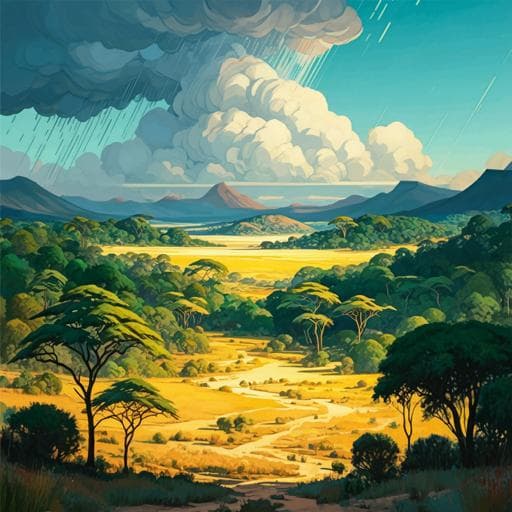
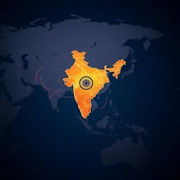
The distribution and drivers of tree cover in savannas and forests across India
T. Gopalakrishna, S. W. Rifai, et al.
The study addresses how resource-based drivers (climate and soils) and disturbance-based drivers (fire and herbivory) regulate tree-grass dynamics and the distribution of savanna and forest biomes across India. Indian savannas have often been misclassified as degraded forests and targeted for afforestation, creating an urgent need to delineate their distribution and understand drivers of tree cover. The authors aim to (1) characterize the distribution of tree cover across climatic water stress gradients, (2) test whether maximum climate water deficit (MCWD) constrains maximum potential tree cover, (3) quantify the shortfall of current tree cover from its climatic maximum potential, and (4) evaluate how soils, fire, herbivory, topography, and anthropogenic pressures explain this shortfall, with specific attention to the under-studied South and Southeast Asian context.
Prior global and regional work indicates that climate, particularly rainfall amount and seasonality, sets an upper bound on tree cover, while disturbance regimes (fire frequency/intensity and herbivory) maintain savannas by limiting canopy closure. Savannas typically exhibit low tree cover, with forests showing high tree cover, and bimodal distributions have been reported in Africa, South America, and Australia. Soil texture mediates tree-grass competition by shaping soil moisture profiles; sandy soils often favor deeper infiltration accessible to trees, whereas clayey soils retain moisture near the surface benefiting grasses. Herbivory can either promote tree recruitment by reducing grass competition (grazers) or suppress tree saplings (browsers), with context-dependent outcomes shown in African experiments. In South and Southeast Asia, savannas have been underrecognized and fire regimes differ markedly from Africa, with lower burned area and more numerous small, less intense fires. There is limited India-specific evidence on how climate, soils, fire, and particularly domestic livestock herbivory jointly shape tree cover and biome distributions.
Study area and sampling: The analysis covers terrestrial India, excluding built-up areas, croplands (including abandoned and current jhum), aquaculture, mangroves, salt pans, permanent wetlands, snow/ice, and elevations >1200 m. The study area was stratified into 31 bins of mean annual precipitation (MAP) in 150 mm increments (0–4000 mm), with 300 random points per bin (n=9600). Points lacking full driver data (10.8%) were removed, leaving n=8554 for core analyses. Tree cover: Current percent tree cover was computed as the mean of annual MODIS MOD44B VCF (Collection 6) from 2000–2020 at 250 m resolution. Climate and MCWD: Monthly climate and climatic water balance from TerraClimate were used to derive MCWD (most negative cumulative P − PET), a measure of dry-season severity, and MAP; correlated variables were screened, retaining MCWD and MAP. Soils: SoilGrids v2.0 sand fraction at 0–30 cm was used. Disturbance: Fire frequency (2000–2021) was derived from MODIS MCD64A1 burned area; fire intensity used VIIRS 375 m fire radiative power (MW). Herbivory pressure was estimated as livestock dry matter intake (DMI) using livestock census and metabolic allometry for buffalo, cattle, horses, sheep, goats; PCA reduced dimensionality, retaining buffalo, sheep, and goat DMI for modeling. Additional drivers: Human population density (proxy for anthropogenic pressure), Heat Load Index (HLI, 0–1) and Topographic Position Index (TPI, −1 to 1) characterized topography and potential energy/water drainage. Tree-cover zones: Non-hierarchical clustering (partitioning around medoids) on the percent tree cover vs MCWD space identified four clusters; MCWD ranges of clusters defined four tree-cover zones. To better identify savanna occurrence, locations of graminoids, forbs, and woody savanna species from Nerlekar et al. within India were overlaid, and 160 random sites were visually inspected via Google Earth, motivating inclusion of topography and population density. Climatic maximum potential tree cover: A 95th percentile smooth additive quantile regression (qgam) of percent tree cover vs MCWD was fit using the stratified sample (n=8554; deviance explained 90.8%), then mapped to predict the climatic maximum potential tree cover. Potential tree cover shortfall: Shortfall was computed as 1 − (current tree cover / climatic maximum potential tree cover), with values near 1 indicating strong divergence from potential. Drivers of shortfall: For points in the medium and mixed tree-cover zones (n=2977), a generalized additive model (mgcv) with beta family and logit link modeled shortfall as smooth functions of sand fraction, fire radiative power, fire frequency (and their interaction term), buffalo, goat, and sheep DMI, human population density, HLI, TPI, and a spatial term s(x,y). Overfitting control included penalized cubic regression splines with double penalties (select=TRUE) and REML estimation; knots were limited (≤5 per smooth). Data were split 80/20 for training/testing; residual diagnostics and performance metrics were reported.
• Tree cover vs MCWD: Percent tree cover exhibits an upper limit that increases as MCWD decreases; however, unlike other tropical regions, there is no clear bimodality at intermediate rainfall. Four tree-cover zones were delineated by MCWD: low (>1209 mm deficit; median −0.7%), medium (845–1209 mm; median up to ~9.4%), mixed (486–845 mm; range ~0–78%, median ~40%), and high (0–486 mm; median ~57%). Savanna vegetation locations were concentrated in the medium and mixed zones. • Climatic maximum potential tree cover: Quantile GAM (95th percentile) between tree cover and MCWD explained 90.8% deviance and mapped maximum potential tree cover highest in NE India and the Western Ghats (~70–82%), moderate along Himalayan foothills (~60–80%), and lowest in western deserts (~1–10%). • Potential tree cover shortfall: Shortfall was highest in deserts (excluded from maps due to negligible potential), and elevated across the Deccan Plateau (~0.3–0.6), Central Highlands (~0.2–0.7), and northern Western Ghats (~0.2–0.6). It was low in NE India (~0.1–0.3) and central/southern Western Ghats (~0.05–0.2). • Drivers of shortfall in medium and mixed zones: The GAM explained 50.4% deviance; explanatory power on training/testing was 45.4%/45.1% with RMSE 39.6%/39.2%. Partial effects showed: – Sand fraction: shortfall decreased linearly with increasing sand (cautiously interpreted). – HLI: shortfall increased with HLI up to ~0.87, then decreased towards warm SW-facing aspects. – TPI: shortfall lowest in valleys, increased to TPI ~0 (flats/lower slopes), then decreased on mid/upper slopes and ridges. – Human population density: shortfall increased linearly with anthropogenic pressure. – Sheep herbivory: threshold response; at low sheep DMI, shortfall decreased with increasing grazing, but beyond ~1 tonnes km^2 year^−1, shortfall rose sharply. – Fire metrics: relationships were statistically significant but unreliable due to highly skewed, low-detection data (0–13 burns 2000–2020; 0–54.5 MW 2012–2020). • Geography and climate types: Low and high tree-cover zones align with arid desert and tropical monsoon climates, respectively; the medium and mixed zones align with dry winter tropical savanna and dry semi-arid/steppe climates and contain savanna herbaceous flora.
Findings confirm that severity of water stress (MCWD) sets a strong, nonlinear ceiling on tree cover across India, clearly delineating desert and forest biomes while revealing two intermediate zones where savannas and forests likely co-occur at fine scales. The absence of a pronounced bimodality in tree cover at intermediate water stress, coupled with evidence of savanna herbaceous species, suggests complex mosaics and potential alternative states in the medium and mixed zones. After accounting for climate, residual divergence from potential tree cover is shaped by soils, topography, herbivory, and human pressures: sandy soils facilitate convergence to climatic potential; topographic energy and drainage proxies (HLI, TPI) show threshold responses consistent with microclimate and hydrological effects; anthropogenic pressure consistently reduces tree cover; and domestic livestock grazing, particularly intense sheep herbivory, increases shortfall beyond a threshold, while low to moderate grazing may reduce it by suppressing grasses. The fire–shortfall link could not be robustly established due to limitations in detecting small, low-intensity fires typical of South Asia and potential fire suppression effects. These insights are highly relevant for restoration and climate policy in India, cautioning against blanket afforestation in savanna regions and advocating nuanced, biome-appropriate management including grazing regimes to maintain savanna structure.
This India-wide analysis quantifies how climate-driven water stress (MCWD) constrains maximum tree cover and identifies four tree-cover zones, with intermediate zones harboring savanna vegetation. By deriving a climatic maximum potential tree cover and mapping the shortfall, the study demonstrates that soils (sandier textures), topography (HLI, TPI), human pressures, and domestic livestock herbivory (notably sheep) are key regulators of divergence from climatic potential in savanna-containing regions, while fire effects remain uncertain due to data limitations. The results can guide ecosystem restoration beyond a forest-centric paradigm by delineating no-go areas for tree planting, highlighting where savannas should be conserved, and informing grazing management to prevent woody encroachment or tree loss. Future work should improve fire detection and characterization in South Asia, incorporate independent high-resolution tree-cover and species composition data to validate savanna–forest mosaics, resolve interactive effects among soils, rainfall seasonality, and topography, and explicitly evaluate roles of wild herbivores alongside livestock.
• Remote-sensing uncertainties in MODIS VCF tree cover can blur forest–savanna distinctions and reduce detection of bimodality; validation with independent tree-cover and species data is needed. • Fire metrics are highly skewed and small, low-intensity fires are likely under-detected by coarse-resolution products, limiting inference on fire–tree cover relationships. • Livestock herbivory estimates rely on census and allometric DMI assumptions; wild herbivore impacts were not explicitly modeled. • Savanna species location data are incomplete, potentially biasing biome delineation. • High-elevation areas (>1200 m) were excluded; findings do not generalize there. • Shortfall mapping excluded deserts to avoid misinterpretation, and results are at coarse spatial resolution with potential local-scale heterogeneity.
Related Publications
Explore these studies to deepen your understanding of the subject.


