Environmental Studies and ForestryNature Communications
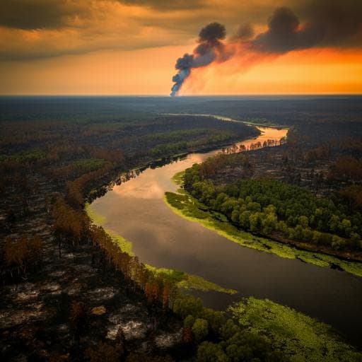
Longitudinal propagation of aquatic disturbances following the largest wildfire recorded in New Mexico, USA
J. Nichols, E. Joseph, et al.
Explore the intriguing dynamics of wildfire disturbance propagation along fluvial networks, as uncovered by researchers Justin Nichols, Eric Joseph, Asmita Kaphle, Paige Tunby, Lina Rodríguez, Aashish Khandelwal, Justin Reale, Peter Regier, David J. Van Horn, and Ricardo González-Pinzón. This groundbreaking study, based on the historic Hermit's Peak-Calf Canyon Fire in New Mexico, reveals unexpected impacts on surface runoff and water quality that extend far downstream.
Related Publications
Explore these studies to deepen your understanding
Adjacent work that informs or extends this paper's methodology and findings.
Environmental Studies and Forestry
Legacies of Indigenous land use shaped past wildfire regimes in the Basin-Plateau Region, USA
V. A. Carter, A. Brunelle, et al.

The Arts
From traditional to digital contexts: new characteristics of the public's spatial perception of urban streets in the age of technology
Z. Xing, R. Zhao, et al.

Engineering and Technology
The microscopic origin of DMI in magnetic bilayers and prediction of giant DMI in new bilayers
P. Jadaun, L. F. Register, et al.

Medicine and Health
Impact of Facebook on Social Support and Emotional Wellbeing in Perinatal Women during Three Waves of the COVID-19 Pandemic in Mexico: A Descriptive Qualitative Study
M. A. Lara, L. Navarrete, et al.


