Environmental Studies and Forestry
Fire deficit increases wildfire risk for many communities in the Canadian boreal forest
M. Parisien, Q. E. Barber, et al.
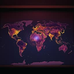
Canada’s boreal forests have experienced an increasing trend in annual area burned, particularly in the west, driven by a complex interplay of climate/weather, fuels, human land use, and fire management. Boreal fire regimes include infrequent, large, high-intensity fires that reduce fuel loads; stands younger than 30 years tend to be less flammable, creating a negative feedback that limits subsequent burning. Canada’s fire management is divided into intensive and extensive protection zones, with aggressive suppression near communities to protect life and property. The study asks whether decades of aggressive suppression around communities have reduced the prevalence of recently burned forests (RBF <30 years), increasing the continuity of older, more flammable fuels and thereby elevating wildfire risk in the wildland–urban interface. The authors quantify and compare RBF around communities to their broader fire regime zones (FRZ) to assess potential fire deficits and associated risk.
Prior work documents rising area burned across Canada’s boreal forest and highlights multiple determinants of wildfire activity, including climate change-driven increases in fire weather severity, fuel composition and continuity, and human influence. Humans are responsible for a large share of ignitions but also reduce area burned via detection and suppression, contributing to a net decrease in burned area in managed zones. Boreal stands younger than ~30 years generally have reduced flammability due to biomass depletion and slow regrowth, creating a negative feedback on subsequent fire ignition and spread observed widely across the biome. The wildland–urban interface has expanded, concentrating ignitions near communities. The concept of a fire deficit from successful suppression leading to fuel accumulation and increased long-term hazard—the “fire paradox”—has been documented in other North American ecosystems and is posited to occur in parts of Canada. Large lakes can limit fire spread locally, but significant reductions in fire likelihood generally require very large water bodies or high proportions of water on the landscape.
Study area and stratification: The analysis covered the Canadian boreal biome (as per the national ecological framework), subdivided into 12 fire regime zones (FRZ) representing ecographic units with similar fire regimes; only boreal FRZ with ≥6 communities were summarized by zone. Software: R v3.6.1 and ArcGIS Enterprise v10.7 were used. Community selection: From 381 boreal populated places, 160 communities were retained. Exclusions: population <200; >30% natural or anthropogenic nonfuel within a 25-km buffer; island communities in large lakes; communities within 25 km of each other (retaining the one with at least twice the population, or if not, the one with greatest forest cover within 10 km). Community centroids were manually corrected using aerial imagery. RBF mapping: Wildfire perimeters were from the National Burned Area Composite (NBAC), characterized at 250-m resolution (1988–2017) to compute time since fire. Permanent nonfuels (tundra, water, open rock) were masked using the KNN Canadian land cover dataset. A pixel was classified as recently burned forest (RBF) if it was <30 years since last fire (i.e., 1988–2017), otherwise non-RBF. Forest harvest polygons (Landsat-based 30-m, 1985–2015) were not included in the RBF calculation. Spatial analysis around communities: For each community, concentric, nonoverlapping 5-km-wide buffers were created from 5 km to 25 km. Pixels within 2 km of community boundaries were removed to limit effects of outlying residences and infrastructure. For each buffer, the percent RBF was computed over forested lands (after masking nonfuels). Overlaps between neighboring communities’ buffers were trimmed by removing parts overlapped by a smaller-radius buffer from a neighbor to avoid interaction. For each FRZ, the average percent RBF across communities and buffers was compared to the overall percent RBF of the entire FRZ. Statistical summaries and tests: Community-buffer RBF values were summarized as bootstrapped medians with 95% confidence intervals; statistical significance versus the FRZ value was inferred when the CI did not intersect the FRZ line. Additional comparisons used Mann–Whitney tests (e.g., for water proportions around communities vs. random points). Sensitivity analyses: The RBF age threshold was varied to 20 years (1998–2017) and 40 years (1978–2017). Results were coherent with the 30-year threshold, indicating robustness to the age definition. An alternative zonation (homogeneous fire zones, HFZ) was tested but dropped due to excessive within-zone variability. Ignitions, harvesting, and land cover: Ignition densities (fires >0.1 ha, 1988–2017) were computed within 5-km concentric buffers around communities and compared to areas beyond 5 km, separating human- and lightning-caused fires. Timber harvest percentages (1985–2015) around communities were compared to those across FRZ. Land cover comparisons (within 10 km of communities vs. random FRZ points) included proportions of open water (MODIS 250-m time series), permanent nonfuel (excluding water), and deciduous forest (from the National Risk Analysis Fuel map, 250 m).
• Most communities had little recently burned forest (RBF <30 years) nearby. Across 160 boreal communities, 74.4% had ≤10% RBF within 10 km, indicating high potential exposure to wildfire. • Relative to their fire regime zones (FRZ), 54.4% of communities showed a fire deficit (≥5% lower RBF than their FRZ), 15.0% showed a surplus, and the remainder showed no substantial difference. • Significant fire deficits were observed in multiple FRZ and distances: FRZ 5 and 11 had significantly lower RBF at all 5-km buffer distances; FRZ 3 up to 10 km; FRZ 8 at 5, 10, 20, and 25 km; FRZ 6 and 7 at 5 km. FRZ 1–2 also had significantly lower RBF but with minimal absolute differences (<5% RBF). Because buffers were nonoverlapping, the observed deficits are cumulative among concentric rings. • Case studies of recent evacuations showed pronounced pre-fire deficits that were largely eliminated post-fire: Eastmain, QC pre-fire RBF 6.4% vs. FRZ 21.9% (post-fire 26.3%); Fort McMurray, AB pre 2.2% vs. FRZ 42.5% (post 73.3%); La Ronge, SK pre 1.1% vs. FRZ 42.5% (post 30.5%); Whatì, NT pre 1.9% vs. FRZ 42.5% (post 41.6%). • Ignition densities were far higher near communities: overall ignition density within 5 km was 21.6 times higher than beyond 5 km; for human-caused ignitions, 62.3 times higher. Human-caused ignitions predominated within 10 km of communities; lightning ignitions showed no relationship with town proximity. • Potential barriers and other factors: Communities often had more nearby open water than random points in their FRZ (significant in FRZ 1, 3, 5, 6, 8, 11), but water proportion around communities was not significantly correlated with percent RBF. Deciduous cover was generally greater at random points than near communities; permanent nonfuel proportions were similar. Timber harvest percentages from 1984/85–2015 around communities were similar to or lower than FRZ averages. • Sensitivity analyses using 20- and 40-year RBF thresholds produced results coherent with the 30-year threshold, supporting robustness.
The findings support the hypothesis that decades of aggressive suppression around Canadian boreal communities have reduced the prevalence of recently burned, less flammable stands near settlements, thereby increasing the continuity of older, more flammable fuels and elevating wildfire risk. This pattern aligns with the “fire paradox,” where successful short-term suppression increases long-term hazard as fuels accumulate. The elevated ignition density near communities, especially human-caused ignitions, further compounds risk where fuels are older and continuous. Although eastern Canada generally exhibits lower burn rates and thus smaller relative deficits, forests there (including around communities) are older and can still experience very large events under conducive weather. While proximity to water can sometimes mitigate spread, substantial risk reductions typically require very large lakes or very high areal water coverage, conditions not commonly met around many communities studied. Young stands not only resist ignition/spread but can create downwind ‘fire shadows’ that disrupt incoming fire spread; however, under extreme weather, even stands <30 years can burn, though reburning of RBF remains relatively rare. These insights underscore the need to complement suppression with proactive mitigation to break the continuity of older fuels near communities, through prevention, fire-smart structures, targeted fuel and vegetation management (including promoting deciduous composition where appropriate), and, where feasible, prescribed burning.
A majority of boreal Canadian communities are surrounded by a low proportion of recently burned forest, and over half exhibit a clear fire deficit relative to their broader fire regime zones, consistent with long-term effects of aggressive suppression increasing flammability near human values. Given concentrated human ignitions and projections of more severe fire weather, reliance on suppression alone is insufficient. A more holistic fire management strategy is needed that includes enhanced prevention, risk reduction at the structure/community scale, targeted fuel and vegetation management, and consideration of prescribed burning where acceptable. Determining the critical proportion and spatial configuration of RBF needed to meaningfully reduce community risk remains an open research question; integrating non- or less-flammable landscape features and understanding weather thresholds that overcome young-stand fuel limitations are additional avenues for future work.
• Observational, comparative design: Results are correlative and infer the role of suppression via patterns of RBF deficits rather than direct experimentation. • Zonation choices: Analyses rely on FRZ; alternative homogeneous fire zones (HFZ) were tested but dropped due to high internal variability. FRZ with <6 communities (e.g., zones 4 and 12) were excluded from zone-level summaries. • RBF definition and data resolution: RBF classification is based on a fixed age threshold (<30 years) and 250-m NBAC data (1988–2017); although sensitivity analyses (20 and 40 years) showed robustness, fine-scale heterogeneity may be underrepresented. • Treatment of harvesting: Timber harvest areas (1985–2015) were not included in the RBF calculation, which may affect the interpretation of young forest prevalence where harvest-created fuels differ from postfire stands. • Spatial preprocessing: Pixels within 2 km of community boundaries were removed to limit confounding from infrastructure; buffers were trimmed to avoid overlap, which may affect local context in densely settled regions. • Case studies: The four community case studies are qualitative demonstrations of pre/post RBF changes rather than formal causal analyses. • Other confounders: While water, deciduous cover, and permanent nonfuel were examined, other local factors (e.g., detailed fuel structure, suppression resource allocation over time) were not exhaustively modeled.
Related Publications
Explore these studies to deepen your understanding of the subject.