logo
ResearchBunny Logo
Unprecedented continental drying, shrinking freshwater availability, and increasing land contributions to sea level rise

Earth Sciences

Unprecedented continental drying, shrinking freshwater availability, and increasing land contributions to sea level rise

H. A. Chandanpurkar, J. S. Famiglietti, et al.

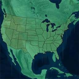
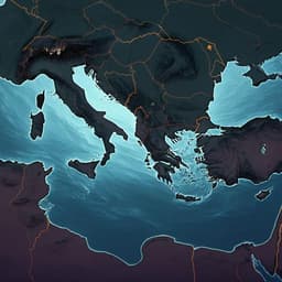
NASA GRACE/GRACE-FO satellite data reveal unprecedented continental terrestrial water storage loss since 2002: expanding mega-drying regions, dry areas drying faster than wet areas are wetting, and groundwater depletion accounting for 68% of non-glaciated TWS loss. Resulting impacts touch 75% of the global population in 101 countries and make continents a larger freshwater contributor to sea level rise than ice sheets—urgent action is required. Research conducted by Authors present in <Authors> tag.

00:00
00:00
~3 min • Beginner • English
Introduction
The study investigates how and why terrestrial water storage (TWS)—including ice, snow, surface water, canopy water, soil moisture, and groundwater—has changed since 2002 in the context of intensifying climate change. As global temperatures set records and hydrological extremes of drought and flooding increase, TWS has shifted rapidly, threatening freshwater availability, sustainable water management, agriculture, biodiversity, and potentially triggering climate migration and conflict. Societal reliance on groundwater has grown amid declining surface water, leading to long-term groundwater depletion that amplifies TWS losses. Losses of continental freshwater contribute directly to global mean sea level (GMSL) rise. Using two decades (April 2002–April 2024) of GRACE/GRACE-FO observations, the authors quantify continental-scale drying, identify the emergence of interconnected mega-drying regions, assess robustness and drivers (climate change vs. human water management), and evaluate implications for freshwater availability and sea level rise. They define "continental drying" as global-scale reduction in TWS (including on-land glacier and ice cap melt, excluding Greenland and Antarctica in designated analyses). Key questions addressed include: Are high-latitude regions still wetting? Where and how fast are drying areas expanding? What are the principal drivers of TWS decline? How do continental drying components contribute to GMSL rise?
Literature Review
Prior GRACE-based studies documented regional and global TWS change patterns, including the "wet gets wetter, dry gets drier" (WW–DD) paradigm and large contributions from glacier and ice sheet melt as well as groundwater depletion. Earlier work identified high-latitude wetting and mid-latitude drying trends, regional hotspots (e.g., California’s Central Valley, Ogallala Aquifer, Middle East aquifers), and climate-driven variability linked to ENSO and PDO. Studies have shown continuity of mass loss from Greenland, Antarctica, and global glaciers and ice caps, widespread declines in lake storage, and strong influences of decadal climate modes on TWS distributions. The present work updates these findings, showing recent deviations from WW–DD at high latitudes, expansion and interconnection of drying hotspots into mega-regions, and increased roles of drought and groundwater depletion. It references major drought assessments in Europe, global glacier melt projections, and widespread groundwater depletion across many of the world's aquifers.
Methodology
Data: JPL GRACE/GRACE-FO Mascon Release 6 Version 3 (JPL-M) were used to represent TWS anomalies over April 2002–April 2024 at native ~3° resolution (provided on 0.5°×0.5° grid). Gap months between GRACE and GRACE-FO were ignored; sporadic data gaps were interpolated after removing climatology. Trend estimation: Seasonal cycles were removed by computing anomalies from monthly climatology, followed by ordinary least-squares (OLS) linear trend estimation. Uncertainty quantification combined: (i) 90% confidence intervals from OLS; (ii) mascon-specific formal 1-σ uncertainties weighted by land fraction, aggregated via root-sum-square to monthly uncertainties; (iii) application of average monthly formal uncertainty with opposing signs to halves of the time series to bound regression fits and derive data-driven trend uncertainty; and (iv) addition of (i) and (iii) to yield total trend uncertainty. Resolution enhancement for regional analysis: To infer sub-mascon-scale information, JPL-M fields were bias-corrected using GLDAS-2.2-DA (which assimilates GRACE/FO via CLSM4) to generate 0.25°×0.25° TWS. Steps: upscale GLDAS to 0.5°, compute mean bias per mascon (model minus observation) normalized by grid count, apply uniform bias within each mascon, resample normalized biases to 0.25° via first-order spline interpolation (skimage), and spatially smooth with a 9×9 moving-average filter; add smoothed bias to GLDAS output to obtain bias-corrected high-resolution TWS. Mega-drying region identification: Regions were delineated by grouping previously identified drying hotspots interconnected with areas where local TWS trends changed from positive to negative since earlier global studies. Criteria: trend magnitude below −0.2 cm year⁻¹ (30th percentile threshold) and inclusion of two or more known hotspots; Southern Hemisphere largely excluded due to frequent strong interannual variability not meeting threshold conditions. Robustness testing: A trend persistence test assessed sensitivity to increasing record length. Local trends were computed starting with the first 5 years, then iteratively adding each successive month (195 iterations total). Locations with trend sign unchanged in ≥95% of iterations were mapped as robust drying or wetting. Variance ratio mapping: Computed ratio of long-term variance (SD of the linear trend fit) to interannual variance (SD of detrended anomalies), with ratios >1 indicating dominance of long-term trend over interannual variability. Masks and separation: Ocean and land were separated using the JPL-M mask. A glacier and ice cap (GIC) mask isolated mascons with >1% glacier/ice coverage and included neighboring mascons with strong ice signals to capture leakage. Drying and wetting regions were separated by the sign of long-term trends. Anomalies and extremes mapping: Monthly TWS were de-seasoned (monthly climatology removal). Global areas under dry and wet anomalies were computed by summing grid areas with negative or positive anomalies, respectively, with and without GIC. Extremes were defined by standardized anomalies exceeding ±1 SD (local), with areas under dry/wet extremes calculated monthly and aggregated into successive 5-year periods to compute percent-of-months with extremes. Decomposition of non-glaciated TWS components: Non-GIC TWS trend was decomposed into groundwater (GW) and soil moisture (SM) using GRACE-assimilated GLDAS-2.2-DA, surface water (SW) and snow water equivalent (SWE) using WaterGAP v2.2d. To avoid double counting, the WaterGAP surface water equivalent (SWWG) was subtracted from GLDAS soil moisture (SMGLDAS). WaterGAP SWE was used due to GLDAS SWE inconsistencies. The merged TWS was computed as TWSmerged = GWGLDAS + SWWG + SWEWG + (SMGLDAS − SWWG). The Caspian Sea storage signal, missing in models, was taken from GRACE and attributed to SW. Trends of individual components were computed globally over non-glaciated land. Annual renewable water: Basin-scale renewable freshwater was defined as precipitation minus evapotranspiration minus environmental flow requirement; precipitation and evapotranspiration means were from ERA5 over the study period; environmental flows followed published datasets. Sea level equivalents: Mass contributions to GMSL were expressed in mm SLE year⁻¹, with continental drying (negative TWS trends) contributing positively to sea level and wetting contributing negatively. ENSO/PDO context: ENSO phases were indicated in time series to interpret interannual variability; PDO acknowledged as a key decadal influence on TWS distributions.
Key Findings
- Continental-scale TWS loss since 2002 is unprecedented, with expansion of interconnected Northern Hemisphere mega-drying regions: northern Canada and Alaska; northern Russia; a contiguous southwestern North America–Central America region; and a vast tri-continental region spanning North Africa–Europe–Middle East–Central Asia–northern China–South/Southeast Asia. - High-latitude regions previously wetting now exhibit drying: northern Canada (−0.86 ± 0.03 cm year⁻¹ excluding GIC; −2.23 ± 0.05 cm year⁻¹ with GIC), northern Russia (−0.41 ± 0.03 cm year⁻¹; −0.42 ± 0.03 cm year⁻¹ with GIC). - Southwestern North America and Central America mega-region: overall −0.76 ± 0.04 cm year⁻¹; southwestern US states (AZ, CA, CO, KS, NM, NV, OK, TX, UT) −0.85 ± 0.05 cm year⁻¹; Mexico and Central America −0.66 ± 0.05 cm year⁻¹. - Middle East/North Africa–Pan-Eurasia mega-region: −0.83 ± 0.02 cm year⁻¹ (−0.88 ± 0.02 cm year⁻¹ with GIC). Notable subregions: Northwestern Sahara Aquifer System −0.45 ± 0.01 cm year⁻¹; Arabian Aquifer System −0.64 ± 0.01 cm year⁻¹; Caspian and Aral Seas −3.0 ± 0.12 cm year⁻¹; Tarim Basin −0.39 ± 0.01 cm year⁻¹ (−0.52 ± 0.02 cm year⁻¹ with GIC); Indus Basin −1.23 ± 0.07 cm year⁻¹; Ganges–Brahmaputra Basin −1.09 ± 0.09 cm year⁻¹ (−1.4 ± 0.09 cm year⁻¹ with GIC); North China Aquifer System −0.82 ± 0.10 cm year⁻¹; Myanmar −0.37 ± 0.09 cm year⁻¹; Thailand −0.94 ± 0.10 cm year⁻¹; Cambodia −0.54 ± 0.13 cm year⁻¹; Malaysia −0.60 ± 0.06 cm year⁻¹. - Areas under drying increased by 831,600 ± 69,100 km² year⁻¹ (non-glaciated: 601,500 ± 65,200 km² year⁻¹). Areas under dry extremes grew by 845,065 ± 122,661 km² year⁻¹ (non-glaciated: 685,096 ± 110,021 km² year⁻¹). Since 2014, non-glaciated areas under dry extremes surged at 2,610,000 ± 242,900 km² year⁻¹. - Complementary decreases in wet areas: −831,600 ± 69,100 km² year⁻¹ (non-glaciated: −601,500 ± 65,200 km² year⁻¹). Areas under wet extremes decreased by −232,300 ± 128,800 km² year⁻¹ overall; post-2014, non-glaciated wet extremes increased more slowly (1,650,900 ± 127,200 km² year⁻¹). - Robustness: 62% of persistent-trend area is drying; 73% of locations with long-term variance exceeding interannual variance lie in drying regions, with ratios up to 5.8, indicating strong, persistent drying signals. - Groundwater depletion is the dominant driver of non-glaciated TWS loss (68% of trend), followed by surface water (18%), soil moisture (9%), and snow water equivalent (5%). - Sea level contributions (mm SLE year⁻¹): global ocean mass increases at 1.99 ± 0.2; Greenland 0.73 ± 0.07; Antarctica 0.37 ± 0.05; global land (TWS) 0.89 ± 0.15; GIC 0.67 ± 0.04; non-glaciated TWS 0.22 ± 0.14. Non-glaciated drying regions contribute 1.01 ± 0.11 (368 ± 40 Gt yr⁻¹), while non-glaciated wetting regions offset −0.79 ± 0.12 (−287 ± 44 Gt yr⁻¹). - Since ~2015, continents are the leading contributor (≈44%) to mass-driven GMSL rise, surpassing Greenland (~37%) and Antarctica (~19%). Non-glaciated robust drying alone contributes ~0.7 mm SLE year⁻¹ (260 ± 43 Gt yr⁻¹). - Societal impact: ~6 billion people (~75% of global population in 2020) live in 101 countries with declining TWS since 2002, indicating widespread shrinking freshwater availability.
Discussion
The findings directly address the core questions about recent changes in global TWS, revealing a pronounced and expanding continental drying signal, especially across the Northern Hemisphere, that departs from earlier WW–DD expectations of high-latitude wetting. The emergence of mega-drying regions links previously isolated hotspots through intensifying drought, high-latitude cryospheric and permafrost changes, and accelerating groundwater depletion. Robustness analyses show that drying trends are persistent and often dominate interannual variability, implying that these declines are likely to continue without major interventions. The growth in areas under dry anomalies and extremes since 2014—coincident with strong El Niño and subsequent La Niña years—suggests a shift in TWS behavior potentially influenced by decadal climate modes like the PDO. The decomposition results highlight human water management, particularly groundwater overpumping, as the most tractable driver to curb. Critically, continents now contribute more freshwater to GMSL rise than either ice sheet individually, and non-glaciated drying contributions rival those from land glaciers and ice caps, indicating that continued continental drying can trigger accelerations in sea level rise. The study underscores the urgent need for targeted groundwater sustainability policies, enhanced storage and recharge, and improved representation of cryospheric and subsurface processes in climate models to capture emerging TWS dynamics.
Conclusion
Using GRACE/GRACE-FO observations from 2002–2024, the study demonstrates unprecedented continental drying characterized by expansion of mega-drying regions, increases in areas and durations of extreme drying, and a pivotal shift in high-latitude TWS from wetting to drying. Groundwater depletion accounts for most non-glaciated TWS loss, amplifying climate-driven aridification and drought. The continents have become the leading contributor to mass-driven global sea level rise, with non-glaciated drying contributions comparable to or exceeding those from land glaciers and ice caps. These robust trends threaten freshwater availability for the majority of the world’s population and demand urgent, coordinated management actions—especially to slow and reverse groundwater depletion and to enhance on-land water storage and recharge. Future research should focus on attribution between human and climate drivers, improved modeling of ice, snow, permafrost, subsurface hydrology, and human water use, and deeper exploration of links between TWS variability and decadal climate modes to better forecast and manage continental drying and its global impacts.
Limitations
- GRACE/GRACE-FO record length (~22 years) is shorter than the recommended ≥30 years for climatological assessments, and some regions (e.g., Amazon) have shown trend sign changes over the mission. - Resolution enhancement relies on bias correction using GLDAS-2.2-DA and WaterGAP models, which have limitations in representing cryospheric processes, subsurface hydrology, human activities, and forcing uncertainties; component decomposition is performed at global non-glaciated scales to mitigate heterogeneity. - Identification of mega-drying regions uses a threshold-based, partly subjective grouping approach and largely excludes the Southern Hemisphere due to strong interannual variability. - Gap months between GRACE and GRACE-FO were ignored; sporadic gaps were interpolated post-climatology removal, introducing potential uncertainties. - CMIP models may inadequately represent ice, snow, permafrost melt, and declining surface water storage, limiting direct model-data comparisons and attributions.
Listen, Learn & Level Up
Over 10,000 hours of research content in 25+ fields, available in 12+ languages.
No more digging through PDFs, just hit play and absorb the world's latest research in your language, on your time.
listen to research audio papers with researchbunny