logo
ResearchBunny Logo
The time since land-use transition drives changes in fire activity in the Amazon-Cerrado region

Environmental Studies and Forestry

The time since land-use transition drives changes in fire activity in the Amazon-Cerrado region

A. F. S. Ribeiro, L. Santos, et al.

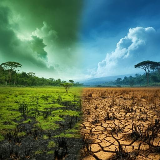
This research explores how deforestation and climate change are transforming fire regimes in the Cerrado-Amazon transition, revealing intriguing links between land-use transitions and fire probability. Conducted by an expert team of authors, including Andreia F. S. Ribeiro and Lucas Santos, this study highlights the critical role of frontier age in understanding fire activities, especially during droughts. An eye-opening look at the ecology of fire!

00:00
00:00
~3 min • Beginner • English
Introduction
The transition zone between the Amazon rainforest and the Cerrado savanna is a major global agricultural frontier shaped by decades of deforestation for cattle ranching and, more recently, by agricultural intensification and expansion of mechanized croplands (soybean, cotton, corn). These land-use changes can fundamentally alter regional fire regimes, with fires used in land clearing and pasture management potentially escaping into native ecosystems, especially during dry, hot years. Amazon forests and Cerrado savannas have contrasting ecological responses to fire: suppression can reduce escaped fires in the Amazon but may disrupt fire-dependent Cerrado ecosystems. The study addresses the limited understanding of how fire activity evolves with the age of agricultural frontiers and different land-use transitions, particularly the lagged responses before and after conversion. The authors hypothesize that frontier age and intensification reduce fire probability across both drought and non-drought years, and they model fire probability as a function of time since transition, alongside climate drivers (VPD, MCWD), to understand spatiotemporal fire patterns across the Amazon-Cerrado frontier.
Literature Review
Prior work indicates a human-driven decline in global burned area and suggests reduced fire activity with agricultural intensification. However, opposing fire responses to human activities are expected in the Amazon versus the Cerrado, and comprehensive analyses of lagged fire responses to land-use transitions in the ecotone are lacking. Studies in the Amazon link deforestation and forest degradation with increased understory fires, and emphasize the role of drought-fire interactions in elevating tree mortality and shifting forests toward lower-biomass states. In the Cerrado, a fire-adapted system, fire suppression can promote woody encroachment and elevate the risk of high-intensity fires when they do occur. Climate change—manifested as warmer, drier, and longer dry-to-wet transition seasons—can amplify flammability and increase fire risk, particularly near fragmented edges. Projections suggest that land-use change alone may be insufficient to reduce future Amazon understory fires without climate mitigation. Thus, the interplay among land-use transitions, agricultural intensification, and climate extremes is central to understanding fire regime trajectories across the Amazon-Cerrado frontier.
Methodology
The study modeled the proportion of burned area associated with specific land-use transitions as a function of time since land clearing, using annual land cover from MapBiomas 6.0 and burned area from MapBiomas Fire 1.0 for 1986–2020. To improve computational efficiency while preserving categorical integrity, datasets were resampled from 30 m to 500 m using nearest neighbor in Google Earth Engine. Land-use transition maps at 500 m were generated for: forest→pasture (F-P), savanna→pasture (S-P), grassland→pasture (G-P), forest→cropland (F-Crop), savanna→cropland (S-Crop), grassland→cropland (G-Crop), and pasture→cropland (P-Crop). Burned area maps were overlaid with transition maps to compute the fraction of burned pixels per transition type. A 2.5-degree grid was used for regionalization; within each grid cell, fire probability was defined as the burned fraction of the converted area. Time lags between fire and conversion ranged from −35 to +34 years, with age 0 the year of conversion; small transition areas below the 15th percentile were filtered to avoid 100% probabilities from tiny areas. Climate drivers were incorporated by deriving maximum cumulative water deficit (MCWD) and vapor pressure deficit (VPD): precipitation from CHIRPS and PET and VPD from TerraClimate, aggregated to the 2.5-degree grid using median reducers. MCWD was computed as the minimum annual cumulative (P − PET), with more negative values indicating greater dryness; annual median VPD was also computed. Statistical modeling employed univariate Generalized Additive Models (GAMs) with Gaussian error and adaptive Gaussian kernel smoothing to capture nonlinear relationships between fire probability and frontier age, fitted for all transition types and both biomes. Non-stationarity over time was assessed by splitting 1986–2020 into five 7-year intervals and fitting GAMs with and without time lags. Segmented regressions (up to three breakpoints) identified abrupt changes in fire-age relationships for key transitions. Linear regressions estimated spatial patterns of pre- and post-conversion fire probability rates (slopes) at the grid-cell level, aggregating transitions to pasture and to cropland to ensure sample sizes. To analyze climate-fire coupling, the database was stratified into quartiles of burned area extent (small, medium, large, very large) and of MCWD and VPD, and GAMs were refit for the dominant transitions (F-P and P-Crop) to evaluate how drought and air dryness modulate age-related fire probabilities.
Key Findings
• Land-use transitions: Over three decades, forest→pasture accounted for 37% of transitions, pasture→cropland 21%, and savanna→pasture 20%. • Burned area associated with transitions: 76% of burned area tied to conversions occurred during forest conversion (72% forest→pasture; 4% forest→cropland); pasture→cropland contributed 9%. • Frontier age effects: Deforestation increased fire activity both before and after conversion to pasture—peaking around the year of conversion—with elevated fire probabilities for several years. In the Amazon, fire probability peaked at about 45% at age 0 for forest→pasture, remained elevated for at least 8 years post-conversion, and showed a detectable rise up to ~4 years pre-conversion. In the Cerrado, analogous but smaller effects were observed, with ~3 years pre-conversion and ~7 years post-conversion elevations. • Transition differences: Savanna/grassland→pasture transitions showed lower and less pronounced spikes than forest→pasture. Transitions to cropland had lower fire probabilities at conversion and achieved faster elimination of fire from the landscape; fire probabilities often declined even before conversion to cropland in both biomes, consistent with pre-emptive fire suppression. • Spatiotemporal patterns: Negative fire probability trends dominated with increasing frontier age both before and after transitions, more strongly in the Amazon for forest→pasture; cropland transitions displayed subtler changes with predominant declines pre- and post-conversion. • Non-stationarity: Fire spikes at forest→pasture conversion (age 0) diminished in magnitude over successive 7-year periods, consistent with broader declines in clearing rates; pasture→cropland spikes were smaller overall and relatively stable over time, especially in the Cerrado. • Climate coupling: Larger extents of burned area during forest→pasture were strongly associated with more severe drought (more negative MCWD) and higher air dryness (higher VPD). Small burned extents showed weaker dependence on climate stress. In contrast, for pasture→cropland, fire probabilities remained low and largely decoupled from climate severity classes. • Implications: Agricultural intensification and frontier aging reduce fire probability overall, but deforestation-related ignition sources—amplified by drought and dryness—drive large burned areas, particularly in the Amazon.
Discussion
The analysis confirms that the age of the agricultural frontier is a key determinant of declining fire probability following land-use transitions, and that agricultural intensification, particularly conversion to mechanized croplands, accelerates fire suppression. Nonetheless, deforestation-related fires generate substantial fire activity both years before and after conversion, with stronger and more persistent effects in the Amazon than in the Cerrado. The coupling of deforestation with drought and elevated air dryness increases the likelihood of large burned extents, highlighting synergistic risks under a warming, drying climate. In the Cerrado, reduced burning under agricultural intensification may have mixed ecological consequences, potentially promoting woody encroachment and elevating the risk of infrequent high-intensity fires. Incorporating frontier age as a proxy for governance and land management into fire models improves the representation of ignition probabilities and temporal dynamics of fire risk. The findings emphasize that preventing deforestation and preserving native vegetation remain critical for mitigating high-severity fires and safeguarding carbon stocks, biodiversity, and regional hydroclimate.
Conclusion
This study demonstrates that time since land-use transition fundamentally shapes fire regimes across the Amazon-Cerrado frontier. Deforestation triggers pronounced fire spikes beginning several years before conversion and persisting for years after, especially in the Amazon, whereas subsequent agricultural intensification—particularly transitions to cropland—rapidly suppresses fire activity. Drought and air dryness amplify large burned extents associated with deforestation, while cropland transitions exhibit low fire probabilities largely decoupled from climate stress. Incorporating frontier age into fire modeling, alongside climate drivers, provides a more realistic depiction of ignition risk and temporal fire dynamics. Policy and management should prioritize ending deforestation and protecting native vegetation; in the Cerrado, strategies must also consider the ecological roles of fire and risks of suppression under hotter, drier conditions. Future research should refine detection of understory and cropland fires, evaluate long-term ecological consequences of sustained fire suppression in the Cerrado, assess governance and management interventions as frontiers age, and further disentangle land-use versus climate controls on regional fire regimes.
Limitations
The MapBiomas Fire 1.0 dataset may underestimate low-intensity understory fires in forests and overestimate cropland fires due to spectral confusion with crop residues, introducing uncertainty into burned area estimates. Resampling from 30 m to 500 m, while appropriate for categorical tracking, can smooth fine-scale heterogeneity. Filtering out small transition areas (below the 15th percentile) reduces extreme probabilities but may exclude some relevant small-scale dynamics. Modeling at a 2.5-degree grid aggregates diverse landscapes and management practices, potentially masking local variability. Although segmented regressions identify breakpoints, the number of breakpoints was chosen for interpretability, which may affect precision of inferred change points. Despite these limitations, the core conclusions—particularly the stronger and longer-lived deforestation-associated fire signals and faster suppression under cropland transitions—are robust.
Listen, Learn & Level Up
Over 10,000 hours of research content in 25+ fields, available in 12+ languages.
No more digging through PDFs, just hit play and absorb the world's latest research in your language, on your time.
listen to research audio papers with researchbunny