logo
ResearchBunny Logo
Ocean mass, sterodynamic effects, and vertical land motion largely explain US coast relative sea level rise

Earth Sciences

Ocean mass, sterodynamic effects, and vertical land motion largely explain US coast relative sea level rise

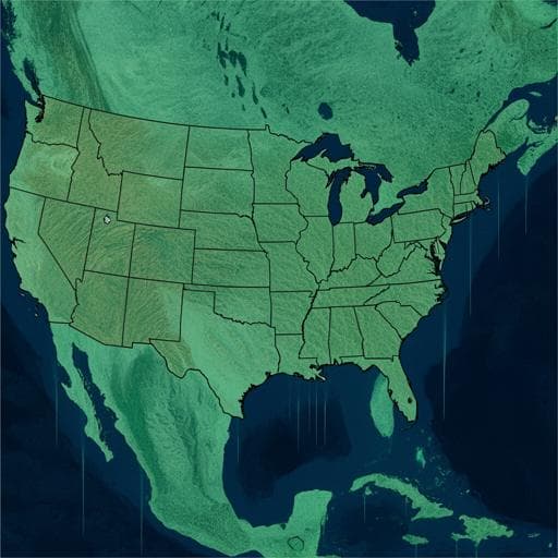
T. C. Harvey, B. D. Hamlington, et al.

This research, conducted by a team of experts including T. C. Harvey and B. D. Hamlington, unveils the intricate interplay of ocean mass changes and land motion contributing to sea-level rise in the contiguous U.S. They meticulously analyze tide gauge data from 1993 to 2018, shedding light on the relative trends at 47 locations, while raising questions about unexplained anomalies.

00:00
00:00
~3 min • Beginner • English
Introduction
The study addresses why regional relative sea level (RSL) along the U.S. coasts differs from global mean sea level (GMSL) and to what extent known processes can explain observed RSL trends during the satellite-altimetry era (1993–2018). Regional sea-level change is influenced by sterodynamic effects (thermosteric expansion and ocean dynamics), contemporary mass redistribution (from land ice and terrestrial water storage) including associated gravitational, rotational, and deformational effects, and vertical land motion (VLM) due to glacial isostatic adjustment (GIA), tectonics, and anthropogenic subsidence. The authors aim to partition observed RSL trends at 55 U.S. tide gauges into these contributions, assess budget closure within uncertainties, and identify locations and processes where gaps remain. This has importance for improving projections and informing coastal planning and risk management.
Literature Review
Prior work has documented strong regional variability in sea-level trends, with elevated RSL rise along the U.S. East Coast linked to GIA-induced subsidence and sterodynamic changes, including Gulf Stream-related dynamics north and south of Cape Hatteras. The western Gulf of Mexico exhibits high RSL rise due to subsidence from subsurface fluid extraction. In contrast, the U.S. Pacific coast has experienced suppressed RSL rise in the altimetry era, associated with decadal climate variability such as the Pacific Decadal Oscillation, though higher rates occurred during parts of the 20th century. Numerous studies have explored components of the sea-level budget regionally (e.g., along the Northwest Atlantic coast and Northwestern European shelf), and reviews have emphasized the need for process-based understanding for reliable regional projections. Persistent challenges include limited coastal observations of sterodynamic signals, altimetry and GRACE limitations near coasts, and uncertainties in GIA and VLM attribution.
Methodology
Study domain and period: 55 tide gauges along the contiguous U.S. coastlines with at least 70% data completeness over 1993–2018. RSL trends from tide gauges were corrected for the inverse barometer effect using HadSLP2 and the Ponte inverted barometer relation. Altimetry-based geocentric sea-level (GSL) trends used the NASA MEASURES Gridded Sea Surface Height Anomalies v1812; trends computed by averaging grid cells within a 300 km radius around each tide gauge. Budget framework: The RSL budget at each location r is expressed as RSL_TG(r) = CMR(r) + SD(r) + GIA_RSL(r) − (VLM(r) − GIA_VLM(r)) + RES(r). For altimetry-derived GSL, GSL_ALT(r) = CMR(r) + SD(r) + GIA_GSL(r) + RES(r). Here, CMR is the contemporary mass redistribution contribution (geocentric), SD is sterodynamic sea level (global-mean thermosteric plus regional dynamic changes), GIA_RSL includes both geoid and VLM components, and VLM is measured by GPS. Subtraction of GIA_VLM from the GPS-based VLM avoids double counting. Trends and uncertainties were consistently evaluated over 1993–2018. Components and data sources: - Contemporary mass redistribution (CMR): GRD patterns and trends from Frederikse et al. (2020), combining Antarctic and Greenland ice sheet mass changes, glaciers, and land hydrology (groundwater, dams, natural variability). Global-mean contribution over 1993–2018 is 1.97 ± 0.35 mm/yr (90% CI). Spatial fingerprints impart north–south gradients along the U.S. coasts, with Greenland/Arctic glaciers enhancing contributions in the U.S. Southeast, and Alaskan glaciers affecting the Pacific coast gradient. - Sterodynamic (SD): Estimated from the data-constrained ECCO Version 4 Release 4 ocean state estimate using the dynamic sea level variable (SSHDYN). To avoid double counting of mass effects, the ECCO global-mean is removed and replaced with an observation-based global-mean thermosteric trend of 1.16 ± 0.4 mm/yr (1993–2018). ECCO and altimetry fields were averaged within 300 km of each tide gauge to reduce small-scale noise while retaining coastal signals. - GIA: GIA-induced geocentric sea-level and VLM components from the Caron et al. ensemble, applied consistently to correct tide-gauge and altimetry observations for GRD effects and to partition VLM into GIA versus non-GIA contributions. - Vertical land motion (VLM): Estimated using GPS Imaging (Hammond et al.), which averages GPS station velocities around each tide gauge weighted by distance, record length/uncertainty. Velocities are in ITRF2014 to be consistent with GRD estimates. VLM not explained by GIA (residual VLM) captures local processes (e.g., groundwater withdrawal, hydrocarbon extraction, sediment compaction, tectonics). Uncertainty estimation: Linear trends by least squares with serial correlation accounted for by reduced degrees of freedom. Uncertainties from component datasets (e.g., GRACE and in situ mass estimates for CMR, thermosteric trend for SD, GIA ensemble spread, GPS-imaging VLM uncertainties) were propagated. Total uncertainties for the summed contributions and residuals were formed by combining process-based and trend-fit terms; results reported at two-sigma when assessing closure. Spatial analyses were stratified into three regions: Northeast (Atlantic north of Cape Hatteras), Southeast and Gulf, and West Coast (Pacific). Additional comparisons used altimetry-only budgets (independent of VLM) to diagnose biases.
Key Findings
- Budget closure: The sum of CMR, sterodynamic effects, GIA, and non-GIA VLM explains observed RSL trends within uncertainties at 47 of 55 tide gauges (85%). Eight locations could not be reconciled within uncertainties. - Component magnitudes: CMR contributed a global-mean 1.97 ± 0.35 mm/yr (1993–2018, 90% CI). Sterodynamic trends were ~2–2.5 mm/yr along the U.S. East and Southeast coasts but small (near zero to slightly positive) along the West Coast in the altimetry era. - Regional patterns: • Northeast (18 gauges): Most gauges show RSL trends near or above 4 mm/yr, with substantial contributions from GIA-induced subsidence. For 15/18 stations, residuals are not statistically different from zero (2σ), but residuals tend to be negative, suggesting potential positive bias in one or more component estimates; ECCO sterodynamic trends north of Cape Hatteras appear higher than surrounding areas and higher than altimetry, indicating likely overestimation of sterodynamic effects. • Southeast and Gulf (17 gauges): 16/17 gauges have trends >4 mm/yr; average sterodynamic contribution approaches ~2.5 mm/yr and CMR near its global mean. Large total trends at Rockport and Grand Isle are tied to significant non-GIA subsidence (residual VLM) linked to subsurface fluid extraction. Thirteen of 17 stations have residuals not significantly different from zero (2σ); residuals tend to be negative overall. • West Coast (20 gauges): Most gauges have trends <3 mm/yr; sterodynamic contributions are small and consistent with decadal variability (e.g., PDO) suppressing rise during 1993–2018. Nineteen of 20 stations have residuals not significantly different from zero (2σ). Notable positive residuals occur at Santa Monica and Port San Luis; several northwest gauges show negative residuals, potentially reflecting GIA model uncertainties. - Altimetry-based diagnostics: Comparing VLM-removed tide-gauge trends to nearby altimetry shows substantial scatter, particularly in the Southeast, implicating VLM uncertainties. Reconstructed GSL (CMR + SD + non-VLM GIA) generally agrees with altimetry on the West Coast but shows a consistent positive bias (reconstructed > altimetry) in the Northeast, reinforcing the inference of overestimated sterodynamic effects there. Southeast exhibits small positive biases in reconstructed GSL versus altimetry, with local discrepancies dominated by non-GIA VLM at specific sites. - VLM assessment: No clear relationship between tide-gauge residual magnitude and distance to nearest GPS station, suggesting non-collocation alone does not explain residuals. However, short and discontinuous GPS records, sparse networks, and local geological differences likely add unquantified uncertainty to VLM estimates.
Discussion
The process-based decomposition largely explains U.S. coastal RSL trends during 1993–2018, confirming that contemporary mass redistribution, sterodynamic changes, and VLM together account for most observed regional differences from GMSL. The analysis clarifies regional contrasts: East and Southeast coasts show large sterodynamic and GIA contributions, with additional local subsidence in parts of the Gulf; the West Coast shows muted sterodynamic rise due to decadal ocean variability. Where residuals persist, patterns implicate two main issues: potential overestimation of coastal sterodynamic trends in the Northeast (likely linked to limitations of ECCO or coastal observing constraints) and uncertainties in non-GIA VLM at specific sites (e.g., due to anthropogenic subsidence). Altimetry-based budgets, independent of VLM, corroborate these findings by reproducing regional biases without invoking VLM in the Northeast and highlighting local VLM impacts in the Southeast. These results improve confidence in process-based interpretations and projections where budgets close, while identifying observational and modeling gaps that, if addressed, can further reduce uncertainties relevant to coastal planning.
Conclusion
This study demonstrates that a process-based budget combining contemporary mass redistribution, sterodynamic effects, and vertical land motion explains the majority (47/55) of U.S. tide-gauge RSL trends over 1993–2018. It quantifies regional drivers: strong sterodynamic and GIA contributions along the Atlantic, significant local subsidence in parts of the Gulf of Mexico, and suppressed sterodynamic rise along the Pacific coast related to decadal variability. Remaining mismatches point to likely overestimation of coastal sterodynamic trends in the Northeast and uncertainties in local non-GIA VLM. Future research should prioritize improved coastal sterodynamic estimation, enhanced and truly collocated GPS-tide gauge stations to better resolve local VLM, extended and higher-quality observational records, and refined GIA models in regions of large uncertainty. Such advances will strengthen regional sea-level projections and inform robust coastal risk management.
Limitations
- Coastal sterodynamic estimation is challenged by limited coastal observations, altimeter footprint and corrections near shore, and coarse GRACE resolution; ECCO-based coastal trends may be biased, especially in the Northeast. - VLM uncertainties arise from non-collocated and short GPS records, discontinuities and low-frequency noise, sparse station density in some regions (e.g., Pacific Northwest), and spatial heterogeneity between GPS foundations and tide-gauge sites; these are difficult to quantify fully. - GIA model uncertainties, particularly in the Pacific Northwest and near the former Laurentide Ice Sheet, affect both sea-level and VLM partitions and contribute to residuals. - The analysis period (1993–2018) is relatively short and influenced by decadal variability, which may affect sterodynamic trend estimates. - Full attribution of non-GIA VLM to specific processes (e.g., groundwater withdrawal vs. natural compaction) is beyond scope, limiting detailed process-level interpretation at some sites.
Listen, Learn & Level Up
Over 10,000 hours of research content in 25+ fields, available in 12+ languages.
No more digging through PDFs, just hit play and absorb the world's latest research in your language, on your time.
listen to research audio papers with researchbunny