Earth Sciences
Ocean fronts and eddies force atmospheric rivers and heavy precipitation in western North America
X. Liu, X. Ma, et al.
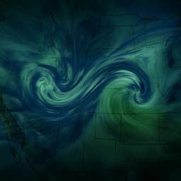
Discover how atmospheric rivers can be influenced by mesoscale sea-surface temperature anomalies along the Kuroshio Extension, leading to an increase in landfalling ARs and substantial precipitation along the U.S. west coast. This groundbreaking research by Xue Liu, Xiaohui Ma, Ping Chang, Yinglai Jia, Dan Fu, Guangzhi Xu, Lixin Wu, R. Saravanan, and Christina M. Patricola highlights the interconnectedness of oceanic conditions and climate events.
~3 min • Beginner • English
Introduction
The study addresses why models struggle to simulate and predict landfalling atmospheric rivers (ARs) and their associated extreme precipitation along the west coast of North America. ARs are key drivers of mid-latitude hydroclimate extremes, producing floods during landfall over orography and influencing both floods and droughts. Improving AR prediction at subseasonal-to-seasonal (S2S) timescales is crucial for water resources and hazard management, yet timing, landfall location, and precipitation impacts remain difficult to forecast even with higher model resolution. Prior predictability research emphasizes tropical variability (MJO, ENSO), but the potential role of mid-latitude mesoscale sea-surface temperature (SST) anomalies from fronts and eddies—prominent along the Kuroshio Extension (KE) and Gulf Stream—has not been explored for ARs, despite evidence that mesoscale SSTs affect the atmosphere beyond the boundary layer, influencing extratropical cyclones (ECs) and storm tracks. Given the tight AR–EC linkage, the paper tests the hypothesis that KE mesoscale SSTs modulate landfalling ARs and heavy precipitation on S2S timescales via a remote mechanism.
Literature Review
Existing work identifies ARs as major sources of poleward moisture transport and extreme precipitation/floods in extratropics, with notable societal impacts in western North America. Forecast skill for AR occurrence/intensity improves with resolution, but landfall timing/location and precipitation remain challenging. Predictability studies have largely focused on tropical drivers (MJO, ENSO) at S2S scales. Concurrently, high-resolution observations and models show mesoscale SST fronts and eddies in western boundary currents (Kuroshio Extension, Gulf Stream) strongly impact atmospheric boundary layer structure and can modulate ECs and storm tracks remotely. ARs are frequently embedded in EC warm conveyor belt dynamics and feeder airstreams. The literature thus suggests a plausible pathway whereby mesoscale SSTs could influence AR genesis and intensity through cyclone–moisture interactions, a gap the current study addresses.
Methodology
Two primary regional twin-ensemble experiments using the WRF model (27 km, 30 levels) over the North Pacific (3.6°N–66°N, 99°E–270°E) were conducted with identical setups except for SST forcing. CTRL used daily 0.09° MW-IR SST; FILT used the same SST after applying a 2-D Loess low-pass spatial filter (15° × 5° cutoff) to remove mesoscale features.
- Seasonal ensemble (SE): 13 boreal winters (2002–2014), each with 5 CTRL and 5 FILT members initialized Oct 1 and integrated 6 months; last 5 months (NDJFM) analyzed, totaling 65 seasons per configuration. Physics: Lin microphysics; RRTMG/Goddard radiation; Noah land surface; YSU PBL; Kain-Fritsch convection. Initial/lateral boundaries: 6-hourly NCEP-DOE AMIP-II (R-2).
- Cyclone ensemble (CE): 568 winter cyclone cases selected from SE CTRL that crossed the KE region. For each, 14-day paired runs (CTRL vs FILT) initialized from SE CTRL restart and boundaries, differing only in SST (CTRL original, FILT filtered as in SE).
- PBL sensitivity experiments: Four twin simulations for 2007/08 winter with 10 CTRL/FILT members each, testing YSU, MYNN, UW (with MM5 surface layer), and MYJ (with Eta surface layer) schemes.
- Global ensemble: CAM5 at 0.23° with prescribed daily 0.25° NOAA OISSTv2 and ice. Thirteen winters (2002–2014), 2 CTRL and 2 FILT members per winter, initialized Dec 1 for 3 months. FILT applied 5°×5° (KE) and 4°×4° (GS) boxcar filters, matching typical mesoscale length scales.
- AR detection/tracking: ARs identified as contiguous regions of IVT anomalies exceeding 250 kg m−1 s−1 with length > 2000 km and width < 1000 km; outer edge defined by closed 250 kg m−1 s−1 IVT contour. Anomalies computed relative to season/ensemble means: SE uses daily minus NDJFM climatology over all 65 members; CE uses 6-hourly minus 2-week mean over all 568 members; CAM uses daily minus DJF mean over all members. Landfalling ARs defined when outermost contour intersects coastline. Lagrangian stitching forms trajectories. Sensitivity tests with alternative algorithms and temporal persistence threshold (≥18 h) yielded consistent conclusions.
- Heavy precipitation definition: Area-averaged daily precipitation over the west coast box (as in Fig. 1c) exceeding the 75th percentile; robustness checked with 90th percentile threshold.
- Mesoscale SST forcing strength analysis: Years (2002–2014) split into two sets (top/bottom four winters) by KE mesoscale SST variance (20°N–45°N, 120°E–180°E) to contrast AR/precipitation responses.
- Reanalysis comparisons: ERA-Interim before (1986–2001; 1° SST) vs after 2002 (2002–2017; 0.5° and finer SST) and ERA5 (1979–2006; 0.25° SST) to assess consistency with model findings regarding AR IVT and mid-tropospheric moisture.
- EC detection and composites: Winter storm tracking using SLP minima within closed contours, cold-core filter (400 hPa temperature), duration ≥2 days, travel ≥10°, stitching with max 6° separation. EC–AR composites constructed within ±2000 km (4000×4000 km box) centered on EC.
- Eddy vs front attribution: Additional 2007–2008 ensembles (10 members each): (i) Front+Eddy (repeat of SE CTRL/FILT), (ii) Front-Only (CTRL/FILT forced by climatological monthly MW-IR SST and filtered climatology), (iii) Eddy-Only (FILT removes only eddy anomalies while retaining SST front). Differences attribute AR response to eddy vs front.
- Statistics: Two-sided Student’s t-test; each detected AR treated as independent sample; values outside AR regions set to zero for testing.
- Observational/validation datasets: ERA-Interim/ERA5 for ARs and moisture; PRISM (CONUS) and GPM for precipitation; MW-IR SST and NCEP-DOE for WRF forcing.
Key Findings
- Inclusion of mesoscale SST forcing (KE fronts and eddies) increases landfalling AR occurrence and intensity along the west coast of North America.
- In SE, landfalling AR count across all members drops from 829 (CTRL) to 631 (FILT). Accumulated AR IVT increases by about 40% in CTRL relative to FILT.
- Concurrent heavy precipitation increases by up to 30% over mountainous terrain when mesoscale SSTs are included.
- CE shows significant enhancement despite 2-week integrations: 2-week mean heavy precipitation increases; fractional increase for events >40 mm/day reaches ~15% on average; time-evolving response shows negligible change in first 4 days, then up to ~40% increase for >40 mm/day thereafter, indicating a ~1–2 week remote effect.
- Mechanism: Warm mesoscale SST anomalies destabilize the lower atmosphere, enhancing vertical moisture flux out of the PBL in the KE region following the passage of an initial cyclone. Cold anomalies suppress this, yielding an asymmetric response and a net moisture increase above the PBL (~800 hPa). In WRF, AR-carried moisture at ~800 hPa is ~10% higher in CE CTRL than CE FILT during day 0–1 of AR evolution. This pre-moistening supports stronger AR genesis associated with subsequent cyclones, shifting AR genesis towards higher IVT values.
- Composite analyses show significant increases in AR IVT and AR-induced precipitation within the warm sector of ECs in CTRL, despite minimal changes to cyclone intensity/structure; >85% of ARs are associated with ECs, linking mesoscale SSTs to AR enhancement via cyclone moisture transport.
- Time/space scale: Remote impact propagates with storm-track transit, taking ~4–5 days from KE to influence landfalling ARs and precipitation on the west coast.
- Eddy vs front attribution: Eddy-induced mesoscale SST forcing primarily drives the increase in landfalling ARs and heavy precipitation; front-only forcing yields decreases; eddy-only experiments reproduce and even strengthen the positive response.
- Observational support: ERA-Interim shows increased landfalling AR IVT after the switch to higher-resolution SST forcing (post-2002). ERA5 (with 0.25° SST) exhibits similar enhancements relative to ERA-Interim, and both reanalyses show increased moisture above the PBL over KE in high-resolution SST periods.
- Global modeling (CAM5 at 25 km) corroborates North Pacific results and shows analogous increases in ARs and precipitation over western Europe associated with Gulf Stream mesoscale SST anomalies.
Discussion
The findings demonstrate a robust remote linkage between mesoscale SST anomalies in the Kuroshio Extension and landfalling ARs and heavy precipitation in western North America on subseasonal time scales. Mesoscale SSTs modulate vertical moisture transport above the boundary layer in the KE region through asymmetric responses to warm versus cold anomalies, preconditioning the environment of developing extratropical cyclones. Enhanced feeder airstreams then transport more moisture into cyclones, strengthening warm conveyor belt ascent and exporting moisture to ARs. This increases AR genesis and IVT without requiring stronger cyclones, allowing more intense ARs to persist across the Pacific and amplify landfall precipitation, particularly over orography. The delayed (multi-day) response aligns with the time for subsequent cyclones to traverse the KE and for ARs to reach North America. Together with reanalysis and global model results, this underscores that resolving mesoscale SST features is crucial for representing AR-related hydroclimate extremes and suggests a pathway to improved S2S predictability by incorporating mesoscale SST forcing into prediction systems.
Conclusion
This study shows that mesoscale SST anomalies associated with KE fronts and eddies substantially enhance landfalling ARs and heavy precipitation along the west coast of North America on subseasonal time scales. High-resolution WRF and CAM5 simulations, supported by reanalyses, indicate about a 40% increase in accumulated landfalling AR IVT and up to a 30% increase in heavy precipitation when mesoscale SSTs are included, with a delayed response of ~4–5 days consistent with a cyclone-mediated remote mechanism. The mechanism hinges on asymmetric vertical moisture pumping over warm versus cold mesoscale SSTs that increases moisture above the PBL, boosting AR genesis and moisture transport within extratropical cyclones. Eddy-induced SST anomalies are the dominant driver of the positive AR/precipitation response. Results imply that using non-eddy-resolving SSTs in atmosphere-only models leads to underestimation of AR-induced heavy precipitation, even at high atmospheric resolution. Future work should quantify gains in S2S predictability from including mesoscale SSTs, investigate the intriguing decrease in ARs under stronger SST fronts, assess regional sensitivities (e.g., Gulf Stream impacts on Europe), and explore coupled model feedbacks.
Limitations
- Observational precipitation validation using PRISM is geographically limited (CONUS) and did not show statistically significant changes due to short records and domain mismatch with peak response regions.
- Reanalysis comparisons (ERA-Interim pre/post 2002; ERA5) provide supportive but not definitive evidence; multiple system changes coincide with SST resolution upgrades, complicating attribution.
- AR detection and tracking choices (thresholds, geometry, persistence) may affect counts and intensities, though sensitivity tests suggest conclusions are robust.
- The WRF experiments are atmosphere-only with prescribed SSTs; fully coupled feedbacks are not explored.
- The Loess filtering approach idealizes mesoscale SST removal and may not perfectly isolate eddy versus frontal contributions outside targeted experiments.
- Statistical tests assume independence between detected ARs; serial dependence could affect effective sample size.
- Model biases remain (e.g., WRF overestimates accumulated precipitation distributions), though spatial patterns and AR-related fractions are realistic.
- Resolution (27 km WRF, 25 km CAM) may not fully resolve all mesoscale processes, especially near orography and within boundary layer turbulence.
Related Publications
Explore these studies to deepen your understanding of the subject.

