
Earth Sciences
Increasing risks of extreme salt intrusion events across European estuaries in a warming climate
J. Lee, B. Biemond, et al.
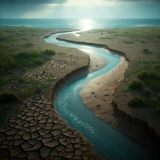
This research by Jiyong Lee, Bouke Biemond, Huib de Swart, and Henk A. Dijkstra reveals alarming predictions about salt intrusion in European estuaries fueled by climate change. Expect a reduction in river discharge leading to extreme salt intrusion events, potentially more than five times more frequent by the century's end.
~3 min • Beginner • English
Introduction
Estuaries are semi-enclosed transition zones where freshwater from rivers mixes with saline ocean water, supporting vital socio-economic and ecological functions. Subtidal salinity distribution results from the balance of salt import by estuarine circulation and tidal pumping against freshwater export by river flow, and the extent of salt intrusion is often measured by the distance of the 2-psu isohaline from the mouth (X2). Prior studies on individual estuaries indicate that salt intrusion will extend landward due to factors such as prolonged droughts, sea-level rise, land subsidence, and channel deepening. Extreme salt intrusion events threaten drinking water supplies and agriculture, causing large economic losses, creating a need for robust projections to inform adaptation strategies. Among external forcings, decreasing upstream freshwater discharge in a warming climate is of particular concern due to projected changes in precipitation, evapotranspiration, and snowmelt that alter freshwater availability. While macro-hydrological projections exist at regional to global scales, few efforts have linked these projections to estuarine salt intrusion processes across multiple systems with uncertainty quantification. Previous high-resolution modeling studies often used single realizations because of computational costs, limiting uncertainty assessment and scale of inference. This study addresses these gaps by quantifying relative changes in 35-year means and return periods of extreme summer salt intrusion events across European estuaries using an ensemble-based river discharge projection and an idealized salt intrusion model.
Literature Review
Previous research has shown landward shifts of salt intrusion driven by extended droughts, sea-level rise, anthropogenic land subsidence, and channel deepening. However, most projections have focused on individual estuaries using detailed 3D hydrodynamic models, typically with single realizations of future forcings due to computational cost, thereby limiting uncertainty quantification and generality. Hydrological studies using CMIP5/6 outputs have assessed future freshwater availability globally and continentally, identifying large uncertainties and regional hotspots of drought and flow reduction, but these have rarely been directly connected to estuarine salt intrusion dynamics at scale. Thus, there is a lack of ensemble-based, continental-scale assessments linking macro-hydrological projections to salt intrusion statistics, including changes in extremes and their return periods.
Methodology
- Climate forcing and river discharge: The study uses the Community Earth System Model Version 2 Large Ensemble (CESM-LE2; n=69) under SSP3-7.0, at ~1° resolution, spanning 1850–2100 with future forcing from 2015. CESM2 includes an improved river routing scheme using Manning’s equation with spatially varying parameters. Daily river discharge time series were extracted at outlets of 22 major European river basins. Present period: 1996–2030; future period: 2066–2100.
- Bias correction: Modeled discharges were bias-corrected using Quantile Delta Mapping (QDM) against observed daily discharge from gauging stations (station list in Supplementary Table S1). QDM maps statistical differences in cumulative distribution functions (CDFs) from simulations onto observed CDFs while preserving projected trends. Observed series lengths were sufficient to ensure converged CDFs. Post-correction PDFs agreed well with observations.
- Estuary selection: From the 22 basins, nine partially or well-mixed estuaries with reported salt intrusion lengths were selected to avoid strongly stratified systems and complex geometries that the model cannot represent accurately. Exclusions included highly stratified estuaries (Ebro, Rhone, Maritsa, Danube, Dnieper, Don), systems with lagoons (Oder, Nemunas), multiple outlets/islands (Glomma, Gota, Ångermanälven), and Onega (different hydrological cycles).
- Salt intrusion model: A time-dependent, idealized subtidal salt transport model based on cross-sectionally averaged hydrodynamics and salt budget was used. Governing equation (for X, the zero-salinity length; X2 computed as (1−s2/s∞)X with s2=2 psu, s∞=35 psu) includes terms for freshwater advection, exchange flow linked to eddy viscosity/diffusion (coefficients C0–C3), and tidal dispersion. The cross-sectional area A is assumed constant. Numerical integration uses a 4th-order Runge–Kutta scheme; daily discharge series were linearly interpolated to 0.5-hourly resolution for stability and convergence. Eddy viscosity/diffusion coefficients were treated constant over the discharge range and calibrated using literature-reported salt intrusion lengths for each estuary to match observed medians with <100 m error.
- Metrics and analysis: Relative changes in 35-year mean river discharge and salt intrusion lengths were computed: ΔQ=(Qf−Qp)/Qp and ΔX2=(X2f−X2p)/X2p, for all months and for summer (June–August, JJA; ΔQJJA, ΔX2JJA). Extreme events were defined as the present-climate 1-in-100-year X2JJA. Annual mean summer discharge QA and X2JJA were analyzed. Kernel Density Estimation (Gaussian kernels; bin widths by grid search) visualized PDFs. Return periods were estimated using the Generalized Extreme Value (GEV) distribution fitted by maximum likelihood to X2JJA; parameters (shape ζ, location λ, scale σ) were obtained and return period curves derived. Scheldt and Humber were excluded from return period analysis due to too-low modeled discharge variability pre-bias-correction ( 325% of observed seasonal SD), which undermined robust extremes estimation.
Key Findings
- River discharge projections: Across Europe, ensemble-mean ΔQ shows strong spatial variability, with significant decreases (−50% to −20%) in Southern Europe, smaller reductions (−20% to 0%) across much of western/central/eastern mid-latitude Europe, and slight increases (0% to 10%) in parts of the UK and Northern Europe. Considering summer only, ΔQJJA shows substantial reductions in most basins: up to about −60% at low latitudes, with magnitudes decreasing toward higher latitudes (e.g., ~−10% in Glomma, Norway). Guadalquivir shows large ensemble uncertainty in ΔQJJA due to extremely low summer flows; Onega shows positive ΔQJJA linked to enhanced runoff.
- Salt intrusion length changes: For nine partially/well-mixed estuaries, ΔX2JJA indicates increases in summer salt intrusion length in most low and mid-latitude systems, typically 10–30%. In several estuaries (Loire, Tamar, Thames, Rhine–Meuse, Elbe), summer increases exceed annual-mean increases because of enhanced future seasonality of discharge; Gironde shows similar ΔX2JJA and ΔX2 due to a year-round monotonic discharge decline; Guadalquivir shows smaller ΔX2JJA than ΔX2 as its summer discharge is already consistently low in present and future.
- Extremes and return periods: Probability densities of QA and X2JJA shift toward lower QA and higher X2JJA with increased variance in the future. Using GEV analysis, the present 1-in-100-year summer salt intrusion event becomes much more frequent by 2066–2100: Tamar ~3-year, Guadalquivir ~4-year, Gironde ~9-year, Loire ~42-year, Thames ~41-year, Rhine–Meuse ~4-year, Elbe ~12-year. Overall, extreme salt intrusion events are projected to occur more than five times as often in many European estuaries by the end of the century under SSP3-7.0.
Discussion
The study directly links ensemble-based projections of summer river discharge to salt intrusion statistics across multiple European estuaries, addressing the need for scalable, uncertainty-aware assessments. The projected summer discharge declines (10–60% in most basins) drive increases in mean salt intrusion length (10–30%) and sharply reduced return periods of present-day 1-in-100-year summer salt intrusion extremes, implying significant risks to freshwater supplies, ecosystems, and coastal infrastructure. By focusing on river discharge as the dominant driver, the projections provide a lower bound on future salt intrusion; additional factors like sea-level rise, changing tides and storm surges, and human-induced morphological changes will likely amplify the impacts. A preliminary estimate suggests sea-level rise contributions could be of comparable importance to discharge changes in several mid-latitude estuaries. The modeling framework is sufficiently simple and data-sparse to be transferable to other partially or well-mixed estuaries, enabling macro-scale screening to identify hotspots warranting detailed studies and to inform stakeholder planning for mitigation and adaptation.
Conclusion
This work delivers a continental-scale, ensemble-based projection of salt intrusion across European estuaries under SSP3-7.0, demonstrating substantial summer flow reductions, 10–30% increases in salt intrusion lengths, and markedly more frequent extreme events by late century. The study provides a transferable framework connecting macro-hydrological projections to first-order estuarine salt intrusion responses with quantified uncertainty. Future research should incorporate additional forcings and feedbacks, including regional sea-level rise patterns, tide and storm surge changes, estuary morphological evolution (e.g., deepening, subsidence), and multiple emission scenarios. Employing more sophisticated, geometry-resolving estuarine models and integrated socio-economic analyses will be essential to refine risk assessments and guide comprehensive adaptation strategies.
Limitations
- Forcing scenario coverage is limited to SSP3-7.0 due to CESM-LE2 availability; other scenarios were not assessed.
- The salt intrusion model assumes constant cross-sectional area and uses constant eddy viscosity/diffusion coefficients, simplifying estuarine geometry and variability; this may misrepresent dynamics under changing conditions.
- Sea-level rise effects were only crudely estimated (global mean 0.74 m, RCP8.5 analog) without regional variability, and only partially represented in model terms; impacts are likely underestimated/overestimated in different respects.
- Only river discharge changes were explicitly considered as drivers, providing lower-bound estimates; tide, storm surge, wind, and wave changes were not dynamically included.
- Estuary selection excluded strongly stratified and complex systems; results apply to partially/well-mixed estuaries and may not generalize to all estuary types.
- Return period analysis excluded Scheldt and Humber due to insufficient modeled discharge variability pre-bias-correction, limiting extreme statistics coverage.
- Climate model and bias-correction uncertainties remain, particularly where observational records are sparse or variability is large.
Related Publications
Explore these studies to deepen your understanding of the subject.