logo
ResearchBunny Logo
Global expansion of tropical cyclone precipitation footprint

Earth Sciences

Global expansion of tropical cyclone precipitation footprint

L. Qin, L. Zhu, et al.

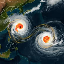
Discover how tropical cyclones are reshaping our landscapes and intensifying flooding risks as this groundbreaking study introduces DIST30—a metric capturing the scope of heavy TC precipitation. The research, conducted by Lianjie Qin, Laiyin Zhu, Baoyin Liu, Zixuan Li, Yugang Tian, Gordon Mitchell, Shifei Shen, Wei Xu, and Jianguo Chen, uncovers alarming trends in TC impact areas across the globe.

00:00
00:00
Playback language: English
Introduction
Tropical cyclones (TCs) pose significant threats due to strong winds, storm surges, and heavy precipitation. While climate models generally project a decrease in global TC frequency and an increase in intensity, the spatial patterns of heavy TC precipitation remain uncertain. Increased TC rainfall rates are expected with warming due to the Clapeyron-Clausius relationship, but recent studies using satellite data suggest a decreasing trend in inner-core rainfall with increases in outer bands. This reversal may be linked to atmospheric stability and increased water vapor availability from warmer sea surface temperatures (SSTs). TC rainfall area also plays a crucial role, increasing with relative SST. Existing research often uses rainfall metrics based on arbitrary radii from the TC center, which may not accurately represent rainfall risk due to high spatial variability. This study addresses these gaps by introducing a new metric, DIST30, which quantifies the mean radial distance from clustered heavy rainfall cells (>30 mm/3h) to the TC center. DIST30 provides a more generalized description of the distance from the center of clustered heavy rainfall cells to each TC center, and offers a more direct approach to understanding the potential major inland flood risk caused by heavy TC rainfall. This work aims to analyze the temporal and spatial changes in DIST30 globally and identify key environmental factors influencing its variability using a machine learning approach. The findings are crucial for understanding and mitigating the increasing risk of inland flooding associated with expanding TC precipitation footprints.
Literature Review
The existing literature highlights the destructive power of tropical cyclones and their projected intensification under climate change. Studies using satellite rainfall measurements have revealed contrasting trends in TC rainfall rates: a decrease in the inner core and an increase in outer rainbands. These trends are linked to factors like atmospheric stability and higher water vapor availability from warmer SSTs. The rainfall area also plays a significant role, expanding with increasing relative SST. However, many studies rely on rainfall metrics based on arbitrary radii from the TC center, limiting their ability to accurately capture the spatial distribution of heavy rainfall and thus the risk of flooding. This lack of consistent methodology makes multi-model comparisons challenging. The current study intends to improve this situation by providing a generalized and comprehensive description of the distance between the center of heavy rainfall and each TC center, which would then be a major improvement to existing spatial metrics used to describe the footprint of TCs.
Methodology
This study utilizes a 41-year (1980-2020) high-resolution global precipitation dataset (MSWEP v2) and the International Best Track Archive for Climate Stewardship (IBTRACS) v04 for TC information (position, minimum sea-level pressure, maximum sustained wind speed). TC precipitation data are extracted within a 500 km radius of TC centers. The precipitation field is resampled to 25 km resolution using the Albers projection. DIST30, the key metric, is calculated as the mean radial distance from the centers of clustered heavy rainfall cells (>30 mm/3h) weighted by their rainfall rate to the TC center. A similar metric, DIST50 (threshold >50 mm/3h), is also calculated for comparison. Linear regression is used to analyze temporal trends in DIST30. To understand the factors controlling DIST30, an XGBoost machine learning model is developed using monthly DIST30 values, TC characteristics (maximum wind speed, central pressure), and environmental factors (SST, relative 2-meter air temperature, vertical wind shear, total column water vapor). SHAP values are used to interpret the model's predictions and assess feature importance. Spatial distributions of SHAP values are also analyzed to understand regional variations. Temporal trends in DIST30 are further analyzed by separating data into three latitude bands: tropics (25°S-25°N), northern mid-latitudes (>25°N), and southern mid-latitudes (>25°S).
Key Findings
The global annual mean DIST30 shows a statistically significant increasing trend of 0.34 km/year from 1980 to 2020. The relative frequency of >30 mm/3h TC precipitation increases significantly beyond 200 km from the TC center in both low and mid-latitudes, while decreasing within 200 km. DIST50 shows a consistent upward trend (0.36 km/year), supporting the findings from DIST30. Spatially, DIST30 increases are observed in 59.87% of the global total TC impact areas, with the strongest increases in the Western North Pacific, Northern Atlantic, and Southern Pacific basins. Coastal areas also show a slight increase in DIST30. The XGBoost model demonstrates good prediction performance (R² = 0.51 globally). SHAP analysis reveals that TC maximum intensity (VMAX), latitude (LAT), central pressure (PRES), vertical wind shear (WS), and relative 2-meter air temperature (RT2M) are the most important factors influencing DIST30. VMAX exhibits a non-monotonic relationship with DIST30, with lower VMAX associated with larger DIST30, potentially due to extratropical transition (ET) of TCs. LAT shows a positive relationship with DIST30, reflecting the poleward migration of TCs and their faster translation speeds at higher latitudes. WS demonstrates a positive but non-linear relationship with DIST30, particularly strong in mid-latitudes. RT2M shows a non-monotonic relationship, likely reflecting the interplay between latitude and SST. Relative SST and total column water vapor also show positive relationships with DIST30. Temporal trend analysis reveals a strong increasing trend in DIST30 in northern mid-latitudes, primarily driven by the increase in TC frequency at higher latitudes and the slight increase in vertical wind shear. In contrast, the tropics show a slight increasing trend in DIST30, potentially linked to reduced vertical wind shear and increased SST.
Discussion
The findings demonstrate a global expansion of the TC precipitation footprint, particularly in mid-latitudes of the Northern Hemisphere. The increase in DIST30 is primarily attributed to the poleward migration of TCs and the interaction with stronger vertical wind shear in these regions. The XGBoost model and SHAP analysis provide valuable insights into the complex interplay of factors influencing DIST30, highlighting the importance of vertical wind shear, TC intensity, latitude, and environmental factors like SST and water vapor. This expansion of the heavy rainfall footprint increases the risk of inland flooding, particularly in densely populated coastal areas and mid-latitude regions historically less exposed to TC hazards. The non-monotonic relationships observed for some variables, such as VMAX and RT2M, underscore the complexity of TC precipitation dynamics and the need for further research to fully understand these processes. The study provides a novel metric (DIST30) for quantifying and analyzing changes in TC precipitation patterns, offering a valuable tool for risk assessment and improved flood prediction.
Conclusion
This study reveals a significant global expansion of tropical cyclone precipitation footprints, as measured by DIST30, primarily driven by the poleward migration of TCs and interactions with vertical wind shear in mid-latitudes. The XGBoost model and SHAP analysis identify key controlling factors. These findings highlight the increasing inland flood risk associated with TCs, particularly in densely populated mid-latitude regions. Future research should focus on refining the DIST30 metric, improving regional-scale analysis, and projecting future changes in TC precipitation patterns under various climate change scenarios.
Limitations
The study relies on MSWEP precipitation data, which has inherent uncertainties. The XGBoost model captures a substantial portion of the variability in DIST30 but doesn't account for all factors affecting TC precipitation. The analysis focuses primarily on the spatial distribution of heavy rainfall, neglecting other aspects of TC impacts, such as wind and storm surge. Future studies could improve the analysis by integrating other variables into the model and providing finer-resolution spatial analysis.
Listen, Learn & Level Up
Over 10,000 hours of research content in 25+ fields, available in 12+ languages.
No more digging through PDFs, just hit play and absorb the world's latest research in your language, on your time.
listen to research audio papers with researchbunny