logo
ResearchBunny Logo
Deforestation reduces rainfall and agricultural revenues in the Brazilian Amazon

Environmental Studies and Forestry

Deforestation reduces rainfall and agricultural revenues in the Brazilian Amazon

A. T. Leite-filho, B. S. Soares-filho, et al.

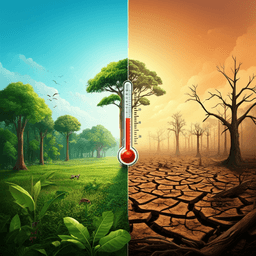
This study reveals the surprising effects of deforestation on rainfall in the Southern Brazilian Amazon, highlighting a delicate balance that tips the scales towards devastating agricultural losses. Conducted by Argemiro Teixeira Leite-Filho, Britaldo Silveira Soares-Filho, Juliana Leroy Davis, Gabriel Medeiros Abrahão, and Jan Börner, this research emphasizes the critical need for effective deforestation policies.

00:00
00:00
~3 min • Beginner • English
Introduction
The Amazon forest shapes regional rainfall regimes that sustain agriculture in the Southern Brazilian Amazon (SBA), a major soy and beef producing frontier. Despite this critical role, deforestation in the Brazilian Amazon has risen sharply, with 11,000 km² lost in 2020 (a 143% increase from the 2012 minimum). Land use and cover change (LUCC) alters moisture recycling and surface energy balance and may affect rainfall as strongly as, or more than, greenhouse-gas-driven warming at regional scales. Prior modeling and empirical studies indicate that rainfall may decline once forest loss surpasses critical thresholds, but the precise values and their scale dependence remain uncertain. Some studies suggest linear declines while others point to nonlinear, threshold-like responses linked to mesoscale circulation changes from heterogeneous deforestation. Modeling at regional scales (~200–600 km) has suggested thresholds between 30–50% forest loss, but empirical identification using observed rainfall has been lacking. This study empirically quantifies how continued forest loss affects annual rainfall across multiple spatial scales in SBA, identifies critical thresholds, and assesses implications for agriculture under alternative deforestation governance scenarios.
Literature Review
Existing work shows Amazon rainfall is closely tied to forest cover via evapotranspiration, albedo, and roughness effects, with LUCC potentially inducing climate responses comparable to or exceeding those from global warming at regional scales. Studies report mixed patterns: some find negative linear relationships between forest loss and rainfall, while others find nonlinear responses where patchy deforestation can enhance local convection and create rainfall dipoles, increasing precipitation over deforested patches but decreasing it over adjacent forests. Regional modeling experiments have indicated critical forest loss thresholds (approximately 30–50%) beyond which rainfall declines. Mechanistically, at small scales deforestation breezes and mesoscale circulations can temporarily enhance rainfall, while at larger scales increased albedo, reduced year-round evapotranspiration of crops/pastures, and lower surface roughness diminish atmospheric moisture and convection, reducing rainfall. However, prior to this work, empirical identification of these thresholds using observed rainfall data across scales remained unresolved.
Methodology
Study area: Southern Brazilian Amazon (SBA), 1.9 million km². Period: 1999–2019. Data: Annual rainfall from TRMM 3B43 v7 (0.25° ~ 28 km) aggregated to yearly totals. Deforestation from INPE PRODES (30 m) aggregated to grid cells of 28×28, 56×56, 112×112, and 224×224 km. Elevation from SRTM. Rainfall anomaly construction: To reduce omitted-variable bias, the authors removed effects of geographic gradients and large-scale interannual variability. Step 1: Estimated spatial rainfall pattern using a second-degree polynomial in latitude, longitude, and elevation (r=0.72), yielding expected rainfall due to location/elevation. Step 2: Computed deviations of observed annual rainfall from these expectations for each year and grid cell. Step 3: Subtracted the annual regional mean to remove large-scale signals (e.g., ENSO), yielding residual annual rainfall anomalies per grid cell and year. Analysis linking forest loss and rainfall: For each grid size, related annual rainfall anomalies to cumulative forest loss fraction using regression. At 28, 56, and 112 km, best fit obtained with Multivariate Adaptive Regression Splines (MARS) with two piecewise linear segments, identifying a critical threshold where the relationship changes sign. At 224 km, a single linear regression sufficed (linear decline with forest loss). Conducted t-tests comparing long-term changes in rainfall between cells below versus above the small-scale threshold across two periods (1999–2009 vs 2010–2019). Evaluated spatial association using Cramer's V and Spearman rank correlation after detrending other signals to assess robustness and directionality of association. Causality checks: Assessed potential reverse causality by overlaying Maximum Climatological Water Deficit effects on deforestation; only 12 of 86 non-null cells showed a statistically significant tendency for more severe deforestation in drier/drying parts, with signal near zero in SBA (which has a long dry season), supporting the hypothesis that forest loss drives rainfall reduction. Scenario simulation: Simulated deforestation and land use expansion 2015–2050 using the spatially explicit Otimizagro LUCC model under two scenarios: Weak Environmental Governance (WEG) with policy dismantling and incentives for illegal deforestation; Strong Environmental Governance (SEG) with full Forest Code enforcement and added conservation incentives. Simulations at multiple spatial levels down to a 25-ha raster grid. Future demands and regrowth rates exogenous to the model. Agricultural impact assessment: Estimated soybean and pasture productivity losses due to deforestation-induced rainfall reduction using spatially explicit yield-loss relationships from the literature. Projected yields to 2050 (soy 3.7 t/ha; pasture 2.9 arroba/ha) adjusted by estimated productivity losses. Calculated annual revenues (US$302.58 per ton soy; US$201.50 per arroba beef) with and without yield reductions, weighting by simulated crop/pasture areas under each scenario. Computed Net Present Value (NPV) of revenues for SBA using a 3.75% discount rate (Selic) and converted to Equivalent Annual Annuity (EAA). Opportunity costs defined as differences in NPV/EAA between WEG and SEG outcomes.
Key Findings
- Empirical critical thresholds and scale dependence: - 28-km grid cells: Rainfall increases with forest loss up to a threshold of ~57.5% (55–60%), then declines sharply. Pre-threshold slope: +22.1 ± 9.3 mm per 10% additional forest loss. Post-threshold slope: −49.2 ± 11.3 mm per 10% additional forest loss. - 56-km grid cells: Threshold ~47.5% forest loss; positive effect before threshold and negative after, both attenuated relative to 28 km. - 112-km grid cells: Threshold ~27.5% forest loss; effects further attenuated. - 224-km grid cells: No threshold; rainfall decreases linearly with forest loss. - Temporal comparisons (t-tests): Cells with smaller historical forest loss (<55–60%) experienced increased annual rainfall of +96.9 ± 12.65 mm between 1999–2009 and 2010–2019; cells with larger forest loss (>55–60%) saw annual rainfall decrease by −306.4 ± 42.77 mm; both P < 0.05. - Spatial heterogeneity: Regions in the south and southwest, with lower baseline rainfall and smaller interannual variability, experience proportionally larger reductions, up to 48% in some areas. - Mechanistic interpretation: At small scales, heterogeneous deforestation can induce rainfall dipoles that locally enhance rainfall. Beyond thresholds and at larger scales, higher albedo, reduced evapotranspiration, and lower surface roughness dominate, reducing atmospheric moisture and rainfall. - Causality support: After detrending, rainfall anomalies spatially co-vary with forest loss (Cramer's V and Spearman correlations). Reverse causality signal (more deforestation in drying areas) was weak and limited (12/86 cells, near zero effect). Rainy season length decreases by 0.9 ± 0.34 days per additional 10% forest loss. - Future thresholds under scenarios: - By 2019, 25% of SBA 28-km cells had already crossed the 55–60% threshold. - Under WEG, 28-km cells crossing threshold: 36% by 2030; 55% by 2050. SEG could reduce the 2050 share by 24% relative to WEG. - Under WEG by 2050, shares of cells crossing thresholds: 61% (56 km; D ≥ 47.5%) and 69% (112 km; D ≥ 27.5%). SEG could reduce these by 28% and 16%, respectively. - Economic impacts: - Under WEG, deforestation-induced rainfall reductions imply NPV productivity/revenue losses of US$ 5.6 billion (soy) and US$ 180.8 billion (beef) by 2050 (SBA, net present values). - Conservation opportunity cost under SEG is US$ 19.5 billion NPV, far smaller than WEG’s productivity losses. - Equivalent Annual Annuity indicates up to roughly US$ 1 billion in annual agribusiness losses from continued deforestation. - Overall, widespread deforestation creates a hydrological and economic negative-sum game: regional rainfall and productivity losses at larger scales outweigh any local, pre-threshold rainfall gains.
Discussion
The study empirically demonstrates that the relationship between deforestation and rainfall in the Southern Brazilian Amazon is nonlinear and scale dependent. At finer scales (28–56 km), patchy deforestation can initially enhance convection and rainfall over cleared patches (deforestation breeze/rainfall dipoles), but only up to a critical forest loss fraction, after which rainfall declines steeply. As spatial scale increases—or as neighboring cells simultaneously lose forest—the threshold occurs at lower levels of forest loss and the net effect becomes an increasingly uniform decline in rainfall, consistent with the dominance of higher surface albedo, reduced evapotranspiration, and diminished roughness over mesoscale circulations. These findings directly address the research question by empirically identifying critical thresholds previously suggested by models, quantifying the magnitude of rainfall changes before and after thresholds, and showing the attenuation of local gains with increasing spatial extent of deforestation. The work also links hydrological changes to agricultural outcomes: in heavily deforested and drier subregions, rainfall losses are proportionally larger, exacerbating yield variability and threatening double-cropping systems via delayed onset, earlier end, and shortened rainy seasons. Under continued weak governance, many regions will cross thresholds by 2050, causing substantial, geographically widespread rainfall and productivity losses. The economic analysis indicates that these hydrological impacts translate into large revenue losses that exceed conservation opportunity costs, implying that continued deforestation harms agribusiness itself. Strong environmental governance that curbs deforestation can prevent many grid cells from crossing thresholds and avoid large economic damages.
Conclusion
This study provides the first empirical identification of scale-dependent critical forest loss thresholds for rainfall in the Southern Brazilian Amazon, showing a nonlinear response at 28–112 km and a linear decline at 224 km. Rainfall increases with forest loss up to approximately 55–60% at 28 km but declines steeply thereafter; analogous thresholds occur at lower forest-loss fractions at larger scales. Projections indicate that, under weak environmental governance, a large share of the region will cross these thresholds by 2050, resulting in substantial rainfall and agricultural productivity losses. Economic appraisal reveals that the revenue losses from deforestation-induced rainfall reductions far exceed the opportunity costs of conservation, implying that reducing deforestation is both environmentally and economically advantageous for Brazil’s agribusiness. Policymakers should strengthen environmental governance to avert crossing hydrological thresholds and safeguard rainfed agricultural systems. Future research could refine causal inference with higher-resolution observations and experiments, quantify interactions with greenhouse-gas-driven climate change, assess adaptation pathways (e.g., crop choices, irrigation) and their costs/benefits, and extend analyses to additional ecosystem services affected by deforestation.
Limitations
The analysis is correlational; while multiple tests (spatial associations, water deficit overlays) support causality from forest loss to rainfall reduction, reverse causality and unobserved confounders cannot be fully ruled out. Results represent regional-average relationships and may vary by location due to spatial heterogeneity in baseline rainfall and variability. Rainfall anomalies rely on satellite-derived TRMM data and detrending assumptions (geographic polynomial fit and removal of regional means). Scenario analyses assume constant agricultural practices and prices over time, and exogenous demands and regrowth rates, which may not hold in reality. Agricultural loss estimates are based on literature-derived yield responses to deforestation-induced rainfall changes and do not fully incorporate potential adaptation or technological change.
Listen, Learn & Level Up
Over 10,000 hours of research content in 25+ fields, available in 12+ languages.
No more digging through PDFs, just hit play and absorb the world's latest research in your language, on your time.
listen to research audio papers with researchbunny