logo
ResearchBunny Logo
Back-to-back high category atmospheric river landfalls occur more often on the west coast of the United States

Earth Sciences

Back-to-back high category atmospheric river landfalls occur more often on the west coast of the United States

Y. Zhou, M. Wehner, et al.

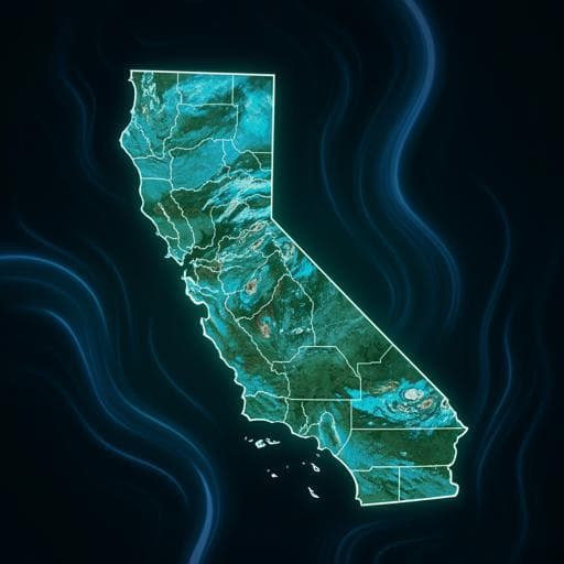
The recent catastrophic atmospheric river events in California have unveiled the urgent need to comprehend high-risk weather extremes. Research conducted by Yang Zhou, Michael Wehner, and William Collins employs machine learning to reveal that high-density AR clusters lead to increased severe weather events. Discover the intricate patterns behind these climate phenomena and their projected changes in a warming world.

00:00
00:00
~3 min • Beginner • English
Introduction
From late December 2022 to mid-January 2023, California experienced nine landfalling atmospheric rivers (ARs) in rapid succession, causing severe flooding, landslides, power outages, and fatalities. The study addresses how spatiotemporally compounding ARs (AR clusters) vary in characteristics and impacts, and what large-scale circulation patterns modulate their occurrence. The authors hypothesize that AR clusters have diverse characteristics and landfall impacts driven by differences in landfall duration, spacing between landfalls, and event intensity, and that high-category ARs are more prone to occur in back-to-back sequences that elevate flood risk. The work aims to improve understanding of AR cluster variability, associated circulation, and projected future changes to inform adaptation and resilience strategies.
Literature Review
Prior studies identified sequences of multiple AR landfalls (e.g., AR families) and linked them to semi-stationary synoptic patterns partially modulated by ENSO. Subseasonal clustering of ARs shows regional differences in cluster counts over the western U.S. Numerous studies project more intense ARs in a warmer climate; consecutive AR intensity and duration increase with warming, yielding unprecedented monthly precipitation totals by century’s end. Case studies (e.g., Oroville Dam crisis) project 21–59% precipitation increases under late 21st-century scenarios. Some work suggests ARs associated with extratropical cyclones show strong precipitation increases under warming, while non-cyclone ARs do not. Land surface preconditioning (antecedent soil moisture, snowpack) elevates runoff ratios during ARs, implying greater flood risk during clustered events when recovery time is insufficient. These gaps motivate focused analysis of AR cluster characteristics, circulation patterns, and projections.
Methodology
Data: ERA5 reanalysis (1979–2023, October–April; 2022–2023 truncated to October–February), using 6-hourly integrated vapor transport (IVT) for AR detection, 500 hPa geopotential height (Z500) and 850 hPa winds for circulation. Land impacts assessed with CPC Unified Daily Precipitation (0.5°), NARR soil moisture saturation and runoff, and PRISM precipitation for observational uncertainty. AR detection: Primary algorithm is TECA-BARD (restrictive, Bayesian ensemble of plausible detectors) applied to IVT to produce binary AR masks. To assess detection uncertainty, two additional algorithms were used: GW15 (relative IVT threshold at 85% of climatology plus geometric/directional criteria; permissive) and RSR14 (absolute IVT threshold 250 kg m−1 s−1; permissive). Fraction of time steps with landfalling ARs differs markedly: TECA-BARD 16.1%, GW15 35.3%, RSR14 56.6%. AR landfall and clustering: Landfall defined where AR masks overlap the U.S. West Coast land mask. A 6-hourly binary landfall flag (1 during landfall) captures event occurrence and duration. Mean Shift clustering (sklearn) is applied to the time indices of landfall flags to identify temporal AR clusters without pre-fixed windows. Bandwidth estimated via sklearn.estimate_bandwidth (ERA5: 8 days; CMIP5/6/CESM2-LENS: 7–9 days). Clusters with one landfall are labeled solitary (density=1). Cluster density is defined as AR days divided by total cluster days. Excluding solitary clusters, clusters are split into dense (≥50th percentile of density) and sparse (<50th percentile). Circulation analysis: Composite daily Z500 anomalies and 850 hPa winds are constructed for dense and sparse clusters. Z500 anomalies are decomposed into synoptic (<20 days), subseasonal (20–100 days), and low-frequency (>100 days) components via Lanczos filtering to quantify contributions. EOF analysis of daily Z500 anomalies (20°–80°N) identifies leading modes; principal components (PCs) are related to cluster density and to binary AR cluster indices (all, dense-only, sparse-only) via temporal correlations. Models and projections: Validation of circulation patterns and EOF–cluster relationships against CMIP5/6 models (ARTMIP Tier 2 with TECA detection) and CESM2-LENS ensembles (historical 1960–2000; future SSP370 at warming levels +1, +1.5, +2, +3, +4 °C relative to 1850–1900). Future changes in Z500 variability assessed using pseudo-PCs by projecting historical CESM2-LENS EOFs onto future Z500 fields (future daily means removed), normalizing by historical PCs. Future AR cluster characteristics (density groups, counts, AR category) are evaluated per warming level. Extreme precipitation days are defined as gridpoint precipitation above the 98th percentile of 44 cool seasons; spatial fractions of AR-related extremes computed for dense vs sparse clusters.
Key Findings
- Cluster occurrence and size: Excluding solitary clusters, most frequent densities are 0.2–0.4, with occurrence frequency decreasing as density increases. Cluster size (time span) decreases with increasing density; despite different durations, dense and sparse clusters both include on average 3–4 AR landfalls, implying density differences mainly arise from shorter spacing between events in dense clusters. - 2022–2023 event: The nine ARs split into two clusters—late December (Category 5 and Category 3) and early January (seven ARs from Weak to Category 3). - AR activity and inland extent: During dense clusters, AR frequency is 100–150% higher than during sparse clusters along 35°–50°N on the U.S. West Coast; ARs during dense clusters penetrate inland to ~117°W. - AR category and precipitation: Average AR category within a cluster increases with density. Approximately 20–50% of top 2% precipitation days occur during dense clusters and 10–20% during sparse clusters along the West Coast. Mean AR-related precipitation intensity is significantly higher in dense clusters; over Oregon and Washington, dense-cluster AR precipitation intensity is 120–140% of sparse clusters. More than 60–65% of AR precipitation over the West Coast is attributed to dense clusters. - Land surface impacts: Both dense and sparse clusters increase soil moisture saturation in mountain ranges; sparse clusters yield ~10–40% increases (max over northern California), while dense clusters yield ~20–50%. Runoff related to AR clusters contributes about 60% of total coastal runoff. Dense clusters increase runoff nearly 100% more than sparse clusters over northern California and 150–300% more over the Cascade Range. - Circulation patterns: Dense clusters associate with a tri-pole Z500 anomaly over the North Pacific, including a strong negative anomaly over the northeastern Pacific inducing cyclonic flow and a poleward, high-speed southeast branch favorable for moisture transport—supporting higher AR categories and impacts. Sparse clusters associate with a south–north dipole and more zonal eastward flow over the subtropical NE Pacific. Subseasonal variability contributes ~40–50% of total Z500 anomalies for both cluster types. The 2023 nine-AR series (during decaying La Niña) shows a La Niña teleconnection when low-frequency variability is removed, consistent with dense-cluster patterns. - EOF links: EOF1 relates to the PNA; EOF2 to tri-pole patterns linked to Western/Eastern Pacific Oscillations and resembles sparse-cluster circulation (spatial r≈0.74); EOF3 closely matches dense-cluster circulation (spatial r≈0.79). Higher cluster density coincides with positive PC1 (positive PNA) and higher PC3; sparse clusters are more coincident with positive PC2. Temporally, PC3 has the highest correlation with AR cluster indices, mainly via dense clusters; PC1 also correlates positively (dense-driven); PC2 aligns more with sparse clusters. - Model evaluation: CMIP5/6 and CESM2-LENS generally reproduce the first three Z500 EOF modes and their relationships with AR clusters; agreement is strongest for EOF3–cluster links. Sparse-cluster Z500 composites show higher spatial correlation with observations than dense-cluster composites. - Future changes: In CESM2-LENS SSP370, pseudo-PC1 decreases with warming (more frequent opposite phase of EOF1), pseudo-PC2 increases (consistent with a deepening/northward-shifting Aleutian Low), while pseudo-PC3 shows no significant trend. The PC3–cluster-density relationship persists across warming levels, while PC1/PC2 links weaken as modes shift. Due to the relative-threshold AR detection, AR and cluster counts change little with warming despite a uniform 2–7% increase in AR-related IVT; AR categories increase with warming because of higher IVT. No consistent change is found in spacing or landfall duration. Cluster counts by density shift: densities <0.6 decrease with warming, while clusters with density >0.6 increase significantly, with a notable increase at +4 °C.
Discussion
The findings confirm that back-to-back, high-density AR clusters are more likely to include higher-category ARs, intensify extreme precipitation, and amplify hydrologic impacts, thereby elevating flood risk. Distinct large-scale circulation patterns—particularly a tri-pole Z500 anomaly fostering poleward moisture transport—modulate dense-cluster activity. Subseasonal variability is the dominant timescale underlying these circulation anomalies, and EOF3 captures the circulation-state most predictive of dense clustering. The established relationships between PCs (especially PC3) and cluster density provide a pathway for anticipating periods conducive to high-density AR clustering. In future climates, while associations with EOF1 and EOF2 weaken as their phases shift, the PC3 link remains, indicating that the most predictive circulation mode for dense clustering persists. The combination of increased AR category under warming and a projected rise in high-density clusters suggests enhanced potential for compounding impacts even if overall AR counts change modestly under a relative-threshold detection framework. These insights underscore the value of monitoring subseasonal circulation states and integrating AR cluster density into flood preparedness and climate resilience planning.
Conclusion
This study introduces a data-driven method to identify AR clusters and quantify their density, revealing that high-density clusters preferentially host higher-category ARs, contribute disproportionately to extreme precipitation, and strongly enhance runoff and soil saturation. Distinct circulation patterns, dominated by subseasonal variability and encapsulated by EOF3, govern dense versus sparse clustering. Model analyses validate these relationships and project that, with warming, high-density clusters become more frequent while AR categories increase due to higher IVT, even as links to EOF1/EOF2 shift. The persistence of the EOF3–cluster-density relationship implies potential for prediction of hazardous back-to-back AR periods in future climates. Future work should refine cluster identification methods, reconcile detection algorithm differences, assess sensitivity to AR thresholds in warming climates, and more directly integrate hydrologic and geomorphic responses into cluster-based hazard prediction to support adaptation and resilience strategies.
Limitations
- Cluster identification sensitivity: Mean Shift bandwidth choices can shift cluster start/end dates or event inclusion. Sensitivity tests indicated robust conclusions, but some event-level uncertainty remains. Mean Shift outperformed fixed/moving-window methods in capturing temporally packed back-to-back ARs, yet the method is still nonparametric and data-driven without physical constraints. - Detection algorithm uncertainty: AR detection fractions vary widely across algorithms (restrictive vs permissive), affecting spacing, counts, and cluster selection. Absolute-threshold methods can inflate AR time-step fractions (especially under warming), merging landfalls and altering cluster density distributions, potentially converging dense and sparse distinctions toward the mean state. - Projection methodology: Use of a relative-threshold detector leads to small changes in AR/cluster counts under warming despite increased moisture; some moderate present-day ARs may not be identified in the future due to rising thresholds. Model biases reduce spatial correlation for dense-cluster composites. Pseudo-PC projections assume stationarity of EOF spatial patterns from historical periods. - Data constraints: The 2022–2023 season analysis ends in February due to data availability; focus is on October–April seasons. Regional focus (U.S. West Coast) may limit generalizability to other AR-prone regions.
Listen, Learn & Level Up
Over 10,000 hours of research content in 25+ fields, available in 12+ languages.
No more digging through PDFs, just hit play and absorb the world's latest research in your language, on your time.
listen to research audio papers with researchbunny