
Transportation
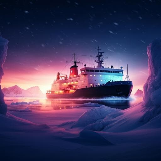
Arctic shipping trends during hazardous weather and sea-ice conditions and the Polar Code's effectiveness
M. Müller, M. Knol-kauffman, et al.
Explore the remarkable growth of Arctic shipping, which has surged by 7% annually despite challenging conditions, as highlighted by researchers Malte Müller, Maaike Knol-Kauffman, Jelmer Jeuring, and Cyril Palerme. This study emphasizes the pressing need for enhanced maritime safety through improved hazard descriptions and warning systems, particularly in light of the tripling of winter voyages.
~3 min • Beginner • English
Introduction
Maritime operations in the Arctic have increased steadily over recent decades across diverse sectors and complex spatial-temporal patterns. Operating conditions are harsh due to sea ice, severe weather, remoteness, and limited infrastructure, elevating risks to people and the environment. The International Code for Ships Operating in Polar Waters (Polar Code), effective since 2017, aims to reduce risks by requiring vessel certification, categorization based on anticipated sea-ice conditions, and a Polar Waters Operational Manual (PWOM) outlining how operators avoid hazardous sea-ice and temperature conditions. In practice, the Polar Code narrowly defines hazardous conditions by sea-ice and temperature thresholds and relies largely on climatological assessments, giving limited consideration to other critical metocean factors (wind, waves, sea-spray icing, visibility). With the growing availability of satellite-based AIS ship tracking and environmental datasets, the study seeks to (1) quantify pan-Arctic activity and trends (2013–2022) and (2) assess where ships encounter Polar Code-defined hazardous conditions, highlighting limitations and proposing integration with maritime warning services and a broader hazard framework.
Literature Review
Prior work documents rising Arctic shipping activity, emerging transits along the Northern Sea Route (NSR) and Northwest Passage (NWP), and the utility of satellite AIS for monitoring vessel movements and emissions. Studies have examined Polar Code implementation challenges and identified gaps between regulatory guidance and operational needs. Research also highlights weather- and sea-ice-related hazards (including icing) relevant to safety. This paper builds on these strands by combining AIS with environmental datasets to assess exposure to Polar Code threshold conditions and additional hazards such as sea-spray icing, thereby informing regulatory and service provision gaps.
Methodology
Data sources and processing: AIS ship-tracking data (ASTD level 2) from PAME were used for 2013–2022, comprising 10–20 million monthly messages from ~5,000–10,000 ships. Ship types were grouped into seven categories (Chemical & Gas; Bulk carrier & Cargo; Offshore services; Other; Fishing; Crude oil & products; Passenger & Cruise). Quality control included computing ship tracks per vessel, removing spatiotemporal outliers, and extracting daily mean position, ship type, and ship size. Analyses were conducted pan-Arctic and for six regions: Northern Sea Route, Svalbard, East Greenland, West Greenland (including Hudson Strait), Northwest Passage, and Chukchi–Bering Sea.
Environmental data: Sea-ice concentration was obtained from University of Bremen AMSR-2 passive microwave retrievals (89 GHz; nominal 6.25 km grid; effective resolution ~20 km). Atmospheric variables were from ERA5 reanalysis: daily minimum 2-m temperature, daily mean sea surface temperature, and maximum daily 10-m wind speed (T639 ~36 km grid, 137 levels). Known Arctic uncertainties include a winter warm bias over sea ice (~2–5 K) and wind RMSE ~2–3 m s−1.
Hazard thresholds and co-location: Daily vessel positions were co-located with environmental fields. Three exposures were quantified: (1) sea-ice concentration ≥80% (“close ice” per WMO), (2) air temperature below −20°C (linked to Polar Service Temperature, PST), and (3) sea-spray icing risk (light, moderate, heavy, extreme) using the Overland (1990) icing predictor PPR for 20–75 m vessels steaming into the wind: PPR = v(T − T0)/(1 + 0.3(Tw − Tr)), where v is wind speed, T0 is 2-m air temperature, Tw sea surface temperature, and Tr −1.7°C (freezing point). Icing-rate classes follow Overland’s thresholds.
Polar Service Temperature (PST) context: PST is defined as MDLT − 10°C, where MDLT is the mean of daily minimum temperatures (≥10-year climatology). The study mapped pan-Arctic MDLT and minimum temperatures (2013–2021) and analyzed exposures to air temperatures <−20°C.
Metrics and trend analysis: The main measure was shipping days per month (ship-days) overall and under threshold conditions. Linear trends were computed on annual means using regression; only trends with >98% confidence (p<0.02) are reported.
Uncertainties considered: AIS undercoverage (especially small craft/fishing), ERA5 warm bias potentially underestimating cold exposures, sea-ice product effective resolution possibly misclassifying ships near the ice edge (mitigated by 80% threshold), and simplifications in the sea-spray icing algorithm (excludes waves/ship specifics).
Key Findings
- Pan-Arctic growth: Shipping days increased by ~7% per year (2013–2022); number of individual ships increased by ~6% (not shown). Excluding fishing, trends rise to ~12% (shipping days) and ~8% (ships).
- Regional trends (annual totals, significance >98%): Pan-Arctic 7.3% per year (11.6% excl. fishing); Northern Sea Route (NSR) 9.3% (14.9% excl. fishing); Chukchi–Bering Sea 20.2% (19.1%); West Greenland 8.6% (13.3%); Northwest Passage −3.0% (2.9%); Svalbard and East Greenland showed no significant linear trend reported.
- Shift to year-round operations: Winter–spring shipping days increased pan-Arctic from ~2,000/month (2013) to ~5,000/month (2022). Along the NSR, winter–spring shipping days roughly tripled from a few hundred (2013) to >1,500 (2022), driven by LNG and oil projects. Around Svalbard, the operational season lengthened (e.g., cruise tourism from June–September in 2013 to roughly April–September by 2020).
- NSR transit vs. destination shipping: 2010–2022 saw 502 NSR interoceanic transits with no significant increase over time. Monthly destination shipping dominated (300–500 individual ships per month), especially in the Kara Sea.
- Exposure to close ice (≥80% sea-ice): Annual mean ship-days in close ice increased from ~150 to ~500 per month (2013–2022); winter peaks rose from ~250 to >1,000 per month. In 2021, there were 6,318 ship-days in close ice, dominated by Bulk carrier & Cargo, Other, and Crude oil & products. Growth is tied to increased winter–spring activity in the NSR, including Arc7 ice-class LNG tankers (>100,000 GT) showing year-round operations.
- Exposure to severe cold (T2m < −20°C): Mean annual exposure increased from ~50 to ~140 ship-days per month (2013–2022); winter peaks rose from ~200 to ~500–800 ship-days per month. In 2021, total ship-days below −20°C were 3,401, concentrated in sea-ice-covered regions along the NSR and dominated by Chemical & Gas, Bulk carrier & Cargo, and Crude oil & products.
- Sea-spray icing hazard: In 2021, about 400 ship-days experienced heavy or extreme sea-spray icing risk, predominantly in the Barents and Bering Seas; fishing accounted for ~63% of these exposures. A December 2020 Barents Sea case (FV Onega) coincided with a well-forecast heavy icing event, illustrating operational risks and the value of forecasts.
- 2021 NSR incident: Multiple ships, including Nordic Nuluujaak (Arc4) and Golden Suek (Ice2), became beset in early freeze-up along the East Siberian Sea. Climatology alone did not anticipate the anomaly, while actual conditions and a 10-day sea-ice forecast indicated the freeze-up, underscoring the need to integrate real-time forecasting into planning.
- Polar Code gaps: Narrow focus on sea-ice and temperature thresholds and reliance on climatologies inadequately captures relevant hazards (e.g., wind, waves, visibility, sea-spray icing) and limits operational utility without mandated use of real-time warnings/forecasts.
Discussion
The analysis demonstrates substantial growth and season extension of Arctic shipping, particularly winter operations along the NSR, resulting in markedly increased exposure to close ice and severe cold. These findings address the core question of how activity trends intersect with Polar Code-defined hazardous conditions and reveal that reliance on sea-ice and temperature thresholds, assessed climatologically, is insufficient for risk mitigation in a rapidly changing, highly variable environment. Case studies of sea-spray icing (FV Onega) and NSR besetment (2021) show that operational hazards often involve combinations of metocean factors and that real-time, high-quality forecasts and warnings could have materially improved voyage planning and risk management. The results thus argue for broadening the definition of hazardous conditions within the Polar Code to include wind, waves, icing, visibility, and sea-ice dynamics (pressure, drift, ridging), and for integrating internationally governed maritime information services (e.g., WWMIWS) into regulatory requirements. Addressing the disconnect between regulatory guidance and the existing forecast/warning infrastructure would enhance the practical value of the Polar Code and reduce incident risks as traffic expands. Sector- and vessel-specific vulnerabilities (e.g., fishing vessels to icing) further support tailored hazard frameworks and co-produced services.
Conclusion
This study provides a pan-Arctic, decade-long assessment of shipping activity and exposure to hazardous environmental conditions. Key contributions include quantifying a ~7% annual increase in shipping days, a tripling of winter exposure in parts of the Arctic (notably the NSR), and strong increases in ship-days within close ice and in severe cold. It evidences the Polar Code’s limitations when hazards are narrowly defined and assessed climatologically, and it demonstrates the operational relevance of real-time forecasting and warnings through case analyses. The authors recommend refining the Polar Code by: (1) expanding hazard scope beyond sea-ice and temperature to include wind, waves, visibility, and sea-spray icing; (2) mandating the use of real-time, standardized forecast and warning services (e.g., via WWMIWS, NAVTEX/SafetyNet), and tailoring these to Arctic needs; and (3) extending requirements to relevant non-SOLAS vessels operating in Polar Waters. Future research should co-develop user-oriented services, assess predictive capabilities for combined hazards, and focus on area- and season-specific risk profiles to inform compliance-oriented service design and regulatory updates.
Limitations
- AIS data do not capture 100% of traffic; smaller pleasure craft and some fishing vessels are underrepresented. Technical issues (infrastructure failures, installation errors, manipulated signals, satellite coverage) may cause gaps.
- ERA5 exhibits a warm bias over Arctic sea ice (≈2–5 K in winter), likely underestimating exposure to very low temperatures.
- Passive microwave sea-ice products have an effective resolution of ~20 km, potentially misclassifying vessels near the ice edge; using an 80% concentration threshold mitigates this but reduces sensitivity near edges.
- Sea-spray icing estimates use a simplified algorithm that omits wave conditions and vessel-specific characteristics; results provide indicative risk rather than precise rates.
- Sparse Arctic observations increase environmental data uncertainties relative to lower latitudes.
- The study focuses on select hazard thresholds; other combinations of metocean factors relevant to operations are not exhaustively analyzed.
Related Publications
Explore these studies to deepen your understanding of the subject.