
Earth Sciences
Tropical intraseasonal oscillations as key driver and source of predictability for the 2022 Pakistan record-breaking rainfall event
J. Xie, P. Hsu, et al.
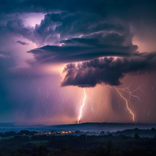
Discover how the devastating floods in Pakistan during August 2022 were influenced by tropical and extratropical intraseasonal oscillations, as revealed by a study conducted by Jinhui Xie, Pang-Chi Hsu, June-Yi Lee, Lu Wang, and Andrew G. Turner. Dive into the mechanics of weather prediction that could reshape our understanding of extreme rainfall events.
~3 min • Beginner • English
Introduction
Pakistan’s summer monsoon rainfall (July–September) is the primary source of its annual precipitation, and its anomalies often drive floods and droughts. Prior studies have linked heavy Pakistan rainfall to large-scale seasonal anomalies including La Niña and the negative Indian Ocean Dipole, associated circulation anomalies (easterlies over northern India and southerlies from the Arabian Sea), and teleconnections from Eurasian heatwaves and blocking. Synoptic systems such as low-pressure systems and western disturbances also modulate extremes. However, the role of intraseasonal oscillations (ISOs, 10–90 days) in the 2022 Pakistan extreme rainfall has been less explored, with most attention on the 30–60-day mode while the 10–30-day mode remains underexamined. Extratropical intraseasonal wave trains are also important across Eurasia. Predictability studies at seasonal scales have emphasized SST forcing (La Niña and Arabian Sea warming), and weather models can warn about a week ahead, but subseasonal-to-seasonal (S2S) predictability for this Pakistan event and model biases are unclear. This study investigates tropical–extratropical interactions among different ISO modes (10–30-day and 30–90-day) in driving the August 2022 Pakistan extreme rainfall and identifies which modes underpin subseasonal predictability, aiming to reveal windows of opportunity for improved S2S forecasts of extreme events.
Literature Review
The literature documents strong links between Pakistan monsoon rainfall and basin-scale SST anomalies: La Niña and negative IOD states enhance easterly anomalies over northern India and southerly flow from the Arabian Sea, increasing moisture convergence over Pakistan. Eurasian and East Asian heatwaves and blocking have been implicated via teleconnections in Pakistan flooding (notably 2010 and 2022). Synoptic disturbances, including tropical depressions and western disturbances, and their interactions influence heavy precipitation and may intensify under warming. Within intraseasonal variability, the Asian monsoon region exhibits 30–60-day and 10–30-day modes; prior work largely emphasized the 30–60-day mode’s role in Pakistan extremes, often overlooking 10–30-day contributions. Extratropical intraseasonal Rossby wave trains also modulate Eurasian extremes. Seasonal prediction studies attributed 2022 predictability to SST forcing (La Niña and Arabian Sea warming), while operational weather models provided about a week of lead time. Recently developed calibrated probabilistic methods improved subseasonal forecasts for Pakistan, but the origin of S2S model biases during extreme events remained to be analyzed.
Methodology
The study applied a scale-decomposed moisture budget analysis to diagnose physical drivers of the August 12–26, 2022 Pakistan extreme rainfall. The column-integrated moisture budget was evaluated using reanalysis fields, partitioning terms into contributions from: synoptic (<10 days), intraseasonal 10–30-day, intraseasonal 30–90-day, and low-frequency background state (LFBS; >90 days), via Lanczos filtering. The vertical moisture advection term −∂(ωq)/∂p was decomposed into scale-interaction components to quantify the role of vertical transport of LFBS moisture by ISO anomalies and other cross-timescale terms. Observational and reanalysis datasets included: CPC daily precipitation (0.5°), ERA5 precipitation and atmospheric fields (0.25° for precip; 1.25° for diagnostics), JRA-55 precipitation and atmospheric fields (1.25°), and NOAA OLR (2.5°). ENSO status was taken from the Niño3.4 index (HadISST1). ISO propagation and tropical–extratropical coupling were examined using latitude–time OLR and vertical motion (ω) sections and composites. The propagation of intraseasonal Rossby wave trains was analyzed with wave activity flux (Takaya–Nakamura WAF) computed for 30–90-day and 10–30-day components. Contribution of different timescales to rainfall was assessed via temporal decomposition at each grid and area-averaged over Pakistan. For prediction assessment, real-time forecasts from six S2S models (CMA, ECCC, ECMWF, HMCR, IAP-CAS, NCEP) initialized on comparable dates (e.g., July 28, August 4, August 11, 2022) were evaluated against observations for the target period (Aug 12–26). Detailed analysis focused on ECMWF ensembles initialized August 4, contrasting the top three members with smallest rainfall bias (BEST3) versus the remaining members (REST), and comparing their predicted ISO signals, LFBS moisture distributions, and vertical motions to observations. Model configuration impacts (resolution, data assimilation) were explored using inter-model comparisons.
Key Findings
- The flooding period (Aug 12–26, 2022) featured exceptionally large daily rainfall anomalies over Pakistan: CPC-based mean anomaly 12.5 mm d−1 (~6.8 standard deviations), ERA5-based 9.5 mm d−1 (~3.7 standard deviations).
- Scale decomposition of Pakistan rainfall during the flood period showed contributions of approximately: synoptic <10 days ~3.6–4.4%, 10–30-day ISO ~21.5–24.7%, 30–90-day ISO ~34.5–35.3%, and LFBS (>90 days) ~36.4–39.6% (CPC and ERA5 ranges reported).
- Moisture budget indicated vertical moisture advection was the dominant source term driving rainfall, largely reflecting vertical transport of LFBS moisture by ISO-scale ascending anomalies (key ω>90, ω30–90, ω10–30 interaction terms), while horizontal advection was smaller and condensation partly offset advection.
- ISO evolution showed clear tropical–extratropical coupling at 30–90-day timescale: northward-propagating convection from the equatorial Indian Ocean and southward-moving mid-latitude wave-train converged over Pakistan during the flood, producing sustained ascent and deep convection. For 10–30-day variability, tropical northward propagation dominated; extratropical 10–30-day signals were weak and less organized during the event.
- Convective instability evolved with preconditioning by tropical ISO-induced low-level moistening and mid-upper-level cold/dry intrusions from mid-latitudes at 30–90-day scale, enhancing instability before the event; both 10–30-day and 30–90-day modes contributed positively to pre-event instability, with 30–90-day having larger, more persistent effects.
- S2S models systematically underestimated Pakistan rainfall amounts during Aug 12–26, with smaller biases at shorter leads (initialized Aug 11). At 2–3 week leads (initialized Jul 28 or Aug 4), only some ECMWF and ECCC members captured enhanced rainfall; others failed.
- ECMWF BEST3 members (initialized Aug 4; 8–22 day lead) skillfully reproduced northward-propagating tropical ISO convection and cyclonic anomalies over Pakistan, yielding better rainfall predictions. REST members failed to capture adequate northward propagation and confined anomalies south of Pakistan, leading to larger underestimation.
- Even without correctly predicting mid-latitude ISO signals, enhanced Pakistan rainfall could be captured when tropical ISO perturbations were well predicted. Across 128 members from six S2S models, Pakistan rainfall biases correlated most strongly with fidelity of predicted tropical 30–90-day ISO evolution.
- Slight underestimation by BEST3 was linked to limited skill in representing synoptic depression systems.
Discussion
The study demonstrates that the 2022 Pakistan extreme rainfall was primarily driven by intraseasonal processes, specifically the coupling and northward propagation of 30–90-day and 10–30-day tropical ISOs, interacting with a moist LFBS associated with La Niña. The resulting sustained vertical moisture advection maintained heavy precipitation, with additional synoptic contributions at event peaks. These findings directly address the research question by identifying which intraseasonal modes and tropical–extratropical interactions were essential for triggering and sustaining the event, and by explaining why rainfall anomalies tracked vertical advection. From a predictability perspective, subseasonal skill depended mainly on accurately forecasting tropical ISO evolution, especially the 30–90-day mode. Ensemble member comparisons in ECMWF indicate that capturing the northward-propagating ISO over the equatorial Indian Ocean and its arrival over Pakistan is a key source of extended-range predictability (8–22 days), even when mid-latitude ISO features are not well predicted. Higher model resolution generally improved representation of rainfall anomalies, whereas differences in data assimilation approaches had limited impact, pointing to the importance of physical parameterizations and resolution for simulating ISO convection and its interactions.
Conclusion
This study identifies tropical intraseasonal oscillations—at both 30–90-day and 10–30-day timescales—as the primary drivers and sources of subseasonal predictability for the record-breaking August 2022 Pakistan rainfall. Heavy precipitation was fueled by enhanced vertical moisture transport arising from ISO-induced ascent acting on a moist low-frequency background linked to La Niña, with occasional synoptic depressions amplifying peaks. Subseasonal prediction skill hinged on accurately forecasting the northward-propagating tropical ISO; models that captured these signals 8–22 days ahead reproduced stronger, more persistent rainfall over Pakistan, even without correctly simulating extratropical ISO contributions. The work highlights windows of opportunity for extended-range flood forecasting in the region and underscores the need for higher-resolution models and improved convective parameterizations to better simulate ISO dynamics. Future research should systematically evaluate model physics affecting ISO fidelity, investigate the role of tropical–extratropical interactions in sustaining South Asian extremes across events, and examine the diversity of ISO propagation over the South Asian monsoon and its impact on subseasonal predictability.
Limitations
- The analysis centers on a single extreme event; generalizability across events requires systematic multi-event studies.
- Even the best ECMWF ensemble members underestimated peak rainfall, likely due to limited skill in representing synoptic tropical depressions and precise timing of maxima.
- Many S2S models failed to reproduce mid-latitude ISO signals; the relative necessity of extratropical contributions remains event dependent.
- Models are hydrostatic and vary in horizontal resolution and parameterizations; while higher resolution improved performance, detailed attributions of parameterization impacts were not performed and data assimilation method differences appeared to have limited influence.
- Some affiliation between tropical ISO predictability and rainfall skill is correlational across members; causal mechanisms for model ISO forecast fidelity were not fully diagnosed.
Related Publications
Explore these studies to deepen your understanding of the subject.