
Earth Sciences
Rock glaciers across the United States predominantly accelerate coincident with rise in air temperatures
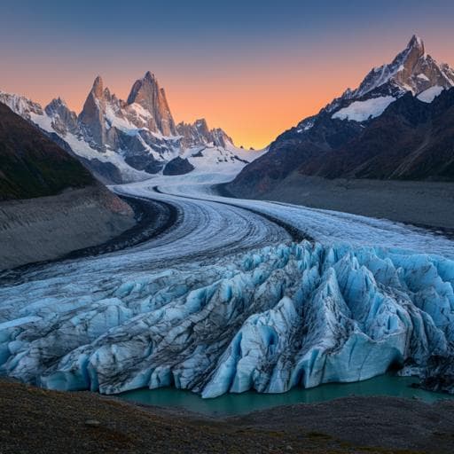
A. Kääb and J. Røste
This groundbreaking study conducted by Andreas Kääb and Julie Røste uncovers significant long-term accelerations in rock glacier movement across the western contiguous United States, showcasing a 2-3 fold increase in surface displacement linked to rising air temperatures. Don't miss the chance to explore these pivotal environmental changes!
~3 min • Beginner • English
Introduction
Permafrost underlies about 11% of Earth’s land surface globally (around 15% in the Northern Hemisphere) and is extensive in non-polar mountain ranges, where the permafrost area is roughly 20 times larger than the area covered by glaciers. Rock glaciers, tongue-like landforms composed of ice-debris mixtures, are a key indicator of mountain permafrost and typically move at rates from centimetres to metres per year. Theory and observations indicate warmer frozen debris moves faster due to reduced viscosity and meltwater effects. The World Meteorological Organization recognizes rock glacier velocity variability as part of the permafrost Essential Climate Variable, yet decadal-scale time series remain scarce, largely concentrated in the European Alps. Despite North America hosting many active rock glaciers and short-term measurements existing, no systematic long-term (>30 years) velocity time series had been established. The mountainous western contiguous U.S. includes roughly 15,000 km² of permafrost and about 10,000 active rock glaciers (~1000 km² area), exceeding regional glacier area, underscoring their climatic and hydrological importance. The study’s objective is to reconstruct multi-decade rock glacier speed time series from historical aerial photographs to quantify long-term kinematic changes and assess their relationship to climate, particularly air temperature trends.
Literature Review
Previous long-term rock glacier velocity series (spanning decades) are limited and predominantly from the European Alps, with few examples elsewhere. Empirical studies have shown rock glacier velocities are sensitive to climatic changes, especially temperature, and the WMO has designated velocity variability as an ECV product for permafrost. In North America, inventories document widespread active rock glaciers and some shorter-term velocity estimates from InSAR and photogrammetry exist, but no continent-wide long-term time series had been compiled. Satellite radar interferometry provides seasonal to interannual observations over roughly the last two decades, but is less suitable for multi-decadal reconstructions due to seasonal/interannual variability and limited historical coverage. Archived historical airphotos offer the only viable path to >30-year reconstructions, though their positional inaccuracies, distortions, and variable quality often exceed the magnitude of the rock glacier displacements and complicate analysis.
Methodology
Study design and site selection: Sixteen rock glaciers across the latitudinal and longitudinal range of the western contiguous U.S. were selected to sample climatic and topographic gradients and, where possible, include clusters within ranges. Selection required adequate historical USGS airphoto coverage (sufficient resolution and radiometric quality, minimal snow) and confirmation of contemporary motion using Sentinel-1 InSAR (12–24 day interferograms from 2022–2023), identified via motion-induced fringes or localized coherence loss.
Airphoto preparation and orthorectification: For pre-2000s, only original non-rectified airphotos were available. Camera calibration protocols (from scans/USGS archive) were implemented in PCI Geomatica OrthoEngine to solve inner orientation. Exterior orientation used 30–50 GCPs from the most recent USGS orthoimages (for horizontal control) and elevations from the Copernicus global 30 m DEM (vertical control). Bundle adjustments typically yielded georeferencing residuals well below 1 m. Images were orthoprojected to UTM (NAD). Post-2000s USGS orthoimages required no preprocessing.
Coregistration and stable ground control: Orthophotos for each site (3–5 epochs spanning 60–70 years) were locally co-registered around each rock glacier using image matching, referencing 20–40 points on stable ground (e.g., bedrock), as determined from InSAR and geomorphology. Coregistration parameters were applied to correct raw displacement fields.
Displacement measurement: Surface displacements between successive orthoimages were measured using automated normalized cross-correlation. Due to limited features and quality in older images, measurements were made at visually identified, irregularly spaced locations exhibiting trackable features (e.g., boulders, ridges) present in all epochs. Template sizes were 20–25 m; search areas were iteratively adjusted. Outliers were interactively identified and removed. For sites with greater uncertainty, additional pairs spanning two intervals were measured.
Speed time series construction: Displacement vectors were converted to speeds. For consistency across epochs, each time series was anchored to initial-epoch measurement locations; for each subsequent epoch, the closest displacement start point within 40 m was assigned to represent the same location. Each resulting point-wise time series was normalized by its mean speed to prevent dilution by spatial speed variability. The number of individual time series per rock glacier ranged from 9 to 370 (average ~100).
Uncertainty and statistics: Uncertainties were expressed in three ways: (1) Median speeds for each interval with boxplot notches; non-overlapping notches indicate statistically different medians at >95% confidence. (2) Stable-ground error (1σ) estimated from the normalized median absolute deviation of stable ground offsets; to derive standard error, a conservative assumption of 4 independent measurements among the 20–40 offsets was used to account for spatial correlation. (3) Standard error of speed changes between intervals and Wilcoxon rank-sum tests for significance of changes. Principal error sources were unresolved orthoimage distortions (from imaging, scanning, photogrammetric modeling, DEM-related orthoprojection) and matching precision; systematic offsets were minimized by coregistration.
Climate data: Regional air temperature anomalies were compiled from NOAA Climate-at-a-Glance for the “Rockies and westwards” region (annual, summer JJA, winter NDJF). High-elevation station data from SNOTEL near study sites were also analyzed. PRISM gridded climate data were interpolated to rock glacier locations and elevations to compare decadal means with photogrammetric intervals. Snow water equivalent trends were examined from SNOTEL and ERA5 (winter snowfall water equivalent and total precipitation above 2000 m and specific ranges). Reanalyses (e.g., ERA5) were visually checked via the University of Maine Climate Reanalyzer.
Validation and comparison: Where available, geodetic in-situ and photogrammetric measurements were compared. For Arapaho, total station measurements (1960–2002) matched photogrammetric speeds (e.g., 14.5 cm/yr vs 13.6 cm/yr for 1953–1999). For Galena Creek, in-situ boulder displacement (1997–2015) agreed with photogrammetry within ~3 cm/yr and trends into 2020–2022 were consistent. Comparisons to 2007–2008 InSAR case studies were limited by differing spatiotemporal sampling but generally within reported uncertainties.
Key Findings
- Constructed 60–70 year velocity time series for 16 U.S. rock glaciers, more than doubling the number of global long-term records and providing the first such North American dataset.
- Average speeds across the period varied widely: from 8 cm/yr (Star Peak, WA) to 70 cm/yr (Ferguson Ranch, CO); point maxima reached up to 130 cm/yr (Galena Creek, WY).
- 12 of 16 rock glaciers exhibited statistically significant acceleration from the earliest to latest intervals; several exceeded a 2× increase, and one site tripled:
- Change factors (last/first interval): Star Peak 2.1; Pine Creek 1.4; Birch Mountain 0.8; Cardinal Mountain North 3.0; Old Hyndman 1.4; Thomas Lake West 1.4; Ferguson Ranch West 1.8; Cardinal Mountain South 0.9; Galena Creek 1.7; Crater Mountain 1.7; Mt Sneffels 1.3; Mt Mears 2.1; Sulphur Creek 1.0; Arapaho Peak 1.6; Teakettle Mountain 1.2; Twin Sisters 2.0.
- Example: Cardinal Mountain North increased from an average 36 cm/yr (1947–1987) to 110 cm/yr (2016–2022).
- Temporal patterns vary by site: some show gradual multi-decade increases (e.g., Cardinal North, Crater), others display hockey-stick-like recent accelerations (e.g., Mt Mears, Twin Sisters). Sites with slight deceleration remain near significance thresholds; Birch shows recent re-acceleration.
- Regional air temperatures have strongly increased since the 1990s, driven mostly by summer warming: NOAA regional anomalies indicate ~+0.4 °C/decade (JJA), while nearby high-elevation SNOTEL stations show up to ~+0.8 °C/decade or more since the 1990s. Snow water equivalent trends are spatially variable with no clear overall signal.
- Correlations: Over entire observation periods, average rock glacier speeds correlate most with temperature-related attributes (mean annual maximum temperature R²=0.46; mean annual temperature R²=0.38). Change factor correlations with static attributes are weak overall; slope shows the highest (R²=0.15), others <0.06. Time series similarity is high (R²>0.5) to mean annual or winter temperatures for most sites; weaker or negative for some (e.g., Cardinal South). Precipitation relationships are inconsistent across sites.
Discussion
The multi-decadal acceleration of U.S. rock glaciers aligns with theoretical expectations that warming reduces the viscosity of ice/debris mixtures and that meltwater influx can further enhance deformation. The predominant agreement between velocity variations and air temperature anomalies, supported by laboratory experiments, modeling, and global long-term observations, indicates that regional warming is the principal driver of the observed accelerations. Nonetheless, site-specific responses are modulated by local/internal factors such as debris grain size and ice content, slope, thickness and internal shear horizons, vertical velocity profiles, water content and pressure, lateral hydrological connectivity, and mass input from rockfall and snow processes. Correlation analyses reinforce temperature as a first-order control on mean speeds, while the weak linkage between change factors and static attributes suggests complex, site-specific evolution and that differing initial reference periods may confound change-factor comparisons. Compared to mountain glaciers, which commonly decelerate under warming due to thinning, rock glaciers distinctly accelerate, highlighting fundamental differences between glacial and periglacial dynamics. Local departures from the warming-driven acceleration pattern (e.g., slight deceleration at Cardinal South or recent slowing at Sulphur/Galena) may reflect thickness reductions or ground ice loss, though direct thickness data are lacking for some sites. Overall, the findings substantiate rock glacier velocity as a sensitive ECV indicator of permafrost response to climate change in the western U.S.
Conclusion
This study reconstructs 60–70 year velocity time series for 16 rock glaciers across the western contiguous United States, more than doubling the global set of long-term records and providing the first comprehensive North American dataset. Most sites show substantial acceleration (often 2× and up to 3×) since the mid-20th century, consistent with strong regional air temperature increases that likely reduced material viscosity and enhanced deformation via meltwater effects. Despite variability in local responses due to internal structure and hydrology, the prevailing signal indicates intensifying periglacial activity and broader environmental changes in frozen ground regimes, with implications for ground temperatures, debris and ground-ice fluxes, landscape evolution, natural hazards, and mountain hydrology. Future research should integrate thickness and internal structure changes, refine local hydrological controls, expand site coverage for continental-scale assessments, and enhance multi-sensor synergy (historic airphotos, modern optical/SAR, in-situ) to better constrain process-response relationships and forecast permafrost landform dynamics under continued warming.
Limitations
- Historical airphoto availability, resolution, radiometric quality, and distortions limited the density of time series (typically 3–5 epochs) and increased uncertainties for early intervals.
- Principal errors arise from unresolved orthoimage distortions (imaging, scanning, modeling, DEM orthoprojection) and image-matching precision. While mitigated by local coregistration and robust statistics, such errors cannot be fully separated from true motion on the rock glaciers.
- Measurement approach required manually selected, trackable features present in all epochs; grid-based matching was infeasible for older imagery, potentially reducing spatial sampling.
- First measurement intervals differ among sites, complicating direct comparison of change factors and potentially reflecting differing climatic phases.
- Sample size is limited (16 rock glaciers) relative to the ~10,000 active rock glaciers in the region; generalizability is constrained by site selection criteria.
- Snow water equivalent and precipitation exhibited high spatiotemporal variability with no strong overall trend, limiting inference on snow-related insulation effects.
- Lack of direct thickness change data for some sites restricts attribution of decelerations (e.g., potential ice loss) and the role of thickness in velocity evolution.
Related Publications
Explore these studies to deepen your understanding of the subject.