Engineering and Technology
Revealing Influencing Factors on Global Waste Distribution via Deep-learning Based Dumpsite Detection From Satellite Imagery
X. Sun, D. Yin, et al.
The study addresses the global challenge of identifying and monitoring both legal and illegal dumpsites, which are difficult and costly to locate using manual surveys. With waste generation projected to outpace population growth and significant health and environmental risks associated with open dumping, there is an urgent need for scalable, automated detection. Traditional remote sensing approaches and UAV-based surveys have limitations in scalability, resolution, and labor costs, and prior deep learning efforts have been local or lacked public, classified datasets. This work proposes a deep learning-based method to detect and classify dumpsites from high-resolution satellite imagery globally, enabling analysis of how dumpsite prevalence relates to socio-economic attributes across space and time.
Prior work used manual or semi-manual remote sensing to map dumpsites, constrained by low-resolution imagery and high labor cost. UAV-based detection showed promise but lacked global scalability. Deep learning approaches have been applied locally (e.g., Shanghai, Johannesburg, Italy) and for semantic segmentation of a small number of landfills, but without publicly available, globally representative, classified dumpsite datasets. BigEarthNet contains some unclassified dumpsites but is focused on general land use. Overall, existing literature lacked a public, fine-grained, global dumpsite dataset and a method demonstrating global generalization for multiple dumpsite categories.
Data and dataset: Through field research and manual annotation, the authors constructed a global dumpsite dataset by labeling about 2,500 dumpsites over ~4,800 km² of high-resolution satellite imagery (0.3–1 m/pixel). Selected areas focused on populous cities with lower Environmental Performance Index rankings based on the 2016 World Cities Report and 2020 Yale EPI. Dumpsites were categorized into four classes: domestic waste, construction waste, agricultural waste, and covered waste (e.g., professionally managed sites covered with films such as HDPE). Images were tiled into 2,219 patches of 1024×1024 pixels (~614×614 m each), and annotations followed PASCAL VOC format. The dataset was split into train/val/test in a 60:20:20 ratio, with 5-fold cross-validation and early stopping to ensure robustness. To address class imbalance, data augmentation (vertical/horizontal flips, ±90° rotations) and category balancing (equal class sampling per batch) were applied.
Model: The proposed Blocked Channel Attention Network (BCA-Net) builds on Faster R-CNN with a Feature Pyramid Network (FPN) to preserve multi-scale features critical for detecting small to large dumpsites. BCA-Net introduces a Blocked Channel Attention (BCA) module to emphasize discriminative regional features within channels, addressing challenges of subtle boundaries and inter-class similarity in dumpsites. In ResNet-50’s high-level residual stages (C4, C5), feature maps are divided into blocks controlled by squeeze factor α. Flattened block features are passed through two fully connected layers (256 units then back to original size) with sigmoid activation to produce attention weights, which are applied (Hadamard product) to the original features. Non-Maximum Suppression threshold was set to 0.001 during large-scale analyses to maximize recall.
Training details: Optimizer was SGD with learning rate 0.0025, momentum 0.9, weight decay 0.0001; LR decayed at epochs 16 and 22 over a maximum of 24 epochs. A linear warm-up (500 iterations, ratio 0.001) was used. Training employed k=5 folds and early stopping, executed on eight NVIDIA RTX 3090 GPUs.
Evaluation metrics: Sensitivity (recall) = correctly predicted dumpsites / all labeled dumpsites; Precision = correct dumpsite predictions / all dumpsite predictions.
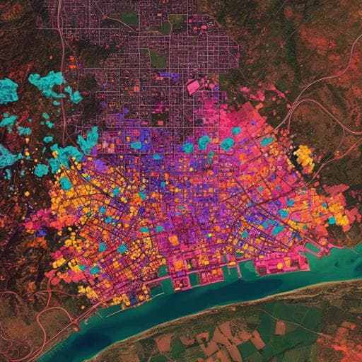
Global analyses: The trained model was applied to central areas (~160 km² each) of 28 urban regions across 15 countries using satellite images from around 2021 to compute a Global Dumpsite Index (GDI = log2 N, where N is the number of detected dumpsites) and to assess dumpsite type proportions. Spearman correlations were computed between the number of dumpsites (total and by type: domestic, construction, agricultural) and 18 socio-economic and geographic attributes from sources such as the World Bank and the United Nations. Temporal analysis was conducted for Munich, Tokyo, Shanghai, and Kampala from 2015 to 2019, standardizing image resolution to 0.6 m to mitigate resolution effects.
- Detection performance: On the test set, average sensitivity (recall) was 0.980 and average precision 0.701. By class: Domestic waste (sens 0.975, prec 0.680), Construction waste (0.982, 0.593), Covered waste (0.991, 0.967), Agricultural waste (0.973, 0.558).
- Efficiency: The method reduces investigation time by about 96.8% compared to manual labeling. The model can process a 162 km² test set in under 30 seconds on a personal laptop; scanning and classifying nearly 30 city centers (~5000 km²) took under an hour, with about six days total including manual recheck versus six months of manual work.
- Generalization: In 28 regions, manual inspection found 763 dumpsites; the model detected 755 (98.6%), indicating strong global generalization. In sampled areas of 28 cities around 2021, nearly 1000 dumpsites were detected.
- Spatial patterns and GDI: More developed cities and nations have fewer dumpsites; within-country comparisons show progressive cities have fewer dumpsites than ordinary large cities. The proposed Global Dumpsite Index (GDI = log2 N) reflects regional dumpsite levels, with lower GDIs in more developed areas.
- Correlation analysis (Spearman): The total number of dumpsites is statistically associated with urbanization ranking (ρ≈0.418, p<0.05), gross national income (ρ≈0.538, p<0.01), being a developed country (negative association, ρ≈-0.554, p<0.01), absolute latitude (ρ≈-0.424, p<0.05), and national cleanliness/health ranking (ρ≈0.487, p<0.01). No significant correlations were found with population size, education rankings, or technology/innovation indices for city centers.
- Temporal trends: From 2015–2019, Shanghai and Kampala had more dumpsites than Tokyo and Munich. Shanghai showed decreases in domestic waste after waste-classification policies (advocated in 2018, implemented in 2019), while Kampala exhibited an overall upward trend, consistent with reported policy implementation challenges and lower urbanization. Munich and Tokyo maintained low, stable numbers, aligning with long-standing waste sorting and circular economy policies.
The findings demonstrate that deep learning applied to high-resolution satellite imagery can robustly and efficiently detect and classify dumpsites worldwide, enabling quantitative assessments of waste management performance. Spatial analyses indicate that economic development, urbanization, sanitation/cleanliness, and geographic factors (latitude) are linked to fewer dumpsites, while population size, education, and technology indicators are not directly associated in city centers. Temporal analyses suggest that effective waste-management policies—particularly waste sorting/classification and urban renewal programs—may reduce illegal dumping over time, as seen in Shanghai, while weaker policy implementation can coincide with increasing dumping, as observed in Kampala. These results highlight the utility of automated dumpsite detection as a policy-relevant monitoring tool to inform environmental governance, public health, and sustainability initiatives.
This work contributes: (1) a global, fine-grained dumpsite dataset with four categories; (2) a novel deep detection model (BCA-Net) that achieves >98% sensitivity; and (3) global spatial and temporal analyses linking dumpsite prevalence to development, urbanization, sanitation, and policy contexts. The approach drastically reduces labor and time relative to manual surveys and provides a scalable tool for governance and research. Future work includes improving precision via higher-resolution imagery and model advances, fully automating detection and classification workflows, and quantitatively assessing the impact of specific waste-management and circular-economy policies on dumpsite dynamics. The framework can also support broader urban studies such as construction dynamics and greening processes inferred from waste-related land-use change.
- Precision remains moderate due to current satellite resolution limits (0.3–1 m/pixel) that obscure internal details and edges, leading to confusion with look-alike structures (e.g., building roofs, water reflections) and necessitating some manual verification.
- Morphological and cultural variability in dumpsite appearance across countries complicates classification and contributes to false positives.
- Temporal analyses may be influenced by image resolution and availability; efforts were made to standardize to 0.6 m for selected cities.
- Dataset coverage, while global in scope, originated from seven countries and selected urban areas; broader coverage and continued validation would further strengthen generalizability.
- Field validation outside China relied partly on collaborators and tools like Google Street View due to COVID-19 constraints, which may limit ground-truth completeness for some sites.
Related Publications
Explore these studies to deepen your understanding of the subject.