Social Work
Realistic characteristics and driving mechanisms of pseudo-human settlements in Chinese cities
W. Yu, J. Yang, et al.
The study addresses how pseudo-human settlements (PHS)—resident-constructed, information-based representations of human settlements—vary spatially and temporally across Chinese cities and what real-world attributes drive their development level and functional structure. With the rise of Web 2.0 and widespread media, residents’ perceptions form a pseudo-environment that extends real human settlements, manifesting authenticity, deviation, and informatization. Social media data provide subjective insights but suffer from bias and event-driven volatility. The Baidu Index, widely used in China, captures large-scale, geographically tagged search behavior that reflects residents’ subjective concerns and mitigates some social media shortcomings. Prior work shows correlations between PHS and real settlements and suggests socioeconomic dominance among drivers, but lacks a comprehensive, nationwide, quantitative examination of how real attributes affect both PHS development level and functional preferences over time. This study constructs a PHS index (PHSI) for 286 cities (2015–2020) and analyzes spatial patterns, autocorrelation, and driving mechanisms to inform urban planning from resident-oriented perspectives.
Existing studies using social media (e.g., Weibo, Flickr, Facebook) and geo-tagged data have linked urban space with residents’ emotions and behaviors, identified urban functions and structure, and assessed environmental impacts on activity. However, social media content is subjective and prone to rumor and event focus, limiting comprehensive PHS depiction. The Baidu Index has been used to study urban influence hierarchies, housing price attention, and environmental concerns, showing correlations with socioeconomic indicators and pollution, but often focusing on single functional aspects rather than comprehensive PHS structures. Human settlements science posits PHS as extensions of real settlements; prior multi-scale analyses reported positive PHS–reality correlations and qualitatively identified socioeconomic factors as key drivers. A gap remains in quantifying nationwide spatiotemporal PHS patterns and disentangling how population, socioeconomic, and environmental attributes drive both development level and functional structure over time.
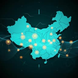
Study area: 286 Chinese cities (4 municipalities, 15 sub-provincial, 267 prefecture-level), spanning seven natural geographic divisions. Data (2015–2020 unless noted): Baidu Index daily search volumes for PHS-related keywords; statistical yearbook data (registered population, per capita GDP/GRP, industrial structure; 2016–2021 annual); NPP-VIIRS annual nighttime lights; daily Air Quality Index; administrative geography and city centers (2020). Collinearity tests showed tolerance >0.1 and VIF <5 across attributes. PHSI construction: An index system of 10 functional structure indices (audio-visual, chat/social, book reading, fashion shopping, learning/education, travel/traffic, financial management, news/information, home life, medical/health). Each function uses three general keywords to reduce app-specific volatility. Keyword Baidu indices are Min–Max normalized across all cities and years. Each functional index PHSIi is the sum of its three normalized keyword indices. The overall PHSI is the sum of the 10 functional indices (range 0–30). The proportional contribution pi = PHSIi / PHSI defines the functional structure (resident preference shares) of PHS for each city-year. Spatial analysis: Global Moran’s I assesses overall spatial autocorrelation of city-level PHSI; Local Indicators of Spatial Autocorrelation (LISA) classify significant local patterns (High–High, High–Low, Low–High, Low–Low) for selected years. Clustering: K-means clustering (SPSS 26) discretizes numerical variables (e.g., per capita GRP, nighttime light, industrial structure) and PHS functional structures. Cluster number K is chosen using silhouette scores over K=2–30, selecting elbow or local maxima to ensure effective, interpretable partitions. Geographical Detectors: Used to quantify drivers of spatial differentiation. Factor detector computes q statistics (0–1) indicating variance explained in PHSI (development level) or functional structure categories by each attribute. Interaction detector evaluates combined effects of attribute pairs via q(X1∩X2). Risk detector tests differences in means between strata. Ecological detector compares explanatory powers of factors using F-tests. Geographic location, population size, and AQI use national standard classifications; per capita GRP, nighttime light, and industrial structure are clustered into 5 strata via K-means based on silhouette results.
- PHSI spatial hierarchy and regional contrasts: PHSI levels are markedly hierarchical, concentrated in municipalities, sub-provincial cities, and provincial capitals. Average PHSI values: municipalities 16.50, sub-provincial 11.25, provincial capitals 10.08, versus prefecture-level cities 3.04. East–west split is pronounced (east mean 4.14 vs west 2.87), while north–south differences are minor (north 3.43 vs south 3.88). High/medium PHSI cities comprise 39.33% in the east vs 17.59% in the west.
- Temporal evolution: Annual mean PHSI is relatively stable with weak evolution: highest in 2015 (3.92), lowest in 2016 (3.49). Inter-annual standard deviations are large relative to means, indicating pronounced cross-city disparities.
- Spatial autocorrelation: Global Moran’s I shows weak but significant positive autocorrelation across years (I=0.124–0.162; Z-scores > 5.9, p<0.01). LISA patterns: High–High clusters around core cities of major agglomerations (Beijing–Tianjin–Hebei, Yangtze River Delta, Pearl River Delta). Low–High outliers are peripheral cities of these agglomerations (e.g., Zhangjiakou, Chengde). High–Low outliers include provincial capitals in remote regions (e.g., Lanzhou, Yinchuan; Shenyang, Changchun, Harbin; Chongqing, Chengdu, Guiyang, Kunming, Nanning). Low–Low clusters occur in remote prefecture-level cities (eastern Heilongjiang; Shaan–Gan–Ning).
- Top cities by PHSI: Beijing (23.55), Shanghai (18.59), Guangzhou (16.34), Shenzhen (15.57), Chengdu (15.24), Hangzhou (14.80), Zhengzhou (12.95), Wuhan (12.85), Chongqing (12.67), Suzhou (12.07), etc.
- Drivers of development level (GeoDetector factor q): Nighttime light has the strongest single-factor explanatory power, followed by population size and per capita GRP; all three have q > 0.3. Industrial structure, geographic location, and AQI have lower single-factor q values but show stronger effects in interactions. The strongest interaction is population size × per capita GRP with q = 0.682. Nighttime light, while strong alone, adds less in interactions due to high correlation with population and GRP.
- Functional structure typology: Six PHS functional structure types (via K-means) were identified. Learning/education function exceeds 10% in all cluster centers, indicating widespread emphasis. Type I is balanced (sum of absolute deviations from 10% = 15.38%); Types II–VI show varying degrees of multi-polarization or strong polarization, with Types IV and V highly polarized toward learning/education. Temporal transitions are dynamic: 243 of 286 cities changed type during 2015–2020. The number of cities in each type follows an inverted-V pattern, indicating a functional structure life cycle (emergence–development–maturity–decline–extinction). From 2015 to 2020, dominant types shifted from balanced (I, III) to multi-polarized (II, IV) and then to strongly polarized toward learning/education (IV, V).
- Drivers of functional structure differentiation (q): Nighttime light q=0.255, population size q=0.240, per capita GRP q=0.199, and tertiary industry share q=0.169 are key. Functional structure types explain PHSI strongly (q=0.52), exceeding any single real-world factor.
- Polarization vs development level: In 2015–2018, PHSI shows no clear correlation with functional polarization degree; in 2019–2020, low-PHSI cities exhibit rapidly increasing polarization, yielding significant negative correlations between PHSI and polarization degree (r = –0.419 in 2019; r = –0.729 in 2020; p<0.01). Spatially, high-PHSI cities tend to Type VI (diversified demands) in core agglomerations; medium-level cities show stable rise in learning/education preference; low-level cities shift from balanced (Type I) to highly learning/education polarized (Type V), notably in Northeast China and Gansu.
The study confirms that PHS development aligns with socioeconomically advanced urban systems, addressing the research question by quantifying that nighttime lights, population, and per capita GRP are primary drivers, and by demonstrating that interactions—especially population × per capita GRP—best explain spatial differentiation. Weak but significant spatial autocorrelation and distinct LISA clusters reflect the diffusion from high-level urban cores and polarization in remote provincial capitals, revealing uneven PHS development mirroring real settlement disparities. Functional structure types are shown to result from multiple interacting real attributes (q=0.52), indicating that residents’ online functional preferences co-evolve with urban socioeconomic conditions. The life-cycle dynamics of functional structures suggest that cities pass from balanced to polarized preference profiles, with low-PHSI cities increasingly concentrating on learning/education functions in recent years. Policy-wise, leveraging high-level areas as growth poles while addressing peripheral ‘sinking’ and remote ‘contagion’ patterns can foster coordinated development. Planners should track the evolving functional preferences (e.g., rising education focus) and adapt urban services and infrastructure accordingly, anticipating shifts along the functional structure life cycle.
This study constructs a resident-oriented PHS index (PHSI) for 286 Chinese cities using Baidu search data and quantitatively reveals: (1) strong spatial hierarchies with a high-east/low-west pattern and weak but significant positive spatial autocorrelation; (2) major drivers of PHS development level and functional differentiation are nighttime lights, population size, and per capita GRP, with the interaction of population and GRP providing the highest explanatory power; and (3) PHS functional structures exhibit a life cycle from emergence to extinction, with a recent intensification of learning/education polarization, especially in lower-level cities. These insights can guide more responsive, resident-centered urban planning and policy to promote coordinated development of pseudo and real human settlements. Future research should extend observation periods to stabilize functional typologies, incorporate additional behavior and sentiment data sources to enrich PHS characterization, and test causal mechanisms and policy interventions across different national contexts.
The functional structure of PHS in Chinese cities is highly dynamic over 2015–2020, so K-means-based typologies may be sensitive to the study period and may vary with longer windows. In contrast, classifications of relatively stable urban reality attributes are more robust. Establishing more stable functional structure classifications requires longer-term observations.
Related Publications
Explore these studies to deepen your understanding of the subject.