logo
ResearchBunny Logo
Human expansion into Asian highlands in the 21st Century and its effects

Environmental Studies and Forestry

Human expansion into Asian highlands in the 21st Century and its effects

C. Yang, H. Liu, et al.

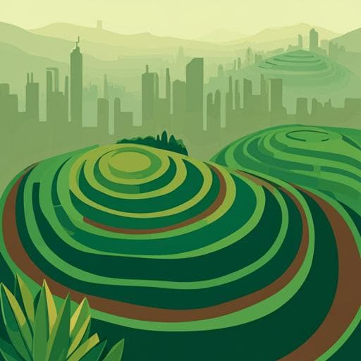
This study by Chao Yang, Huizeng Liu, and colleagues delves into the remarkable transformation of human activities across Asian highlands between 2000 and 2020, revealing a staggering 23% growth primarily at the expense of ecological lands. While this has intensified habitat fragmentation, it has also fostered development by preserving cultivated land and accommodating 40 million people, emphasizing the complex nature of regional sustainable growth.

00:00
00:00
~3 min • Beginner • English
Introduction
Asia contains extensive highlands (hills and mountains) that are ecologically important yet generally less suitable for intensive human activities than lowlands. Despite assumptions that agriculture and settlements are not economically feasible in highlands, regional evidence shows recent expansions of cultivated land and urban areas in Asian highlands, often associated with forest loss. Global assessments (e.g., FAO, IPCC scenarios) have assumed little to no net expansion of cultivated land in mountains, but observations from Southeast Asian mountains deviate from this. This study aims to fill gaps by comprehensively quantifying highland human activity expansions across 48 Asian countries from 2000 to 2020 and assessing their effects on ecological lands, habitat fragmentation, cultivated land conservation, and population capacity. The research addresses: (1) how much and where highland human activity expanded since 2000, and (2) what effects these expansions have had.
Literature Review
The paper notes that FAO and IPCC incorporate assumptions about land-use expansions (e.g., negligible net cultivated land expansion in mountains) into climate models, but recent studies in Southeast Asia report highland cultivated land expansion and hillside urban growth (e.g., in China) with associated forest loss. Prior reports have limited geographic coverage, focus mainly on forests, and omit other ecological land types such as grasslands, wetlands, and shrublands. A comprehensive, high-resolution assessment across Asia has been lacking to inform models, conservation, and sustainable development planning.
Methodology
Study area: 48 countries across East, Southeast, South, Central, and West Asia. Landform delineation: Derived lowland and highland (upland/hills and montane/mountains) from ASTER GDEM (30 m) using elevation–slope criteria summarized by Margono et al.; highlands ≈40.41% and lowlands ≈59.59% of Asia. Land cover data: GlobeLand30 (2000, 2010, 2020; 30 m) chosen over MLCT, ESA-CCI, FROM-GLC, and GLC_FCS30 due to resolution and temporal coverage; includes classes such as cultivated land and artificial surface with overall accuracy ≈85.72% (2020). Socioeconomic data: World Bank country income classifications and population data; WorldPop 2020 constrained population density (100 m, resampled to 30 m). Administrative boundaries from GADM v3.6. Detecting human activity expansions: Defined as expansions of cultivated lands and artificial surfaces from 2000 to 2020. Applied a Python-based target-level change detection to GlobeLand30 to map increased, unchanged, and decreased areas; then overlaid with landforms to separate highland vs lowland expansions and compute rates. Effects assessed: (1) Ecological land loss (forest, grassland, wetland, shrubland) due to transitions to cultivated/artifical surfaces using transfer matrices. (2) Habitat fragmentation of ecological lands using Habitat Fragmentation Index HFI = 1 - max(Ai)/ΣAi (values 0–1; higher indicates more fragmentation) computed for 2000–2020. (3) Contribution rate of highland cultivated land net growth to conserving total cultivated land using Cr = (H_{T+1}-H_T)/((H+L)_{T+1}-(H+L)_T), capturing contributions to either conserving net growth or preventing net loss. (4) Population capacity of artificial surface expansions in highlands using Pc = w Σ N_i, matching population density to expansion pixels with sampling coefficient w=0.09 after resampling. Accuracy assessment: Randomly selected 10,684 validation samples across Asia (4008 lowland, 6676 highland; balanced between cultivated and artificial) interpreted using high-resolution imagery (Google Earth, Planet), Landsat, in-situ/open data. Achieved >90% detection accuracy for highland human activity expansions; similar to lowlands (93.13% vs 94.80%). Ecological land loss detection accuracy ≈88% and comparable between highlands and lowlands (88.92% vs 88.45%).
Key Findings
- About 23% of human activity growth areas in Asia from 2000–2020 occurred in highlands (≈45% hills, 55% mountains), with regional heterogeneity: West 32.31%, East 29.23%, Southeast 13.14%, South 9.77%, Central 4.45%. - Expansion type composition in highlands: ~80% cultivated land, ~20% artificial surface. Southeast and South Asia had >91% cultivated land share; West and East Asia had >22% artificial surface share. - Approximately 27% of cultivated land expansions and 14% of artificial surface expansions in Asia were in highlands. Expansion rates for cultivated land (>16%) and artificial surfaces (>37%) in West and East Asian highlands exceeded Asia’s overall rates. - Country-level: 15 countries exceeded the Asia-level highland expansion rate (~23%). Top 10 rates: Bhutan 89.25%, Nepal 75.23%, Armenia 71.12%, Iran 56.85%, Yemen 55.16%, Afghanistan 53.71%, Kyrgyzstan 50.28%, Mongolia 42.13%, Turkey 42.08%, North Korea 37.61%. - In some high/upper-middle income countries (e.g., Maldives, Brunei, Singapore, East Timor, Bahrain, Israel, Jordan, Kuwait, Lebanon, Oman, Palestine, Qatar, Saudi Arabia, UAE), artificial surface growth proportion in highlands exceeded cultivated land growth; in many low/lower-middle income countries, cultivated land dominated (≈≥90%). - Ecological effects: 76% of highland human activity expansions came from ecological lands (forest, grassland, wetland, shrubland); share reached 95% in Southeast Asia, and 62–77% in West, East, South, and Central Asia. About 87% of highland cultivated land expansion and 35% of artificial surface expansion were converted from ecological lands. - Encroached ecological land composition in highlands was dominated by forests (~45%) and grasslands (~49%); Central Asia had highest grassland share (92%) and Southeast Asia highest forest share (81%). - Habitat fragmentation of ecological lands increased from 2000 to 2020; fragmentation was higher in hills (~0.97) than in mountains (~0.65), with mountains showing a larger increasing trend, consistent with rising activities there. - Socioeconomic disparity: Ecological land loss rate from highland developments in low/lower-middle income countries was 1.9× that in high/upper-middle income countries. - Agricultural land balance: Despite a net loss of cultivated land in Asia (reported as ~3.64 × 10^6 km²), highland cultivated lands showed a net growth of ~1.96 × 10^4 km². Highland net growth contributed ~54% to preventing total cultivated land net loss; major contributions from West and Southeast Asia (≈80% of total). South Asia’s highlands contributed ~328% to conserving total cultivated land growth; East Asia’s highlands had negative net growth. - Thirty countries had net growth of highland cultivated land; six (China, Vietnam, Afghanistan, Iran, Yemen, Nepal) exceeded 1500 km² each (together ~99% of Asia’s contribution rate). - Population capacity: Highland artificial surface expansions (~14% of Asia’s artificial surface expansion) provided living/working space for ~40 million people (~39% hills, ~61% mountains), about 9% of total population capacity of new artificial surfaces in Asia. West Asia’s highlands accounted for ~21% of total capacity, East Asia ~11%; 16 countries exceeded the Asia-level highland capacity rate, with Mongolia, Bhutan, Nepal, and Iran at ~50–78%.
Discussion
The study demonstrates widespread and heterogeneous expansion of cultivated lands and artificial surfaces across Asian highlands since 2000, directly addressing the research questions. These developments have dual effects: they support agricultural land balance and accommodate population growth, yet they incur significant ecological costs, especially by converting forests and grasslands and increasing habitat fragmentation. Income level correlates with development patterns: high/upper-middle income countries tend to expand artificial surfaces in highlands, whereas low/lower-middle income countries prioritize cultivated land expansion, often at higher ecological cost. The findings improve transparency for land-use monitoring, can help validate official statistics, and offer better inputs for FAO and IPCC climate models. Policy-relevant insights include the need to regulate highland overexploitation, consider biodiversity conservation, water quality impacts from intensified agriculture, and adopt strategies such as land sharing and land sparing, alongside careful transport planning, to reconcile development with conservation.
Conclusion
Human activity expansions in Asian highlands accounted for roughly a quarter of all expansions from 2000–2020 and predominantly converted ecological lands, intensifying habitat fragmentation with implications for biodiversity, warming, water security, and ecosystem services. While highland cultivated land growth helped prevent net losses of cultivated land and highland artificial surfaces housed tens of millions of people, the ecological costs were disproportionately high in low and lower-middle income countries. The study provides a continental-scale, high-resolution baseline that can feed into climate models and guide sustainable development and conservation policies. Future research should refine highland delineation standards, improve population allocation accuracy, integrate higher-resolution satellite data, quantify biodiversity impacts more explicitly, and determine thresholds to balance development with ecological protection.
Limitations
- Spatial resolution constraints: 30 m imagery limits boundary precision of detected expansions; combining Landsat with Sentinel data may improve availability and detail. - Population capacity estimation depends on the accuracy of WorldPop’s settlement/building inputs; misclassification can over- or under-allocate population near missed or false settlements. - Lack of a unified highland definition; results rely on chosen elevation–slope criteria, while alternative standards (e.g., WCMC-UNEP) may yield differences. - Uncertainty in quantifying the optimal balance between development and ecological protection; biodiversity impacts in highlands require further dedicated analysis.
Listen, Learn & Level Up
Over 10,000 hours of research content in 25+ fields, available in 12+ languages.
No more digging through PDFs, just hit play and absorb the world's latest research in your language, on your time.
listen to research audio papers with researchbunny