Space Sciences
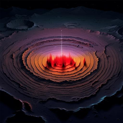
First look by the Yutu-2 rover at the deep subsurface structure at the lunar farside
J. Lai, Y. Xu, et al.
Discover groundbreaking findings from the Chang'e-4 mission, where researchers, including Jialong Lai and Yi Xu, reveal deep subsurface structures on the Moon's farside. Using data from the Yutu-2 rover's ground-penetrating radar, this study unveils multiple distinct layers of lava flows that shed light on the Moon's thermal history.
~3 min • Beginner • English
Introduction
The study investigates the shallow to deep subsurface structure of mare basalts at the Chang’e‑4 (CE‑4) landing site on the lunar farside (Von Kármán crater, within the South Pole‑Aitken basin) to better understand the history of basaltic volcanism and its relation to the Moon’s thermal evolution. Prior remote-sensing constrained basalt thicknesses and emplacement, but direct stratigraphy on the farside was lacking. With the Yutu‑2 rover’s lunar-penetrating radar (LPR), the authors aim to identify subsurface reflectors, reconstruct stratigraphy, estimate physical properties (e.g., loss tangent), and infer eruption sequences and sources, thereby addressing the nearside–farside volcanic dichotomy and the timing and nature (single vs multiple) of lava infill events in Von Kármán.
Literature Review
Previous orbital radar sounders (Apollo Lunar Sounder Experiment; Kaguya/SELENE Lunar Radar Sounder) identified deep mare–basement interfaces (apparent depths ~1–1.6 km) and subsurface basalt layering hundreds of meters deep on the nearside. Remote-sensing approaches using crater morphology, gravity, and reflectance spectra have modeled basalt thicknesses and stratigraphy across maria. Chang’e‑3 LPR provided higher-resolution nearside stratigraphy, indicating multilayered terranes. For the farside SPA region, volcanism is inferred to be shorter/less extensive than nearside, potentially due to crustal thickness, heat-producing elements distribution, or consequences of the SPA-forming impact. However, the detailed volcanic history at Von Kármán (single vs multiple infill events) remained unresolved from surface spectral uniformity; thus, in situ farside radar was needed.
Methodology
In situ radar sounding was conducted with Yutu‑2’s Lunar Penetrating Radar (LPR). Channel 1 (CH‑1) operates at 60 MHz center frequency (40 MHz bandwidth) using 12 mm diameter, 1150 mm length monopole antennas mounted ~60 cm above ground; CH‑2 operates at 500 MHz to complement the near-surface to ~35 m depth. The study analyzes CH‑1 data collected over the first 9 months along a 284.6 m traverse with 49 waypoints. Data processing included removal of repetitive/background noise, filtering, and amplitude compensation using AGC; reflector picking combined motion-acquired radargrams with aggregated stationary traces per waypoint (hundreds to ~1000 repeated traces) to enhance SNR and suppress random noise. Time-to-depth conversion used d = ct/(2√ε) with ε = 4.5 for depths ≤52 m and ε = 6.5 for >52 m, based on Apollo regolith/basalt dielectric properties measured at 60 MHz. Subsurface reflector identification was cross-checked against CE‑3 LPR characteristics to mitigate system artifact misinterpretation. Trend surface analysis (low-order polynomial fits) quantified lateral elevation trends of reflectors A–E along the path using a DEM derived from LRO NAC stereo. Attenuation and average loss tangent (tanδ) were estimated from depth vs. signal power profiles applying geometric spreading/backscatter corrections (R^1, R^2, R^3), fitting attenuation η (dB/m) to infer tanδ. Forward modeling/simulation used gprMax (2D FDTD, TE mode) with layered subsurface models (vacuum, regolith, ejecta, multiple basalt layers with interlayered regolith/ejecta), including Gaussian noise consistent with the CH‑1 detection limit; models tested different tanδ and permittivity scenarios to match observed reflector continuity and penetration depths. Ejecta thickness at CE‑4 site from candidate source craters/basins was estimated using ballistic sedimentation scaling: T = 0.068 Rt (r/Rt)^−1.2 with Rt from crater scaling relations (and literature values for large basins), combined with cratering efficiency to include local excavation, to compare with deep reflector interpretations. Geological context (ages, distances) informed source directionality via trend analysis.
Key Findings
- LPR CH‑1 achieved penetration to ~330 m (analysis focused on 52–328 m due to near-surface saturation from rover coupling); CH‑2 complemented the top ~35 m.
- Five prominent subsurface reflectors (A–E) were identified at depths: A = 51.8 ± 1.1 m, B = 63.2 ± 1.2 m, C = 96.2 ± 3.2 m, D = 130.2 ± 3.7 m, E = 225.8 ± 5.5 m. Reflector D shows ~7.1 m rise toward the right (west) end before flattening near repeated sampling around waypoint 42.
- The upper ~38 m comprises fine-grained regolith over coarse ejecta over fractured basalt; between 38–52 m a uniform basalt layer likely occurs (boundary below CH‑1 resolution). Reflectors B–D mark interfaces between basalt units and higher-porosity interbeds (ejecta/regolith) formed during volcanic pauses.
- The D–E interval (~100 m thick) contains subtle, discontinuous internal echoes interpreted as multiple thin lava flows interleaved with small-scale ejecta and thin regolith, indicating an undefined number of intermittent eruptions.
- Below E, more continuous reflectivity suggests large-scale ejecta deposits. The deepest strong stratum (near ~230 m; thickness >116 m) matches modeled ejecta deposit thickness ranges from large impacts (e.g., Imbrium and/or Orientale), consistent with thickening toward the west.
- Trend surface analysis shows layers A, B, D rise toward the west (implying western lava sources), whereas layer C rises eastward, consistent with an eastern ejecta source (plausibly Alder). Stratum E thickens toward the west.
- Direct evidence of at least four distinct lava infill events within VK: lava layer thicknesses of approximately 12 m, 33 m, 34 m, and 96 m at the CE‑4 site.
- Average loss tangent (tanδ) of farside mare basalts estimated as 0.0040–0.0061: R^1 correction yields 0.0041 ± 0.0001; R^2, 0.0060 ± 0.0001; R^3 (rough interface), 0.0051 ± 0.0001, consistent with observed penetration depth.
- Radar simulations reproduce observed reflector continuity and penetration for tanδ ≈ 0.005; lower tanδ (0.001) produces much deeper penetration and strong deeper reflections, whereas higher tanδ (0.009) shows faster attenuation.
- Geomorphology west of VK (40 km dome/mounded flow with ~110 m lobe heights and slopes ~2.6°–4.6°) corroborates substantial, punctuated lava flooding consistent with radar-inferred thick flows.
- Regional basalt thickness exceeds ~300 m, in line with independent estimates from crater ejecta spectroscopy near Zhinyu and excavation depths of large impacts.
Discussion
The radar-detected stratigraphy directly addresses whether VK crater was filled by a single or multiple volcanic episodes: the presence of multiple, discrete interfaces and a thick, internally complex D–E section indicates repeated, punctuated lava infill events separated by periods of surface weathering and ejecta deposition. Trend analysis suggests different source directions for specific layers (A, B, D rising westward indicating western flow sources; C rising eastward consistent with eastern ejecta inputs, e.g., Alder), implying a complex interaction between volcanism and impact resurfacing. The deep, thick stratum near ~230 m aligns with large-scale ejecta emplacement, likely associated with Imbrium and/or Orientale, although later impacts and complex ballistic pathways preclude unique attribution. The derived loss tangent (0.0040–0.0061) refines electrical properties of farside mare basalts and supports observed penetration depth. Collectively, these findings refine the volcanic history in SPA/VK as prolonged and episodic, consistent with Late Imbrian peak activity and an overall basalt thickness exceeding ~300 m, augmenting models based on gravity and reflectance data.
Conclusion
This work provides the first in situ deep subsurface stratigraphic profile on the lunar farside using Yutu‑2 LPR data at the CE‑4 landing site. The results deliver direct evidence of multiple lava infill events within Von Kármán crater, quantifying four major basalt layers (~12, 33, 34, 96 m thick) overlying large-scale ejecta, and revealing a ~100 m thick internally heterogeneous section indicative of intermittent eruptions. Trend analysis constrains likely flow source directions and an eastern ejecta contribution, while simulations confirm the plausibility of the stratigraphic model. The average electrical loss tangent of farside mare basalts is constrained to 0.0040–0.0061. These findings advance understanding of farside volcanic evolution within SPA and support a prolonged, punctuated infill history. Future work should expand traverse coverage, integrate additional CH‑2 and multi-instrument datasets, refine dielectric property estimates spatially, and improve ejecta source attribution and absolute timing through combined crater chronology and in situ measurements.
Limitations
- Near-surface saturation of CH‑1 data due to rover–antenna coupling limits resolution above ~52 m; CH‑2 mitigates only to ~35 m depth.
- CH‑1 vertical resolution may miss thin boundaries, potentially underrepresenting fine layering (e.g., 38–52 m interval).
- Attribution of deep, large-scale ejecta to specific distant impacts remains uncertain due to complex ejecta pathways and overprinting by later events.
- Limited traverse length (~285 m) and localized sampling restrict lateral extrapolation of stratigraphy.
- Crater size–frequency dating in the area is complicated by resurfacing and secondary cratering, introducing age uncertainties.
- Estimations of ejecta thickness and deposits rely on scaling laws and assumed parameters (e.g., transient crater sizes, efficiencies), adding model uncertainty.
- Potential system artifacts are addressed by comparisons with CE‑3, but residual ambiguities in reflector origin and exact dielectric properties remain.
Related Publications
Explore these studies to deepen your understanding of the subject.

