Environmental Studies and Forestry
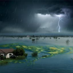
Coastal ecological disasters triggered by an extreme rainfall event thousands of kilometers inland
W. Li, Z. Wang, et al.
Coastal zones are sensitive interfaces experiencing growing socio-economic activity and heightened vulnerability to climate change. While direct coastal extreme events (storms, tsunamis, flooding) are known to rapidly alter coastal ecosystems, the downstream ecological impacts of extreme inland weather events on distant coastal systems are poorly documented. In 2021–2022, Rongcheng City (eastern Shandong Peninsula), China—home to the nation’s largest kelp cultivation—suffered unprecedented kelp mortality and severe red tide blooms, nearly extinguishing Saccharina japonica yields in 2022 with large economic losses. Post-event field investigations implicated unusually high water transparency and severe phosphate depletion but lacked mechanistic attribution. Previous work linked wintertime wind-driven sediment resuspension to nutrient availability and typical turbidity patterns, but no wind anomalies occurred in autumn 2021. Concurrently, North China experienced record-breaking autumn rainfall and an autumn flood in the Yellow River. The study poses the research question: Did the extreme inland rainfall and resultant floods causally trigger the coastal kelp mortality event far downstream, and through what mechanisms? The purpose is to integrate field observations and satellite data to elucidate the physical, biogeochemical, and biological cascades connecting inland extreme rainfall to coastal ecosystem disruption, with implications for climate change teleconnections and aquaculture risk management.
The study builds on several strands of prior research: (1) Coastal ecosystem vulnerability to climate change and extreme events, including the importance of kelp as a foundational habitat and key aquaculture species in China. (2) Typical winter processes in the Bohai and North Yellow Seas, where wind-driven waves resuspend bottom sediments, supplying nutrients and creating a turbid, low-salinity North Shandong Coastal Current (NSCC). Reduced wind speeds had been associated with lower suspended sediment concentrations and higher transparency, though plankton contributions within sediments were considered negligible; no autumn 2021 wind anomalies were detected. (3) Atmospheric circulation drivers of East Asian hydroclimate, notably the Western North Pacific Subtropical High (WNPSH), whose westward intrusion can cause extreme rainfall. In 2021, anomalous Indo-Pacific warm pool SSTs contributed to WNPSH behavior and record autumn rainfall in North China. (4) Nutrient sources and variability in the Yellow/Bohai system: fertilizer losses (DIN), sewage (DIP), and natural runoff (DSi) dominate riverine nutrient fluxes; submarine groundwater discharge may influence coastal nutrients; and prior observations of eutrophication and nutrient ratio shifts in the Bohai Sea. (5) Documented red tide occurrences and their relationship to nutrient fronts and frontal dynamics. This context motivates examining an inland–coastal teleconnection via autumn floods, nutrient delivery, altered turbidity, and frontal bloom dynamics, and their consequences for kelp.
Field surveys were conducted aboard R/V Chuangxin I from October 27 to November 4, 2021, covering 55 stations across the Bohai and North Yellow Seas along four sections (through Bohai/Laizhou Bays, Bohai Strait, Chengshantou–Dalian line, and central North Yellow Sea). At each station, an SBE-911plus CTD profiled temperature, salinity, chlorophyll-a fluorescence (WET Labs ECO-AFL/FL), and turbidity (WET Labs ECO-NTU). Discrete water samples from surface, mid-depth, and near-bottom were collected via Niskin bottles for lab analyses: chlorophyll-a (filters on GF/F, acetone extraction, TD-700 fluorometer) and nutrients (DIN = NO2− + NO3− + NH4+, DIP as PO4-P, DSi as silicate), measured by flow injection analysis (AA3). Detection limits: NO3− 0.015 µM L−1, NO2− 0.003 µM L−1, NH4+ 0.04 µM L−1, DIP 0.02 µM L−1, DSi 0.03 µM L−1. In situ chl-a fluorescence was calibrated against lab chl-a (R=0.80). A surface buoy at station YS16 (Rongcheng offshore) recorded 1 m temperature, salinity, dissolved oxygen (except 2020), and 3 m wind speed hourly (JFE Advantech sensors; RM Young anemometer). Shipboard RDI 300 kHz ADCP (downward-looking, 3 m depth, 1 m bins, bottom track mode) collected currents and acoustic backscatter; data were quality-controlled (PG4 ≥75%, correlation ≥128 counts, near-bottom exclusion ~6%). Tidal currents were extracted from the TPXO barotropic tide model (eight constituents) and subtracted to derive residual currents; backscatter strength (Sv) was used as a proxy for suspended sediment concentration. Satellite products (MODIS Level 3, 4.63 km) provided daily/monthly SST, Rrs555, PAR, and chlorophyll-a (2002–2022). Sea surface temperature gradient (SSTG) was computed as the magnitude of the horizontal SST gradient. Rrs555 was converted to suspended sediment concentration (SSC) using an empirical relationship (SSC = exp(101.8 × Rrs555) × 1.301). To identify true phytoplankton blooms in turbid waters, a chl-a threshold of 10 mg m−3 was adopted, acknowledging overestimation limits in Chinese coastal seas. LANDSAT-8 OLI imagery tracked turbidity changes at higher resolution. Long-term meteorological/hydrological and socioeconomic data were compiled from national agencies: wind (NCEP/NCAR Reanalysis 1), rainfall (China Water Resources and Climate Bulletins), Yellow and Hai River discharge/sediment (Yellow River Conservancy Commission; Chinese River Sediment Bulletin), monthly riverine TDN/TDP at Lijin (China National Environmental Monitoring Centre), red tide reports (Bulletin of China Marine Disaster 2021), agricultural and population datasets (CAS Resource and Environment Data Center; National Bureau of Statistics), and kelp aquaculture statistics (China Fisheries Statistical Yearbook). Climatologies (2002–2022) and anomalies were calculated; lag correlations were assessed between November environmental parameters (wind speed, SST, PAR, SSC, chl-a, Yellow River discharge) and next-year kelp unit yield (2014–2021). Analytical focus included identifying autumn flood timing/magnitude, water–sediment separation, coastal salinity and turbidity anomalies, frontal blooms, nutrient ratios, NSCC evolution (ADCP and satellite), and spatial–temporal linkage to kelp farming operations.
- North China experienced record autumn rainfall in 2021 (wettest since 1961). Annual rainfall anomalies reached 162.9 mm (≈1,314.5 × 10^9 m^3) in the Yellow River watershed and 300.3 mm (≈1,105.4 × 10^9 m^3) in the Hai River watershed. Both basins saw historically high floods.
- Yellow River discharge in 2021 showed a bimodal pattern with a summer peak and a larger autumn peak (Oct–Nov). Sediment load spiked in mid-October then rapidly declined by late October, producing a period of high discharge with low sediment load (water–sediment separation) during the field cruise.
- The autumn flood freshened the southwestern Bohai Sea, with salinity <30 and a pronounced salinity front outside Bohai and Laizhou Bays. High surface chl-a was observed along the front, indicating frontal phytoplankton blooms.
- Nutrient fields showed high DIN and DSi with anomalously high DIN:DIP (>3000) in the Bohai Sea surface, indicating severe phosphorus limitation; North Yellow Sea exhibited silicon limitation. Strong linear correlation between DIN:DIP and DSi:DIP (slope 1.13, r=0.99, p<0.001) implicated common riverine sources during the flood. DIN and DSi correlated negatively with salinity; DIP correlated with turbidity, suggesting sediment resuspension as a DIP source and DIP consumption by blooms.
- The NSCC typically transports cold, low-salinity, turbid Yellow River water in winter. In November 2021, SSTG anomalies exceeded 0.02 °C km−1 along the north Shandong coast, indicating early NSCC intrusion, but MODIS SSC anomalies were strongly negative, revealing an anomalously limpid NSCC sourced from the water–sediment separated estuarine plume.
- ADCP on 2 Nov 2021 documented a two-layer flow: buoyant eastward surface NSCC >1000 mm s−1 overlying westward bottom flow <300 mm s−1, with pycnocline inhibiting upward sediment diffusion; backscatter increased offshore as advection waned and mixing increased.
- Satellite time series (Oct–Nov 2021) showed transition from a turbid coastal belt in October to a low-turbidity NSCC by mid-November, advancing past Cape Chengshan to Rongcheng. Concurrently, high chl-a patches (>10 mg m−3) tracked along the coast consistent with NSCC evolution.
- Two large red tide events were reported: (1) Oct 27–Nov 5, 2021 near Dongying (Laizhou Bay), 1052 km^2, dominated by dinoflagellates Akashiwo sanguinea and Gonyaulax polygramma (abundances up to >1.0×10^6 cells L−1); (2) Nov 27–Dec 16 near Yantai–Weihai, 921 km^2, dominated by Gonyaulax polygramma. MODIS chl-a anomalies in Nov exceeded 5 mg m−3 along the north coast.
- In November 2021, the Shandong coast registered the lowest SSC (4.69 mg L−1) and highest chl-a (7.03 mg m−3) for that month in the 2002–2022 record over the Rongcheng offshore area.
- Kelp aquaculture area remained steady over the past decade, but yield and unit yield had more than doubled since 2014, then collapsed in 2022 after the 2021 event, with near extinction of Rongcheng yield and an estimated direct economic loss of ~200 million CNY.
- Environmental attribution: lower salinity from fresher NSCC waters, stronger light due to low turbidity (increasing UV stress on juvenile sporophytes), and post-bloom oligotrophy (notably phosphorus limitation) driven by frontal red tides jointly caused mass kelp mortality. No abnormal wind, SST, or PAR anomalies were identified as primary drivers. Negative relationships were found between SSC and chl-a with next-year kelp unit yield.
- Teleconnection mechanism: warm Indo-Pacific warm pool and equatorial Pacific SST anomalies facilitated westward WNPSH intrusion and extreme autumn rainfall, with tropical Atlantic SSTs helping anchor the rainfall over North China, linking tropical SSTAs to mid-latitude coastal ecosystem impacts via extreme inland rainfall.
The study establishes a causal chain from inland extreme rainfall to coastal ecological disaster. Record-breaking autumn rainfall in North China drove an autumn Yellow River flood with pronounced water–sediment separation. This generated a fresher, unusually clear NSCC that intruded early along the Shandong coast. In the Bohai Sea, massive riverine DIN and DSi inputs, coupled with limited DIP (largely associated with sediment resuspension and rapidly consumed by blooms), created severe phosphorus limitation and high nutrient ratios (DIN:DIP >3000). Frontal dynamics at salinity and nutrient fronts, where DIN/DSi-rich coastal waters met DIP-rich local waters, enhanced primary productivity and triggered large red tide blooms. As the limpid NSCC transported these frontal zones alongshore, blooms migrated from the Bohai towards the North Yellow Sea, progressively stripping nutrients and leaving oligotrophic, phosphorus-limited conditions in their wake. When kelp juvenile sporophytes were transferred offshore (Oct–Nov), they encountered a confluence of stressors: reduced salinity from fresher NSCC waters, enhanced irradiance/UV due to low turbidity, and nutrient scarcity following blooms, particularly phosphorus limitation, resulting in widespread mortality. Traditional attributions (wind-driven resuspension, SST, PAR) did not explain the anomalies observed in autumn 2021. The findings reveal a climate teleconnection: tropical SST anomalies modified the WNPSH and produced extreme inland rainfall, which, via hydrological and coastal current pathways, reshaped coastal physicochemical conditions and biotic dynamics, culminating in kelp aquaculture collapse. This underscores the significance of integrated, multidisciplinary observations to anticipate cascading ecosystem effects from extreme events and to inform coastal aquaculture risk management under climate change.
This work demonstrates a full cascade linking an inland extreme rainfall event to a coastal ecological disaster. The 2021 North China autumn floods produced an anomalously clear, fresher NSCC, induced severe phosphorus limitation and frontal red tide blooms, and ultimately precipitated mass kelp mortality along the eastern Shandong Peninsula. The study integrates shipboard hydrography and nutrients, ADCP currents and backscatter, buoy records, and multi-satellite remote sensing to resolve the physical–biogeochemical–biological chain of causality. It reveals a teleconnection from tropical SST anomalies (via WNPSH behavior) to mid-latitude coastal ecosystem impacts. The primary contributions are: (1) identification of water–sediment separation during autumn floods as a driver of anomalous low-turbidity NSCC; (2) documentation of extreme nutrient ratios and phosphorus limitation leading to frontal red tide blooms; and (3) attribution of kelp mortality to combined low salinity, enhanced light, and post-bloom oligotrophy. Future research should: expand sustained, integrated coastal observations; improve coupled climate–hydrology–coastal ecosystem modeling to forecast cascading effects; refine satellite bio-optical algorithms in turbid waters; and develop adaptive aquaculture strategies (e.g., timing of seedling transfer, nutrient supplementation, selective breeding for stress tolerance) to mitigate risks from increasingly frequent extreme events.
- Temporal and observational constraints: Extreme events are unpredictable; short records and data gaps (e.g., buoy dissolved oxygen sensor malfunction in 2020) limit comprehensive assessment and generalization.
- Remote sensing uncertainties: Satellite-derived chl-a is overestimated in turbid coastal waters; a threshold approach (10 mg m−3) was used to flag blooms, but magnitude estimates remain uncertain.
- Proxy and comparability issues: Riverine nutrient ratios (TDN/TDP) differ from in situ marine DIN/DIP; while trends are informative, direct equivalence is imperfect.
- Attribution complexities: Although the mechanistic chain is well supported, direct statistical correlation between Yellow River discharge and kelp unit yield was not established; multiple co-occurring stressors (salinity, light, nutrients) complicate isolation of single drivers.
- Spatial coverage: Shipboard surveys and satellite cloud cover leave spatial/temporal gaps, and subsurface processes (e.g., episodic groundwater discharge) are constrained by limited observations.
Related Publications
Explore these studies to deepen your understanding of the subject.