Earth SciencesCommunications Earth & Environment
Climate and land use changes explain variation in the A horizon and soil thickness in the United States
Y. Zhang, A. E. Hartemink, et al.
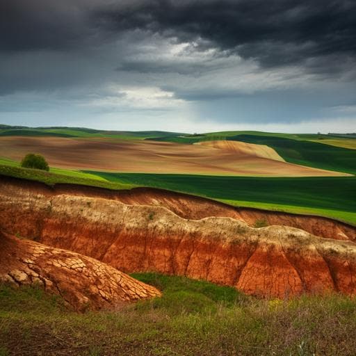
This study by Yakun Zhang and colleagues unveils crucial insights into the spatio-temporal dynamics of soil thickness across the conterminous United States from 1950 to 2018. Discover how climate influences soil distributions while land use and erosion shape changes over time, highlighting the regions most affected and in need of conservation.
Related Publications
Explore these studies to deepen your understanding
Adjacent work that informs or extends this paper's methodology and findings.

Environmental Studies and Forestry
Projected climate-driven changes in pollen emission season length and magnitude over the continental United States
Y. Zhang and A. L. Steiner

Medicine and Health
The translational lag narrative in policy discourse in the United States and the European Union: a comparative study
E. Aarden, L. Marelli, et al.

Psychology
Emotional adaptation during a crisis: decline in anxiety and depression after the initial weeks of COVID-19 in the United States
A. Shuster, M. O'brien, et al.

Political Science
The political influence of an interest group: A comparative study on the Muslim minority in the United States and Britain
E. Jan


